
What You Missed
Fall 2025
Fall 2025
![]()
![]()
![]()
![]()
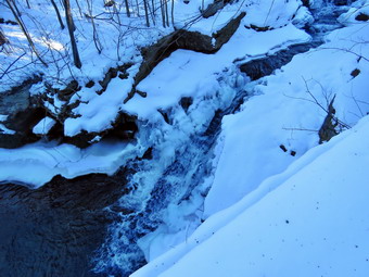
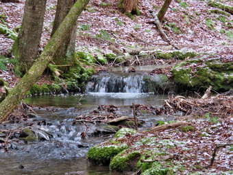
![]() On Thursday, December 18th, I had ambulance coverage from 8:00 AM TO 2:00 PM and thought about taking a hike with Sheena. We had not hiked for two weeks and I was out of the habit. There had been many ambulance calls and I had been and still was sick but these are excuses. I wanted to sleep a little later in the morning to make up for sleep I had missed on calls earlier in the week. I also wanted to let the temperature have a chance to rise from the 14 degrees I found at 6:30 AM. I laid down with Sheena on the couch and fell asleep almost instantly. Unfortunately, the pager went off and after that people kept calling me! O decided around 11:00 AM that I wanted to get out of the house and away from everything. There was still quite a bit of snow on the ground which meant I didn't need snowshoes but I could wear them. The temperature at 11:00 AM was already 40 degrees so I decided not to wear snowshoes as the snow would clump on them as the temperature rose. Sheena loves warm places and has a short coat but also seems to really like the snow. I decided to hike the Parksville Rail Trail because it is out and back and I could turn around whenever I wanted. I also knew that the trail was probably packed by people walking the trail. I began to get ready with blue skies and dome white clouds. he Parksville Rail Trail is under three miles out and back but keeping a quick pace helps increase the difficulty as does carrying my pack. Sheena actually does get in about twice the mileage that I do as she forges ahead and then comes back to me! I have transitioned from using a leash all the time to using a GarmimSport PRO electronic collar which has many versatile settings and seems to do the job. This allows Sheena to roam and keeps me sane by not having to yank on her leash. It seems that Sheena likes hiking as she smells my clothes and then runs to sit by the door! I got dressed in my Mammut crew top with a long-sleeved baselayer hoping that would keep me warm enough. I put on a pair of insulated hiking pants which seemed to have no maker's label attached. The pants fit well and seemed to have just the right insulation. For boots I decided to put on my old pair of Salomon B52s which still fit well and keep my feet warm enough. I have recently bought several brands of socks and put on an OTC from Suri which is alpaca. They seemed tick enough but maybe slightly large. I put on my Mammut hoody to block the wind and keep me warm. It also has a lot of zippers to dump heat when needed. I grabbed a pair of Leki Micro Vario poles I have been using for some time because they are light and lock without slipping. I chose a warmer fleece hat to completely cover my ears. I took a light pair of knit gloves but also pack a heavier pair just in case. I decided to take my pack so that I could take my camera as I thought the snow on the trail and the waterfalls might be good subjects for a few shots. I decided to take my TSL Symbioz snowshoes along because they have a lot of flex and are good for most terrain except for the steepest ascents on the 35s. They have a ratchet type binding and a televator for steeper climbs. The televator elevates the hiker's heel on ascents and take some strain off the calf muscles. This is a feature that you didn't know you needed until you try it and then it is hard to live without it! I knew I might not need them but have learned you can't use them if you don't have them. I put my gear in the back of the car and Sheena in the back seat and left Livingston Manor at 11:20 AM. I drove out Old Route 17 toward Parksville and turned left under the Quickway overpass onto Service Road. I drove toward Parksville and pulled into the parking area on the right side of the road just after Fox Mountain Rd. There were no cars parked in the lot when we arrived. I got out of the car and checked the trail and found a hard-packed surface. I concluded that I did not need snowshoes. I made sure Sheena's ecollar was adjusted correctly and let her out of the car. The temperature was 44 degrees but the sunshine made it feel a little warmer as we started on our hike at 11:30 AM.
On Thursday, December 18th, I had ambulance coverage from 8:00 AM TO 2:00 PM and thought about taking a hike with Sheena. We had not hiked for two weeks and I was out of the habit. There had been many ambulance calls and I had been and still was sick but these are excuses. I wanted to sleep a little later in the morning to make up for sleep I had missed on calls earlier in the week. I also wanted to let the temperature have a chance to rise from the 14 degrees I found at 6:30 AM. I laid down with Sheena on the couch and fell asleep almost instantly. Unfortunately, the pager went off and after that people kept calling me! O decided around 11:00 AM that I wanted to get out of the house and away from everything. There was still quite a bit of snow on the ground which meant I didn't need snowshoes but I could wear them. The temperature at 11:00 AM was already 40 degrees so I decided not to wear snowshoes as the snow would clump on them as the temperature rose. Sheena loves warm places and has a short coat but also seems to really like the snow. I decided to hike the Parksville Rail Trail because it is out and back and I could turn around whenever I wanted. I also knew that the trail was probably packed by people walking the trail. I began to get ready with blue skies and dome white clouds. he Parksville Rail Trail is under three miles out and back but keeping a quick pace helps increase the difficulty as does carrying my pack. Sheena actually does get in about twice the mileage that I do as she forges ahead and then comes back to me! I have transitioned from using a leash all the time to using a GarmimSport PRO electronic collar which has many versatile settings and seems to do the job. This allows Sheena to roam and keeps me sane by not having to yank on her leash. It seems that Sheena likes hiking as she smells my clothes and then runs to sit by the door! I got dressed in my Mammut crew top with a long-sleeved baselayer hoping that would keep me warm enough. I put on a pair of insulated hiking pants which seemed to have no maker's label attached. The pants fit well and seemed to have just the right insulation. For boots I decided to put on my old pair of Salomon B52s which still fit well and keep my feet warm enough. I have recently bought several brands of socks and put on an OTC from Suri which is alpaca. They seemed tick enough but maybe slightly large. I put on my Mammut hoody to block the wind and keep me warm. It also has a lot of zippers to dump heat when needed. I grabbed a pair of Leki Micro Vario poles I have been using for some time because they are light and lock without slipping. I chose a warmer fleece hat to completely cover my ears. I took a light pair of knit gloves but also pack a heavier pair just in case. I decided to take my pack so that I could take my camera as I thought the snow on the trail and the waterfalls might be good subjects for a few shots. I decided to take my TSL Symbioz snowshoes along because they have a lot of flex and are good for most terrain except for the steepest ascents on the 35s. They have a ratchet type binding and a televator for steeper climbs. The televator elevates the hiker's heel on ascents and take some strain off the calf muscles. This is a feature that you didn't know you needed until you try it and then it is hard to live without it! I knew I might not need them but have learned you can't use them if you don't have them. I put my gear in the back of the car and Sheena in the back seat and left Livingston Manor at 11:20 AM. I drove out Old Route 17 toward Parksville and turned left under the Quickway overpass onto Service Road. I drove toward Parksville and pulled into the parking area on the right side of the road just after Fox Mountain Rd. There were no cars parked in the lot when we arrived. I got out of the car and checked the trail and found a hard-packed surface. I concluded that I did not need snowshoes. I made sure Sheena's ecollar was adjusted correctly and let her out of the car. The temperature was 44 degrees but the sunshine made it feel a little warmer as we started on our hike at 11:30 AM.
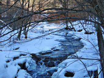 The whole trail was covered in show varying from 3 packed inches to 8 inches off the trail. I tried to walk where most people had stepped to continue to pack the track that others had set. Off her leash Sheena would run ahead of me a certain distance and then maintain that distance by waiting for me or increasing her pace. We were soon under the cover of the trees which blocked the sunlight and made it feel cooler. After a short distance I knew I was dressed warmly enough and Sheena was enjoying the snow. I was happy I had my hoody which was warm enough, blocks the wind, and sheds the snow. The temperatures had been well below freezing at night and barely above freezing during the day. Everything was frozen solid. The trail runs parallel to the Little Beaverkill and the new section of State Route 17. It follows the route of the O&W railroad and is very flat. Sheena was setting a quick pace and I didn't mind as long as she would listen and wait for me when necessary. The water level in the stream was high and at about the same level as the last trip but there was much more ice. We continued walking on the trail through the snow following the track until we came to the viewpoint just before the wooden walkways. This spot has a nice view down to the stream and I stopped to take a peek. I was not convinced that I was going to take any pictures so I continued the hike. We walked across the wooden walkways which were slippery due to a layer of packed snow and some ice. The area before the bridge was icy but we had no troupe negotiating it. The large patch of mud that is often present was frozen solid. The culvert under the bridge appeared permanently blocked and the water that does flow freezes into layers of ice. No one seems concerned about solving this problem.
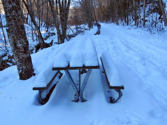 I was beginning to notice that my toes were a little cool and I expected more from the new socks. I was wearing a pair of boots that still fit well but are over 10 years old. I assume the insulation is past its prime. We came to the landslide that had brought down several trees that had been cut and cleared. This area was covered in snow with some ice underneath. Soon I could hear the increase in noise from the stream. The falls came into but I decided not to descend the path to the streambed as the path was covered in sow and ice and I had not brought my spikes. I walked passed the picnic table, which was covered in snow, to an area just above the falls. I cleared a little space for my pack and put it down to get out my camera. I took pictures of the picnic table covered in snow and a few of the trail. I walked as close to the edge of the bank as I dared and took pictures of the falls from different angles. Compared to my last visit there was a lot ice in the stream and even more in the falls. I walked along the edge a little upstream and took pictures of the rapids above the falls. When I was done I put the camera away. I decided that we would continue to the other end of the trail as Sheena seemed fine and I was feeling good despite the long layoff. We started off toward the end of the rail. Almost immediately we saw someone walking toward us. As we closed the gap, I took Sheena by the collar and walked her to the side of the trail. As the man passed we greeted each other and exchanged comments about the weather. Sheena and I continued toward Parksville. The large dog across the stream was absent. As we approached the end of the trail, the dogs that are usually outside barking were nowhere to be found! We tagged the end of the trail at 12:12 PM and then immediately turned around to return. We kept a fast pace back toward the car with Sheena in the lead and I was able to keep up with her. Just after the falls we saw a dog walking toward us with a woman on a leash! I pulled Sheena to the side of the trail. As the hiker came by she said "Hello" and I returned the greeting. At that point her dog decided to say "Hello" to Sheena. The lunge that he made caused the woman to fall. I asked if she was okay and she said "Yes" and she got up, controlled her dog, and headed toward the falls. Walking on the snow was not as easy as walking the bare trail but was less difficult than using snowshoes. We soon came to the bridge, where Sheena and I carefully walked over the slippery snow and ice which was starting just a bit. Sheena decided that she would do some zoomies on the slippery bridge! We continued hiking and met the man we had first encountered at the other end of the trail. We hiked passed each other with a quick greeting. As we approached the end of the trail, I called Sheena and told her "With" which is the equivalent of "Heel". We arrived back at the car at 12:57 PM after hiking about 3 miles in an hour and 27 minutes. Sheena seemed fresh and I felt she could have hiked out and back on the trail another time. I on the other hand was a little tired. We returned home and we had something to eat and drink. There had been no ambulance calls while we were gone which made me feel good. I had just enough time to get ready to leave to time two basketball games at Liberty HS.

![]()
![]()
![]()
![]()
![]() On Thursday, December 4th, I had ambulance coverage for the only day of the week so I decided to hike with Sheena. There was at least 8 inches of snow on the ground which meant I didn't need snowshoes but I could wear them. The temperature at 10:00 AM was only 21 degrees and I didn't know how Sheena would fare. She loves warm places and has a short coat but also seems to really like the snow. I decided to hike the Parksville Rail Trail because it is out and back and I could turn around whenever I wanted. I began to get ready with completely overcast skies and it looked like it might snow again. The Parksville Rail Trail is under three miles out and back but keeping a quick pace helps increase the difficulty and snowshoes would add an extra layer of difficulty. Sheena actually does get in about twice the mileage that I do as she forges ahead and then comes back to me! I have transitioned from using a leash all the time to using a GarmimSport PRO electronic collar which has many versatile settings and seems to do the job. This allows Sheena to roam and keeps me sane by not having to yank on her leash. It seems that Sheena likes hiking as she smells my clothes and then runs to sit by the door! I got dressed in my Mammut crew top with a long-sleeved baselayer hoping that would keep me warm enough. I put on a pair of insulated hiking pants which seemed to have no maker's label attached. The pants fit well and seemed to have just the right insulation. For boots I decided to put on my old pair of Salomon B52s which still fit well and keep my feet warm enough. I put on my Mammut hoody to block the wind and keep me warm. It also has a lot of zippers to dump heat when needed. I grabbed a pair of Leki Micro Vario poles I have been using for some time because they are light and lock without slipping. I chose a warmer fleece hat to completely cover my ears. I took a light pair of knit gloves but also pack a heavier pair just in case. I decided to take my pack so that I could take my camera as I though the snow on the trail and the waterfalls might be good subjects for a few shots. I decided to take my TSL Symbioz snowshoes which have a lot of flex and are good for most terrain except for the steepest ascents on the 35s. They have a ratchet type binding and a televator for steeper climbs. The televator elevates the hiker's heel on ascents and take some strain off the calf muscles. This is a feature that you didn't know you needed until you try it and then it is hard to live without it! I put my gear in the back of the car and Sheena in the back seat and left Livingston Manor at 10:20 AM. I drove out Old Route 17 toward Parksville and turned left under the Quickway overpass onto Service Road. I drove toward Parksville and pulled into the parking area on the right side of the road just after Fox Mountain Rd. There were no cars parked in the lot when we arrived. I made sure Sheena's ecollar was adjusted correctly and let her out of the car. I looked at the trail and it was obvious that people had been walking on it and that no one had worn snowshoes. I concluded that I did not need snowshoes but would wear them anyway. I got them out and put them on pretty easily. The temperature was 26 degrees and there were a few snowflakes already falling as we started on our hike at 10:35 AM.
On Thursday, December 4th, I had ambulance coverage for the only day of the week so I decided to hike with Sheena. There was at least 8 inches of snow on the ground which meant I didn't need snowshoes but I could wear them. The temperature at 10:00 AM was only 21 degrees and I didn't know how Sheena would fare. She loves warm places and has a short coat but also seems to really like the snow. I decided to hike the Parksville Rail Trail because it is out and back and I could turn around whenever I wanted. I began to get ready with completely overcast skies and it looked like it might snow again. The Parksville Rail Trail is under three miles out and back but keeping a quick pace helps increase the difficulty and snowshoes would add an extra layer of difficulty. Sheena actually does get in about twice the mileage that I do as she forges ahead and then comes back to me! I have transitioned from using a leash all the time to using a GarmimSport PRO electronic collar which has many versatile settings and seems to do the job. This allows Sheena to roam and keeps me sane by not having to yank on her leash. It seems that Sheena likes hiking as she smells my clothes and then runs to sit by the door! I got dressed in my Mammut crew top with a long-sleeved baselayer hoping that would keep me warm enough. I put on a pair of insulated hiking pants which seemed to have no maker's label attached. The pants fit well and seemed to have just the right insulation. For boots I decided to put on my old pair of Salomon B52s which still fit well and keep my feet warm enough. I put on my Mammut hoody to block the wind and keep me warm. It also has a lot of zippers to dump heat when needed. I grabbed a pair of Leki Micro Vario poles I have been using for some time because they are light and lock without slipping. I chose a warmer fleece hat to completely cover my ears. I took a light pair of knit gloves but also pack a heavier pair just in case. I decided to take my pack so that I could take my camera as I though the snow on the trail and the waterfalls might be good subjects for a few shots. I decided to take my TSL Symbioz snowshoes which have a lot of flex and are good for most terrain except for the steepest ascents on the 35s. They have a ratchet type binding and a televator for steeper climbs. The televator elevates the hiker's heel on ascents and take some strain off the calf muscles. This is a feature that you didn't know you needed until you try it and then it is hard to live without it! I put my gear in the back of the car and Sheena in the back seat and left Livingston Manor at 10:20 AM. I drove out Old Route 17 toward Parksville and turned left under the Quickway overpass onto Service Road. I drove toward Parksville and pulled into the parking area on the right side of the road just after Fox Mountain Rd. There were no cars parked in the lot when we arrived. I made sure Sheena's ecollar was adjusted correctly and let her out of the car. I looked at the trail and it was obvious that people had been walking on it and that no one had worn snowshoes. I concluded that I did not need snowshoes but would wear them anyway. I got them out and put them on pretty easily. The temperature was 26 degrees and there were a few snowflakes already falling as we started on our hike at 10:35 AM.
 The whole trail was covered in show varying from 6 to 8 inches deep. I don't fid walking with snowshoes difficult but there is a different stride and foot placement you must use. I tried to walk where most people had stepped to set a track but that was nit easy as the footprints wandered all over the place! Off her leash Sheena would run ahead of me a certain distance and then maintain that distance by waiting for me or increasing her pace. We were soon under the cover of the trees which helped to block the breeze which lowered the temperature. Blocking sunlight was not a factor as there was none. After a short distance I knew I was dressed warmly enough and Sheena was enjoying the snow. I was happy I had my hoody which was warm enough, blocks the wind, and sheds the snow. There were a few wet and muddy patches in all the usual spots but I could step over them or walk around. The trail runs parallel to the Little Beaverkill and the new section of State Route 17. It follows the route of the O&W railroad and is very flat. Sheena was setting a quick pace and I didn't mind as long as she would listen and wait for me when necessary. The water level in the stream was high and at about the same level as the last trip. We continued walking on the trail through the snow following some footprints until we came to the viewpoint just before the wooden walkways. This spot has a nice view down to the stream and I stopped to take some shots. The scene was mostly black and white and the skies were completely overcast. The pictures showed the sharp contrast and almost looked like I had taken black and white photos. I had Sheena pose on the bridge and I took some pictures of her before continuing the hike. We walked across the wooden walkways which were slippery due to a layer of snow over a layer of leaves. The area before the bridge was icy but the snowshoes offered sufficient grip. Just after the bridge was a large patch of mud that was beginning to freeze and was a little smaller than usual. The culvert under the bridge appeared permanently blocked and the water forms the mud. No one seems concerned about solving this problem. I walked around the mud to continue the hike and this time Sheena did also.
 I was beginning to notice that my legs were tiring from wearing the snowshoes. As usual my inner thigh muscles were getting a little sore. We came to the landslide that had brought down several trees that had been cut and cleared. This area was covered in snow with some mud underneath. Soon I could hear the increase in noise from the stream. The falls came into view and I decided not to descend the path to the streambed as the snowshoes would not help and would only get in the way. I cleared a little space for my pack and put it down to get out my camera. I took pictures of the picnic table covered in snow and a few of the trail. I walked as close to the edge of the bank as I dared and took pictures of the falls from different angles. I walked along the edge a little upstream and took pictures of the rapids above the falls. When I was done I put the camera away. I decided that we would turn around at the falls so that Sheena did not get too cold and so that my legs would carry me back the car! We had made it to the falls at 11:10 AM and we were now headed back at 11:20 AM. I thought these times were good as it was my first hike with snowshoes this year. We immediately turned around and started back toward the car in the parking area. We kept a fast pace back toward the car with Sheena in the lead but I did have to take short breaks every now and then. We soon came to the bridge, where Sheena and I walked around the mud. Sheena decided that she would do some zoomies on the slippery bridge! We continued hiking and as we approached the end of the trail, I called Sheena and told her "With" which is the equivalent of "Heel". We arrived back at the car at 11:55 AM after hiking over 2 miles in an hour and 20 minutes. Sheena seemed fresh and I felt she could have hiked out and back on the trail another time. I on the other hand was tired and glad I had turned around at the falls We returned home and we had something to eat and drink. There had been no ambulance calls while we were gone which made me feel good.
![]()
![]()
![]()
![]() On Tuesday, November 25th, it had been over a week since we had hiked. The weather had been lousy and I had not been feeling well but I decided I needed to get out and that Sheena needed it even more. I had coverage for ambulance calls until 2:00 Pm and decided to go hike the Parksville Rail Trail. Brad, my son-in-law, and his daughter Ashlynn wanted to come with us which was great. We began to get ready at 11:30 AM with the temperature at 38 degrees with completely overcast skies and the look of rain or snow in the air. The Parksville Rail Trail is under three miles out and back but keeping a quick pace helps increase the difficulty. Sheena actually does get in about twice the mileage that I do as she forges ahead and then comes back to me! I have transitioned from using a leash all the time to using a GarmimSport PRO electronic collar which has many versatile settings and seems to do the job. This allows Sheena to roam and keeps me sane by not having to yank on her leash. It seems that Sheena likes hiking as she smells my clothes and then runs to sit by the door! I got dressed in my Mammut crew top with a short-sleeved baselayer. I put on a pair of insulated hiking pants which seemed to have no maker's label attached. The pants fit well and seemed to have just the right insulation. I decided to put on my Keen Durand hiking boots which fit well. I added a new pair of Xstance insoles in an effort to find the best support and cushioning for my feet. These insoles have shock absorbing gel pads, TPU arch support, and memory foam cushioning all wrapped in a breathable fabric. The insoles have been hyped by their manufacturer and seemed to be living up to their claims. I put on my Mammut hoody which has a lot of zippers to dump heat when needed. I grabbed a pair of Leki Micro Vario poles I have been using for some time because they are light and lock without slipping. I chose a light hat to cover my ears and a light pair of gloves. I decided not to take my pack as I just wanted to walk and had many pictures of the trail. We put my gear in the back of the car and Sheena and Ashlynn in the back seat and left Livingston Manor at 11:45 AM. I drove out Old Route 17 toward Parksville and turned left under the Quickway overpass onto Service Road. I drove toward Parksville and pulled into the parking area on the right side of the road just after Fox Mountain Rd. There were two cars parked in the lot when we arrived. I made sure Sheena's ecollar was adjusted correctly and let her out of the car. The temperature was 40 degrees as we started on our hike at 12:00 PM.
On Tuesday, November 25th, it had been over a week since we had hiked. The weather had been lousy and I had not been feeling well but I decided I needed to get out and that Sheena needed it even more. I had coverage for ambulance calls until 2:00 Pm and decided to go hike the Parksville Rail Trail. Brad, my son-in-law, and his daughter Ashlynn wanted to come with us which was great. We began to get ready at 11:30 AM with the temperature at 38 degrees with completely overcast skies and the look of rain or snow in the air. The Parksville Rail Trail is under three miles out and back but keeping a quick pace helps increase the difficulty. Sheena actually does get in about twice the mileage that I do as she forges ahead and then comes back to me! I have transitioned from using a leash all the time to using a GarmimSport PRO electronic collar which has many versatile settings and seems to do the job. This allows Sheena to roam and keeps me sane by not having to yank on her leash. It seems that Sheena likes hiking as she smells my clothes and then runs to sit by the door! I got dressed in my Mammut crew top with a short-sleeved baselayer. I put on a pair of insulated hiking pants which seemed to have no maker's label attached. The pants fit well and seemed to have just the right insulation. I decided to put on my Keen Durand hiking boots which fit well. I added a new pair of Xstance insoles in an effort to find the best support and cushioning for my feet. These insoles have shock absorbing gel pads, TPU arch support, and memory foam cushioning all wrapped in a breathable fabric. The insoles have been hyped by their manufacturer and seemed to be living up to their claims. I put on my Mammut hoody which has a lot of zippers to dump heat when needed. I grabbed a pair of Leki Micro Vario poles I have been using for some time because they are light and lock without slipping. I chose a light hat to cover my ears and a light pair of gloves. I decided not to take my pack as I just wanted to walk and had many pictures of the trail. We put my gear in the back of the car and Sheena and Ashlynn in the back seat and left Livingston Manor at 11:45 AM. I drove out Old Route 17 toward Parksville and turned left under the Quickway overpass onto Service Road. I drove toward Parksville and pulled into the parking area on the right side of the road just after Fox Mountain Rd. There were two cars parked in the lot when we arrived. I made sure Sheena's ecollar was adjusted correctly and let her out of the car. The temperature was 40 degrees as we started on our hike at 12:00 PM.
The first part of the trail was pretty damp from the rain and snow that had fallen recently. Off her leash Sheena would run ahead of us a certain distance and then maintain that distance by waiting for us or increasing her pace. Almost immediately we could see a couple of hikers coming toward us with a dog on a leash. We passed each other and said "Hello". I asked them what breed of dog they had and they told us in was a Plotthound mix. The dog was beautiful and very friendly. We were soon under the cover of the trees which didn't change the temperature too much. I was happy I had my hoody which was warm enough and blocks the wind. The trail was wet with soft and muddy patches in all the usual spots. The trail runs parallel to the Little Beaverkill and the new section of State Route 17. It follows the route of the O&W railroad and is very flat. Sheena was setting a quick pace and I didn't mind as long as she would listen and wait for us when necessary. Ashlynn was chasing here and Sheena responded by running around us in a crazy figure 8 pattern. I hoped this would burn off some of Sheena's energy! The water level in the stream was almost as high as during the spring. The rain and snow had helped to augment the volume. We continued walking on the trail through some muddy patches until we came to the viewpoint just before the wooden walkways. This spot has a nice view down to the stream but the skies were completely overcast. We walked across the wooden walkways which were damp and slippery due to a layer of leaves that had fallen from the trees. The area before the bridge was wet with some running water. Just after the bridge was a large patch of mud that was a little larger than usual. The culvert under the bridge appeared permanently blocked and the water forms the mud. No one seems concerned about solving this problem. There was water draining off the slope and flowing under the bridge. We walked around the mud to continue the hike but Sheena walked right through it. We came to the landslide that had brought down several trees that had been cut and cleared. This area was muddy but there were some stepping stones. Sheena does not seem to mind sloshing through the water and wading through the mud. Soon we could hear the increase in noise from the stream. The falls came into view and as we walked by I inspected them and found the water was higher than last time. Ashlynn had been very interested in the stream and some small rapids. She was very interested in the falls so we took a few minutes to view them.
We continued on the trail passing them as we pushed on toward the other end with Sheena in the lead. We did our best to keep up with her. I did take a peek at the stream from the bench on the trail but found nothing interesting. We came to a spot in the trail where we could see the other side. The large dog that had been absent for some time was still missing. We continued toward Parksville where the dogs near the end of the trail were also absent. The gate at the beginning of the trail had been placed upright but was not secured in the ground in any way. Whoever places the poles has not learned that they must be deeper and have more cement to support them. We tagged the end of the trail when we reached the sign at the Parksville end of the rail trail. I explained some of the information on the sign to Ashlynn. It was 12:40 PM and it had taken us 40 minutes to hike the length of the trail non-stop. We immediately turned around and started back toward the falls. At that point the dogs from the house near the end of the trail ran into the backyard. They began barking and jumping on the fence. Sheena ignored them so we continued our hike. As we approached the falls, we could hear the roaring water. We kept a fast pace back toward the car with Sheena in the lead. We soon came to the bridge, I walked around the mud while Sheena pushed through. Sheena decided that she would do some zoomies on the slippery bridge! It was much slipperier than the last time we were there. Sheena would come tearing toward me and put on the brakes so she would slide the last 10 feet! We continued hiking back to the parking area. As we approached the end of the trail, I called Sheena and told her "With" which is the equivalent of "Heel". We arrived back at the car at 1:15 PM after hiking over 2.7 miles in 1 hour and 15 minutes. The temperature was 41 degrees. Sheena seemed fresh and I felt she could have hiked out and back on the trail another time as could I. We returned home and we all had something to eat and drink. There had been no ambulance calls while we were gone which made me feel good.
![]()
![]()
![]()
![]()
![]() On Tuesday, November 18th, I had wanted to get in a hike away from home as the weather forecast included no rain or snow and temperatures in the mid 30s. I had ambulance coverage from 9:00 AM to 2:00 Pm so I knew I could get in a hike that was a little longer and a little farther away from home. I started to get ready at 10:30 AM and planned to go to Frick Pond and hike the Logger's Loop. This hike is less than 4 miles and is relatively flat. I had not been on the trail for some time and I wanted to see how it had faired after some recent wind and rain storms. I started to get ready with the temperature at 35 degrees on the back porch. As I was getting dressed, Sheena was very quiet but did not let me out of her sight. I got dressed in my Mammut crew top with a light long-sleeved baselayer. I put on a pair of insulated hiking pants which seemed to have no maker's label attached. The pants fit well and seemed to have just the right insulation. I decided to put on my Keen Durand hiking boots which I ordered a half size larger than the previous pair. These shoes fit well out of the box but get much tighter when I add a decent insole. Without the third party insole, by feet hurt from the lack of support. I added a new pair of Xstance insoles in an effort to find the best support and cushioning for my feet. These insoles have shock absorbing gel pads, TPU arch support, and memory foam cushioning all wrapped in a breathable fabric. The insoles have been hyped by their manufacturer and they really do seem to deliver. I knew that I would soon have to get out the winter boots and decide which ones I wanted to wear as my go-to winter footwear. I decided to take my Leki Micro Vario poles with external locks as the internal twist locks sometimes fail. I donned my Mammut hoody to block the breeze and keep me warm. It has pit zips that open all the way to the lower hem. I did put on a light hat and took a pair of light knitted gloves. I left my phone at home as there is no service in most places and I did not want to be bothered with spam phone calls and texts. I put my gear in the car and Sheena in the back seat and we left Livingston Manor at 10:45 AM. I drove out the DeBruce Road about 6 miles to Mongaup Road. I turned left to continue up the road to the point where it splits. I stayed left on Beech Mountain Road and drove to the Frick Pond trailhead. When we arrived at the parking areas, there were no cars parked in either lot. I pulled into the smaller lot and parked. The skies were completely overcast and a slight breeze blowing. The temperature was right at 34 degrees which was about what I thought it might be. I set my GPS so that I could track our progress. We started out the woods road to the register at 11:02 AM. As we walked out the woods road, I was not surprised that it was wet and muddy. There were areas of standing water and many of the small streams across the trail were running. At the register we continued straight ahead on the Quick Lake Trail. From the register the trail was wet with some standing water, some running water and plenty of mud.
On Tuesday, November 18th, I had wanted to get in a hike away from home as the weather forecast included no rain or snow and temperatures in the mid 30s. I had ambulance coverage from 9:00 AM to 2:00 Pm so I knew I could get in a hike that was a little longer and a little farther away from home. I started to get ready at 10:30 AM and planned to go to Frick Pond and hike the Logger's Loop. This hike is less than 4 miles and is relatively flat. I had not been on the trail for some time and I wanted to see how it had faired after some recent wind and rain storms. I started to get ready with the temperature at 35 degrees on the back porch. As I was getting dressed, Sheena was very quiet but did not let me out of her sight. I got dressed in my Mammut crew top with a light long-sleeved baselayer. I put on a pair of insulated hiking pants which seemed to have no maker's label attached. The pants fit well and seemed to have just the right insulation. I decided to put on my Keen Durand hiking boots which I ordered a half size larger than the previous pair. These shoes fit well out of the box but get much tighter when I add a decent insole. Without the third party insole, by feet hurt from the lack of support. I added a new pair of Xstance insoles in an effort to find the best support and cushioning for my feet. These insoles have shock absorbing gel pads, TPU arch support, and memory foam cushioning all wrapped in a breathable fabric. The insoles have been hyped by their manufacturer and they really do seem to deliver. I knew that I would soon have to get out the winter boots and decide which ones I wanted to wear as my go-to winter footwear. I decided to take my Leki Micro Vario poles with external locks as the internal twist locks sometimes fail. I donned my Mammut hoody to block the breeze and keep me warm. It has pit zips that open all the way to the lower hem. I did put on a light hat and took a pair of light knitted gloves. I left my phone at home as there is no service in most places and I did not want to be bothered with spam phone calls and texts. I put my gear in the car and Sheena in the back seat and we left Livingston Manor at 10:45 AM. I drove out the DeBruce Road about 6 miles to Mongaup Road. I turned left to continue up the road to the point where it splits. I stayed left on Beech Mountain Road and drove to the Frick Pond trailhead. When we arrived at the parking areas, there were no cars parked in either lot. I pulled into the smaller lot and parked. The skies were completely overcast and a slight breeze blowing. The temperature was right at 34 degrees which was about what I thought it might be. I set my GPS so that I could track our progress. We started out the woods road to the register at 11:02 AM. As we walked out the woods road, I was not surprised that it was wet and muddy. There were areas of standing water and many of the small streams across the trail were running. At the register we continued straight ahead on the Quick Lake Trail. From the register the trail was wet with some standing water, some running water and plenty of mud.
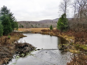
 At Gravestone Junction we stayed left on the Quick Lake Trail heading toward the bridge at the outlet to Frick Pond. This area of the trail had more mud but it was minimal compared to what it sometimes looks like. We continue on the trail and soon arrived at the bridge. I looked at the scene and decided to take some shots even though I have hundreds from the same location. The pond was higher than it had been for some time! I took pictures of the whole scene and some of Beech Mountain. The skies were overcast and the scene had a bleak look. I asked Sheena to sit on the bridge and she immediately posed for a picture. I took several shots and stowed Mt camera to continue our hike. We continued around the west side of the pond where the trail was also wet and muddy. The mud pit was manageable due to the work that had done to increase its drainage. At the junction with the Big Rock Trail, we headed left on the Quick Lake Trail which wet and muddy in places. Just after the junction with the Big Rock Trail there was a large branch across the trail which would have to be cleared with tools. The trail had standing and running water with some mud but these were rather easily avoided. A little farther along there was a complex blowdown across the trail. This consisted of five separate trunks with a maze of branches. It was obvious that the NYNJTC had not assigned a maintainer to these trails and that the Catskill Trail Crew had not bothered to visit. I do not know why they have abandoned maintenance on these trails but it is a schemed as so many people use them. As we walked through the spruce tunnel, we came to several older blowdowns across the trail which were easy to step over. When we came to the small stream across the trail, we found that it was not as narrow or shallow as it had been. I took some pictures as the stream was higher than it had been since the spring. Sheena jumped across the stream but I used some stepping stones to cross. Meanwhile Sheena jumped back and forth across the water several times and then did some wading in the cold clear water. After crossing we continued on the Quick Lake Trail toward Iron Wheel Junction. The trail was wet and muddy for most of the way to Iron Wheel Junction. There was one more blowdown which partly blocked the trail.
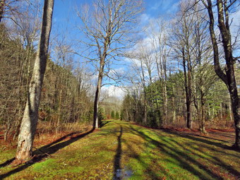
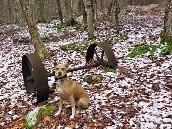 When we got to Iron Wheel Junction, we turned right on the Logger's Loop. Before continuing the hike, I took some pictures. There was a thin layer of snow in many places on the trails. I asked Sheena to pose and I took some more pictures of her. We started out on the Loggers Loop heading toward Times Square. The trail was muddy and wet in most places. There were some small puddles and muddy areas. We were able to walk around these areas without straying far from the trail. The stream that runs under the trail through the large culvert had some water flowing for the first time in months. As we walked up the trail there were more muddy and wet areas. I always notice the ledges on the north side of the trail and promise myself that I would explore them. Today was not the day. Some of the streams which flow across the trail had water but the volume was limited. We passed a tricycle perched on a large rock that had been there for a very long time. The most amazing part of this is that it had been there for 20 years and no one had removed it! When we came to the seasonal pond on the left side of the trail, I could see that it was dry with grasses growing in it. I was surprised as I though there would be some water filling it. We continued on the trail and headed downhill to Times Square which was damp but relatively dry compared to the rest of the trail. I thought about turning left and climbing the Big Rock Trail to add mileage but decided to get back for my ambulance shift. We walked straight across Times Square to stay on the Logger's Loop and came to a stream which is often dry. This time the stream had some water flowing but was easily crossed. We started uphill and encountered more water and mud. Although the trail is slightly uphill we were setting a good pace. We continued walking on the trail trying to avoid the deep mud that was present in many areas. Soon we crested the hill and continued to walk out to Gravestone Junction. This was the driest section of trail with no water or mud. There were still two large blowdowns near the primitive campsites. The blowdowns had been there for months and no one had bothered to clear them. At the Gravestone Junction, we turned left on the Quick Lake Trail. I headed back to the car on the woods road. We walked back toward the register over the wet trail. At the register we continued straight ahead on the woods road back to the car. There were still no vehicles parked in either lot ad I have to admit this the way I like to hike. It was 12:42 PM and we had spent 1 hour and 40 minutes hiking 3.7 miles with an elevation gain was a modest 343 feet. I spent 12 minutes taking picture. The temperature was 34 degrees as we left the parking area. When we got home, I noticed we had no ambulance calls.
![]()
![]()
![]()
![]()
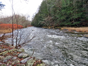
![]() On Sunday, November 16th, I planned to get a hike in after returning from church. I had ambulance coverage for the afternoon but thought I would do a shorter hike so that Cindy could go. When we got home at 12:20 PM, I asked Cindy if she would like to hike. She decided it was too cold and too wet so Sheena and I were on our own. I decided to go to the Beaverkill Campgrounds to see the level of the water in the stream after the recent rainfall. I started to get ready at 12:30 PM with the temperature at 4o degrees on the back porch with overcast skies showing a little blue. As usual, Sheena was excited but was trying to be the "good dog". I got dressed in my Mammut crew top with a short-sleeved baselayer. I put on a pair of insulated hiking pants which seemed to have no maker's label attached. The pants fit well and seemed to have just the right insulation. I decided to put on my Keen Durand hiking boots which fit well. I added a new pair of Xstance insoles in an effort to find the best support and cushioning for my feet. These insoles have shock absorbing gel pads, TPU arch support, and memory foam cushioning all wrapped in a breathable fabric. The insoles have been hyped by their manufacturer and seemed to be living up to their claims. I put on my Mammut hoody as it was cool enough and there was a stiff wind blowing. It has a lot of zippers to dump heat when needed. I grabbed a pair of Leki Micro Vario poles I have been using for some time because they are light and lock without slipping. I put on a light hat to cover my ears and took a pair of light gloves. I decided to take my pack so I could take some pictures which I had not done in some time. I put my gear in the back of the car and Sheena in the back seat and left the house at 12:45 PM. I drove out Old Route 17 toward Roscoe and turned right on Beaverkill Road. When we came to the top of the hill, the temperature had dropped to 36 degrees and a snow squall all but obliterated the road. As we started the descent into the Beaverkill Valley, I turned left on Campsite Road and followed it down to the parking area near the Beaverkill Covered Bridge. The snow had abated but was still falling as I parked. There was one car parked in the lot with no one inside. A glance at the river showed that the level was much higher than it had been in some time. The sandy beach was only slightly exposed and the rock I usually stand on to take pictures was partly covered in water.
On Sunday, November 16th, I planned to get a hike in after returning from church. I had ambulance coverage for the afternoon but thought I would do a shorter hike so that Cindy could go. When we got home at 12:20 PM, I asked Cindy if she would like to hike. She decided it was too cold and too wet so Sheena and I were on our own. I decided to go to the Beaverkill Campgrounds to see the level of the water in the stream after the recent rainfall. I started to get ready at 12:30 PM with the temperature at 4o degrees on the back porch with overcast skies showing a little blue. As usual, Sheena was excited but was trying to be the "good dog". I got dressed in my Mammut crew top with a short-sleeved baselayer. I put on a pair of insulated hiking pants which seemed to have no maker's label attached. The pants fit well and seemed to have just the right insulation. I decided to put on my Keen Durand hiking boots which fit well. I added a new pair of Xstance insoles in an effort to find the best support and cushioning for my feet. These insoles have shock absorbing gel pads, TPU arch support, and memory foam cushioning all wrapped in a breathable fabric. The insoles have been hyped by their manufacturer and seemed to be living up to their claims. I put on my Mammut hoody as it was cool enough and there was a stiff wind blowing. It has a lot of zippers to dump heat when needed. I grabbed a pair of Leki Micro Vario poles I have been using for some time because they are light and lock without slipping. I put on a light hat to cover my ears and took a pair of light gloves. I decided to take my pack so I could take some pictures which I had not done in some time. I put my gear in the back of the car and Sheena in the back seat and left the house at 12:45 PM. I drove out Old Route 17 toward Roscoe and turned right on Beaverkill Road. When we came to the top of the hill, the temperature had dropped to 36 degrees and a snow squall all but obliterated the road. As we started the descent into the Beaverkill Valley, I turned left on Campsite Road and followed it down to the parking area near the Beaverkill Covered Bridge. The snow had abated but was still falling as I parked. There was one car parked in the lot with no one inside. A glance at the river showed that the level was much higher than it had been in some time. The sandy beach was only slightly exposed and the rock I usually stand on to take pictures was partly covered in water.
 I took out my camera and shot some pictures of the covered bridge through the snowstorm. I let Sheena out of the car and we started our hike at 1:00 PM by walking out of the parking lot to the bridge with the temperature at 33 degrees! When we got to the other side, the gate that blocks the road along the river and through the old campsites was closed for the season. I looked at the trail and saw that it was wet and had some running water as well as a developing layer of snow. We turned left on a woods road that parallels the river and started down the short hill. I had decided to take some pictures on the way out. When we got to the spring house on the right I found there was no water so pictures would be uninteresting. I turned my attention to the small streambed next to the spring house and found it had some water but nothing jumped out at me. When we got to the first culvert, I noticed that the path down to the edge of the stream was eroded and very steep. The rocks were damp and had some snow on them so I decided not to attempt to get down to the stream. We continued our walk along the woods road to a little viewpoint where I stopped to take some shots of the stream which had some whitecaps and rapids. The mowed grass was covered in a layer of colorful leaves with some snow accumulating on top of the. The picnic tables blended into the bleak landscape and had a little covering of snow. The whole area had a haunted feeling enhanced by the sound of the flowing water. On the trail we passed by several areas with picnic tables. These tables sit unused and rotting along the road, a testimony to better days when this area had campsites. Now this area is used for day use only. We walked by more tables which had not been used in years. Soon we came to what was once a bathroom for some campsites that had long since disappeared. There were more tables in this area. We stopped and I walked to the stream where rocks had been piled up and contained by wire screen. I walked to the edge and carefully stood on some rocks to take more pictures of the stream in both directions. Sheena came over and stood on the wall next to me. The rapids in this area were more turbulent than during our last visit. I returned to the picnic table where I left my pack and noticed that the snow had stopped and the skies had cleared with some sun shining through. I took some pictures of the path in both direction. In one direction there was blue sky and in the other the skies were overcast. We continued on the woods road. At about .7 miles into the hike the woods road met the paved road that serves the campsites. We continued on the road through the campsites and along the river. Many of the campsites have a cement block fireplace with a grill but some were upgraded to poured concrete. Everything was very quiet except for the water in the river. This was not surprising as the campsites were closed.
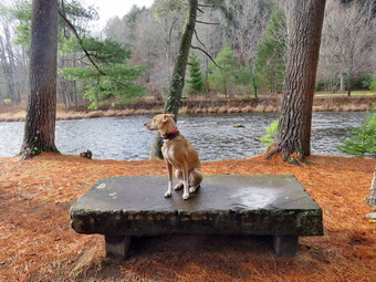 We walked along the paved road to the last campsite where the road ends and I walked down to the edge of the river. I was careful to watch where I was walking as the water level was higher than it had been since the spring. I got pictures from different locations, angles and zooms. I stopped to take some pictures of the river especially downstream. I walked back up to my pack and saw that it was snowing again so I took some pictures of the pathways through the snow. After this I stowed the camera and Sheena and I walked back on the campsite road toward the last bathroom. Where the road split, there was a gathering of picnic tables where we stayed to the left to walk the parallel section of road back through the campsites. This road parallels the one we walked out on to make a sort of loop. We continued along the woods road to the maintenance building and stayed right to walk back toward the parking area. We returned the way we had come although at a quicker pace. We continued our hike and I began to look to the left where the land rose out of the valley to a ridge. I could see that the land leveled off part of the way up and then started up again. I had walked up a path to this area on a previous hike and had no intention of trying it again as I was looking for something new. I had wanted to start further back but will save that for another time. We passed the spring house on the main campsite road and walked up the hill to the gate. We turned right to walk through the bridge but I stopped to look upstream of the bridge. I could see the shoal of rocks and the ledges of bedrock near the bridge. We walked through the bridge and turned right to head back to the parking area. Sheena and I walked down to the streambed to the rock partly covered by water. I took pictures of the rock and then carefully used it to take more pictures. I snapped some shots of the bridge with a layer of snow and some snow still falling. I turned downstream and took more pictures as the sun was behind the clouds. After finishing the photography, I decided to walk passed the car in the parking area and along the river to a stone bench. We passed through the gate at the end of the parking area. We crossed the "sidewalk" which was actually a ford for a branch of the river which has now dried up. Cars would use the ford to drive through a foot or so of water to get to the campsites on the other side. We continued on the wide mowed pathway along the river to the stone bench. I had Sheena jump up on the bench and I took shots of her. I walked to the edge of the stream bank and took a few more pictures upstream including a few of the covered bridge. I also took some photographs downstream. I packed the camera and shouldered my pack choosing to return by another route that paralleled the one we walked out on. We were soon back at the gate and arrived back at the car at 2:20 PM. We had hiked over 2.5 miles in 1 hour and 20 minutes with about 20 minutes of stopped time for pictures. The car's thermometer read 34 degrees and snow was now falling at a rate equivalent to when we had arrived.
![]()
![]()
![]()
![]() On Friday, November 14th, it had been 11 days since we had hiked. Sheena had been spayed the previous Friday and I wanted to make sure she was healed. In addition, ambulance coverage had been slim, the weather was horrendous and Cindy had multiple doctor's appointments. When we came home from her last appointment on Friday, I called another EMT who agreed to cover for about 2 hours which gave us enough time to hike the Parksville Rail Trail. Cindy did not want to go even though she is supposed to walk everyday. I began to get ready at 11:45 AM with the temperature at 38 degrees with completely overcast skies and the look of rain or snow in the air. The Parksville Rail Trail is under three miles out and back but keeping a quick pace helps increase the difficulty. Sheena actually does get in about twice the mileage that I do as she forges ahead and then comes back to me! I have transitioned from using a leash all the time to using a GarmimSport PRO electronic collar which has many versatile settings and seems to do the job. This allows Sheena to roam and keeps me sane by not having to yank on her leash. It seems that Sheena likes hiking as she smells my clothes and then runs to sit by the door! I got dressed in my Mammut crew top with a long-sleeved baselayer. I put on a pair of insulated hiking pants which seemed to have no maker's label attached. The pants fit well and seemed to have just the right insulation. I decided to put on my Keen Durand hiking boots which fit well. I added a new pair of Xstance insoles in an effort to find the best support and cushioning for my feet. These insoles have shock absorbing gel pads, TPU arch support, and memory foam cushioning all wrapped in a breathable fabric. The insoles have been hyped by their manufacturer and seemed to be living up to their claims. I put on my Mammut hoody although I probably did not need it. It has a lot of sippers to dump heat when needed. I grabbed a pair of Leki Micro Vario poles I have been using for some time because they are light and lock without slipping. I chose a light hat to cover my ears and a light pair of gloves. I decided to take my pack so I would have my camera if I wanted to snap some shots. I wanted to set a quick but relied pace. I put my gear in the back of the car and Sheena in the back seat and left Livingston Manor at 12:00 PM. I drove out Old Route 17 toward Parksville and turned left under the Quickway overpass onto Service Road. I drove toward Parksville and pulled into the parking area on the right side of the road just after Fox Mountain Rd. There were no cars parked in the lot when we arrived. I made sure Sheena's ecollar was adjusted correctly and let her out of the car. The temperature was 39 degrees and there were a few snowflakes falling as we started on our hike at 12:12 PM.
On Friday, November 14th, it had been 11 days since we had hiked. Sheena had been spayed the previous Friday and I wanted to make sure she was healed. In addition, ambulance coverage had been slim, the weather was horrendous and Cindy had multiple doctor's appointments. When we came home from her last appointment on Friday, I called another EMT who agreed to cover for about 2 hours which gave us enough time to hike the Parksville Rail Trail. Cindy did not want to go even though she is supposed to walk everyday. I began to get ready at 11:45 AM with the temperature at 38 degrees with completely overcast skies and the look of rain or snow in the air. The Parksville Rail Trail is under three miles out and back but keeping a quick pace helps increase the difficulty. Sheena actually does get in about twice the mileage that I do as she forges ahead and then comes back to me! I have transitioned from using a leash all the time to using a GarmimSport PRO electronic collar which has many versatile settings and seems to do the job. This allows Sheena to roam and keeps me sane by not having to yank on her leash. It seems that Sheena likes hiking as she smells my clothes and then runs to sit by the door! I got dressed in my Mammut crew top with a long-sleeved baselayer. I put on a pair of insulated hiking pants which seemed to have no maker's label attached. The pants fit well and seemed to have just the right insulation. I decided to put on my Keen Durand hiking boots which fit well. I added a new pair of Xstance insoles in an effort to find the best support and cushioning for my feet. These insoles have shock absorbing gel pads, TPU arch support, and memory foam cushioning all wrapped in a breathable fabric. The insoles have been hyped by their manufacturer and seemed to be living up to their claims. I put on my Mammut hoody although I probably did not need it. It has a lot of sippers to dump heat when needed. I grabbed a pair of Leki Micro Vario poles I have been using for some time because they are light and lock without slipping. I chose a light hat to cover my ears and a light pair of gloves. I decided to take my pack so I would have my camera if I wanted to snap some shots. I wanted to set a quick but relied pace. I put my gear in the back of the car and Sheena in the back seat and left Livingston Manor at 12:00 PM. I drove out Old Route 17 toward Parksville and turned left under the Quickway overpass onto Service Road. I drove toward Parksville and pulled into the parking area on the right side of the road just after Fox Mountain Rd. There were no cars parked in the lot when we arrived. I made sure Sheena's ecollar was adjusted correctly and let her out of the car. The temperature was 39 degrees and there were a few snowflakes falling as we started on our hike at 12:12 PM.
The first part of the trail was pretty damp from the rain and snow that had fallen recently. Off her leash Sheena would run ahead of me a certain distance and then maintain that distance by waiting for me or increasing her pace. We were soon under the cover of the trees which helped block the breeze which made the cool weather colder. I was happy I had my hoody which was warm enough and blocks the wind. I looked up and saw a man hiking toward us so I escorted Sheena off to the side of the trail. The man passed as we said "Hello". The trail was wet with soft and muddy patches in all the usual spots. The trail runs parallel to the Little Beaverkill and the new section of State Route 17. It follows the route of the O&W railroad and is very flat. Sheena was setting a quick pace and I didn't mind as long as she would listen and wait for me when necessary. The water level in the stream was even higher than the last trip and was as high as I have seen it since the spring. The Iran and sow had helped to augment the volume. We continued walking on the trail through some muddy patches until we came to the viewpoint just before the wooden walkways. This spot has a nice view down to the stream but the skies were completely overcast. We walked across the wooden walkways which were damp with some snow and slippery due to a layer of leaves that had fallen from the trees. The area before the bridge was wet with some running water. Just after the bridge was a large patch of mud that was a little larger than usual. The culvert under the bridge appeared permanently blocked and the water forms the mud. No one seems concerned about solving this problem. There was water draining off the slope and flowing under the bridge. I walked around the mud to continue the hike but Sheena walked right through it. We came to the landslide that had brought down several trees that had been cut and cleared. This area was muddy but there were some stepping stones. Sheena does not seem to mind sloshing through the water and wading through the mud. Soon I could hear the increase in noise from the stream. The falls came into view and as we walked by I inspected them and found the water was higher than last time.
I looked ahead and saw a man and a woman walking toward the falls. I took got out Sheena's leash and was about to put it on her when the couple turned by the bench and walked down to the stream. We continued on the trail passing them as we pushed on toward the other end of the trail with Sheena in the lead. I did my best to keep up with her. I did take a peek at the stream from the bench on the trail but found nothing interesting. Within a few minutes, I looked up to see some hikers with dogs ahead. I put Sheena on her leashed and hoped the other owner had her dogs leashed. As we approached, I saw that it was a mother a daughter and two white and brown Huskies. The dogs were leashed but the woman was having trouble controlling them and he 4 year old daughter was no help! We hurried passed the group with Sheena paying almost no attention to the dogs. As we neared the Parksville end of the trail a young man came hiking toward us. He stopped to ask if I had seen a woman with two dogs. I indicated she was just ahead of him. We were nearing the Parksville end of the trail and Sheena was eager to continue. We came to a spot in the trail where we could see the other side. The large dog that had been absent for some time was still missing. We continued toward Parksville where the dogs near the end of the trail were also absent. The gate at the beginning of the trail had been placed upright but was not secured in the ground in any way. Whoever places the poles has not learned that they must be deeper and have more cement to support them. We tagged the end of the trail when we reached the sign at the Parksville end of the rail trail. It was 12:42 PM and it had taken us 30 minutes to hike the length of the trail non-stop. We immediately turned around and started back toward the falls. As we approached the falls, I could see the man, woman, child, and two dogs at the picnic table. The dogs were still leashed and Sheena and I walked quickly passed them. We kept a fast pace back toward the car with Sheena in the lead. We soon came to the bridge, I walked around the mud while Sheena pushed through. Sheena decided that she would do some zoomies on the slippery bridge! It was much slipperier than the last time we were there. Sheena would come tearing toward me and put on the brakes so she would slide the last 10 feet! We continued hiking back to the paring area. As we approached the end of the trail, I called Sheena and told her "With" which is the equivalent of "Heel". We arrived back at the car at 1:08 PM after hiking over 2.7 miles in 56 minutes. The temperature was 42 degrees. Sheena seemed fresh and I felt she could have hiked out and back on the trail another time as could I. We returned home and we all had something to eat and drink. There had been no ambulance calls while we were gone which made me feel good.

![]()
![]()
![]()
![]()
![]() On Monday, November 3rd, I had hoped to have ambulance coverage so that I could hike with Sheena. No other EMT was available so I hung around all day without any calls! I was able to get another EMT to cover from 4:00 PM to 6:00 PM which gave us enough time to hike the Parksville Rail Trail. Cindy agreed to go with us and we waited around all day to go. At 3:30 PM I told Cindy to get ready to go and she informed me she was not going. Although I was disappointed, I was not really surprised as this happens quite often. I began to get ready with the temperature at 54 degrees with completely overcast skies and the look obtain in the air. The Parksville Rail Trail is under three miles out and back but keeping a quick pace helps increase the difficulty. Sheena actually does get in about twice the mileage that I do as she forges ahead and then comes back to me! I have transitioned from using a leash all the time to using a GarmimSport PRO electronic collar which has many versatile settings and seems to do the job. This allows Sheena to roam and keeps me sane by not having to yank on her leash. It seems that Sheena likes hiking as she smells my clothes and then runs to sit by the door! I got dressed in my Mammut crew top without a baselayer. I put on a pair of RailRiders hiking pants which are expensive but last a long time and have features like deep pockets and a generous cut which I really like. I decided to put on my Keen Durand hiking boots which fit well. I added a new pair of Xstance insoles in an effort to find the best support and cushioning for my feet. These insoles have shock absorbing gel pads, TPU arch support, and memory foam cushioning all wrapped in a breathable fabric. The insoles have been hyped by their manufacturer and seemed to be living up to their claims. I put on my Mammut hoody although I probably did not need it. It has a lot of sippers to dump heat when needed. I grabbed a pair of Leki Micro Vario poles I have been using for some time because they are light and lock without slipping. I chose a light hat to cover my ears and a light pair of gloves. I decided not to take my pack but to hike as fast as we could. I put my gear in the back of the car and Sheena in the back seat and left Livingston Manor at 3:35 PM. I drove out Old Route 17 toward Parksville and turned left under the Quickway overpass onto Service Road. I drove toward Parksville and pulled into the parking area on the right side of the road just after Fox Mountain Rd. There were no cars parked in the lot when we arrived. I made sure Sheena's ecollar was adjusted correctly and let her out of the car. The temperature was 52 degrees and there were a few raindrops already falling as we started on our hike at 3:50 PM.
On Monday, November 3rd, I had hoped to have ambulance coverage so that I could hike with Sheena. No other EMT was available so I hung around all day without any calls! I was able to get another EMT to cover from 4:00 PM to 6:00 PM which gave us enough time to hike the Parksville Rail Trail. Cindy agreed to go with us and we waited around all day to go. At 3:30 PM I told Cindy to get ready to go and she informed me she was not going. Although I was disappointed, I was not really surprised as this happens quite often. I began to get ready with the temperature at 54 degrees with completely overcast skies and the look obtain in the air. The Parksville Rail Trail is under three miles out and back but keeping a quick pace helps increase the difficulty. Sheena actually does get in about twice the mileage that I do as she forges ahead and then comes back to me! I have transitioned from using a leash all the time to using a GarmimSport PRO electronic collar which has many versatile settings and seems to do the job. This allows Sheena to roam and keeps me sane by not having to yank on her leash. It seems that Sheena likes hiking as she smells my clothes and then runs to sit by the door! I got dressed in my Mammut crew top without a baselayer. I put on a pair of RailRiders hiking pants which are expensive but last a long time and have features like deep pockets and a generous cut which I really like. I decided to put on my Keen Durand hiking boots which fit well. I added a new pair of Xstance insoles in an effort to find the best support and cushioning for my feet. These insoles have shock absorbing gel pads, TPU arch support, and memory foam cushioning all wrapped in a breathable fabric. The insoles have been hyped by their manufacturer and seemed to be living up to their claims. I put on my Mammut hoody although I probably did not need it. It has a lot of sippers to dump heat when needed. I grabbed a pair of Leki Micro Vario poles I have been using for some time because they are light and lock without slipping. I chose a light hat to cover my ears and a light pair of gloves. I decided not to take my pack but to hike as fast as we could. I put my gear in the back of the car and Sheena in the back seat and left Livingston Manor at 3:35 PM. I drove out Old Route 17 toward Parksville and turned left under the Quickway overpass onto Service Road. I drove toward Parksville and pulled into the parking area on the right side of the road just after Fox Mountain Rd. There were no cars parked in the lot when we arrived. I made sure Sheena's ecollar was adjusted correctly and let her out of the car. The temperature was 52 degrees and there were a few raindrops already falling as we started on our hike at 3:50 PM.
 The first part of the trail was pretty damp from the rains that had fallen recently. Off her leash Sheena would run ahead of me a certain distance and then maintain that distance by waiting for me or increasing her pace. We were soon under the cover of the trees which helped to fend off some of the raindrops. I was happy I had my hoody which was warm enough, blocks the wind, and sheds some of the rain. The trail was wet with soft and muddy patches in all the usual spots. The trail runs parallel to the Little Beaverkill and the new section of State Route 17. It follows the route of the O&W railroad and is very flat. Sheena was setting a quick pace and I didn't mind as long as she would listen and wait for me when necessary. The water level in the stream was even higher than the last trip due to the rain and runoff. We continued walking on the trail through some muddy patches until we came to the viewpoint just before the wooden walkways. This spot has a nice view down to the stream but the skies were completely overcast. We walked across the wooden walkways which were damp and slippery due to a layer of leaves that had fallen from the trees. The area before the bridge was wet. Just after the bridge was a large patch of mud that was a little larger than usual. The culvert under the bridge appeared permanently blocked and the water forms the mud. No one seems concerned about solving this problem. I walked around the mud to continue the hike but Sheena walked right through it. We came to the landslide that had brought down several trees that had been cut and cleared. This area was muddy but there were some stepping stones. Sheena does not seem to mind sloshing through the water and wading through the mud. Soon I could hear the increase in noise from the stream. The falls came into view and as we walked by I inspected them and found the water was higher than last time.
 The rain was now falling harder and I thought about turning around. I decided to continue and we pushed on toward the other end of the trail continuing toward Parksville with Sheena in the lead. I did my best to keep up with her. I did take a peek at the stream from the bench on the trail but found nothing interesting. Within a few minutes, we were nearing the Parksville end of the trail and Sheena was eager to continue. We came to a spot in the trail where we could see the other side. The large dog that had been absent for some time was still missing. We continued toward Parksville where the dogs near the end of the trail were also absent. The gate at the beginning of the trail had been placed upright but was not secured in the ground in any way. Whoever places the poles has not learned that they must be deeper and have more cement to support them. We tagged the end of the trail when we reached the sign at the Parksville end of the rail trail. It was 4:10 PM and it had taken us 25 minutes to hike the length of the trail non-stop. I was surprised because I thought we weren't moving that fast! We immediately turned around and started back toward the falls. Once we arrived at the falls, we kept our fast pace back toward the car with Sheena in the lead. We soon came to the bridge, I walked around the mud while Sheena pushed through. Sheena decided that she would do some zoomies on the slippery bridge! We continued hiking as the rain began to pick up. As we approached the end of the trail, I called Sheena and told her "With" which is the equivalent of "Heel". We arrived back at the car at 4:33 PM after hiking over 2.7 miles in 48 minutes. The temperature was still 52 degrees. Sheena seemed fresh and I felt she could have hiked out and back on the trail another time as could I. We went to Liberty to visit the Agway Pet Store so I could buy some bags of treats. We then picked up some eyedrops at the pharmacy. I called Cindy to see if she wanted some take out food but she declined that offer also. We returned home and we all had something to eat and drink. There had been no ambulance calls while we were gone which made me feel good.
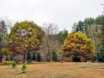
![]()
![]()
![]()
![]()
![]() On Wednesday, October 15th, I planned to get a longer hike in after hiking the rail trail the day before. I had ambulance coverage from 8:00 AM to 4:00 PM but as luck would have it a call came it at 7:00 AM. I called in to go on the call which was rather routine. We returned and I completed some paperwork. At 11:00 AM we went to the school to escort the girls' soccer team on their way to a sectional game. I finally got home at 12:10 PM and asked Cindy if she would like to hike. She chose a shorter hike than I wanted but I knew we both needed to get out so I agreed. We decided to go to the Beaverkill Campgrounds to see the level of the water in the stream after the recent rainfall and to see if any colorful leaves remained on the trees. Cindy was recovering from eye surgery but thought getting out would be good for her. We started to get ready at 12:30 PM with the temperature at 45 degrees on the back porch with completely overcast skies. As usual, Sheena was excited but was trying to be the "good dog". I got dressed in my Mammut crew top with a short-sleeved baselayer. I put on a pair of insulated hiking pants which seemed to have no maker's label attached. The pants fit well and seemed to have just the right insulation. I decided to put on my Keen Durand hiking boots which fit well. I added a new pair of Xstance insoles in an effort to find the best support and cushioning for my feet. These insoles have shock absorbing gel pads, TPU arch support, and memory foam cushioning all wrapped in a breathable fabric. The insoles have been hyped by their manufacturer and seemed to be living up to their claims. I put on my Mammut hoody as it was cool enough and there was a slight breeze. It has a lot of zippers to dump heat when needed. I grabbed a pair of Leki Micro Vario poles I have been using for some time because they are light and lock without slipping. I put on a light hat to cover my ears and took a pair of light gloves. I decided to take my pack so I could take some pictures which I had not done in some time. I put our gear in the back of the car and Sheena in the back seat and we left the house at 12:45 PM. I drove out Old Route 17 toward Roscoe and turned right on Beaverkill Road. As we started the descent into the Beaverkill Valley, I turned left on Campsite Road and followed it down to the parking area near the Beaverkill Covered Bridge. There was one car parked in the lot as I pulled in and parked. A glance at the river showed that the level was higher than it had been in some time. The sandy beach was exposed and the rock I usually stand on to take pictures was also exposed.
On Wednesday, October 15th, I planned to get a longer hike in after hiking the rail trail the day before. I had ambulance coverage from 8:00 AM to 4:00 PM but as luck would have it a call came it at 7:00 AM. I called in to go on the call which was rather routine. We returned and I completed some paperwork. At 11:00 AM we went to the school to escort the girls' soccer team on their way to a sectional game. I finally got home at 12:10 PM and asked Cindy if she would like to hike. She chose a shorter hike than I wanted but I knew we both needed to get out so I agreed. We decided to go to the Beaverkill Campgrounds to see the level of the water in the stream after the recent rainfall and to see if any colorful leaves remained on the trees. Cindy was recovering from eye surgery but thought getting out would be good for her. We started to get ready at 12:30 PM with the temperature at 45 degrees on the back porch with completely overcast skies. As usual, Sheena was excited but was trying to be the "good dog". I got dressed in my Mammut crew top with a short-sleeved baselayer. I put on a pair of insulated hiking pants which seemed to have no maker's label attached. The pants fit well and seemed to have just the right insulation. I decided to put on my Keen Durand hiking boots which fit well. I added a new pair of Xstance insoles in an effort to find the best support and cushioning for my feet. These insoles have shock absorbing gel pads, TPU arch support, and memory foam cushioning all wrapped in a breathable fabric. The insoles have been hyped by their manufacturer and seemed to be living up to their claims. I put on my Mammut hoody as it was cool enough and there was a slight breeze. It has a lot of zippers to dump heat when needed. I grabbed a pair of Leki Micro Vario poles I have been using for some time because they are light and lock without slipping. I put on a light hat to cover my ears and took a pair of light gloves. I decided to take my pack so I could take some pictures which I had not done in some time. I put our gear in the back of the car and Sheena in the back seat and we left the house at 12:45 PM. I drove out Old Route 17 toward Roscoe and turned right on Beaverkill Road. As we started the descent into the Beaverkill Valley, I turned left on Campsite Road and followed it down to the parking area near the Beaverkill Covered Bridge. There was one car parked in the lot as I pulled in and parked. A glance at the river showed that the level was higher than it had been in some time. The sandy beach was exposed and the rock I usually stand on to take pictures was also exposed.
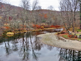 I put Sheena on her leash and we started our hike at 1:05 PM by walking out of the parking lot to the bridge with the temperature at 46 degrees. When we got to the other side, the gate that normally blocks the road along the river and through the old campsites was open. I looked at the trail and saw that it was completely bare and only a little damp. We turned left on a woods road that parallels the river and started down the short hill. I had decided to take some pictures on the way out. When we got to the spring house on the right I found there was no water so pictures would be uninteresting. I turned my attention to the small streambed next to the spring house and found it was dry with a thin layer of mud. Again no chance to take pictures. When we got to the first culvert, I noticed that the path down to the edge of the stream was eroded and very steep. I decided to attempt to get down to the stream using my poles. I successfully reached the stream and perched on a rock to take pictures. There was no direct sunlight and the overcast made for some interesting shots. Sheena came to join me and decided to jump in the water which was pretty deep. She took a little swim and then jumped back up on shore. I worked my way back up to the bank and we continued our walk along the woods road. The landscape including the mowed grass covered in a layer of colorful leaves and the picnic tables blended into the bleak overcast. The whole area had a haunted feeling enhanced by the sound of the flowing water. On the trail we passed by several areas with picnic tables. These tables sit unused and rotting along the road, a testimony to better days when this area had campsites. Now this area is used for day use only. We walked by more tables which had not been used in years. I did stop at one point to take some pictures of the tables that were in better condition. I also snapped some shots of the woods road covered in leaves. A little later we came to what was once a bathroom for some campsites that had long since disappeared. There were more tables in this area. We stopped and I walked to the stream where rocks had been piled up and contained by wire screen. I walked to the edge and stood on some rocks to take more pictures of the stream in both directions. Sheena came over and stood on the wall next to me. The rapids in this area were more turbulent than during our last visit. I returned to the picnic table where I left my pack and took a few shots of the bathroom and the woods road before we continued on the woods road. At about .7 miles into the hike the woods road met the paved road that serves the campsites. I stopped to take some pictures of the empty campsites. We continued on the road through the campsites and along the river. Many of the campsites have a cement block fireplace with a grill but some were upgraded to poured concrete. Everything was very quiet except for the water in the river. This was not surprising as the campsites were closed.
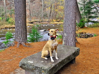 We walked along the paved road to the last campsite where the road ends and I walked down to the edge of the river. I was careful to watch where I was walking but the water level was low enough to allow me to walk out into the stream to get pictures from a different location and angle. Sheena decided she wanted to wade a little a get a short drink. I stopped to take some pictures of the river especially downstream. I walked back up to my pack and stowed the camera. Sheena and I walked passed the campsites along a path next to the stream. We came to a spot where the path ended and I could see the bend in the river. I took out my camera and took some shot of the stream before stowing the camera. We walked back to Cindy who waited at one of the last campsites. We turned around and walked back passed the last campsite. We continued on the campsite road toward the last bathroom. Where the road split, there was a gathering of picnic tables where we stayed to the left to walk the parallel section of road back through the campsites. This road parallels the one we walked out on to make a sort of loop. I stopped again to take pictures of the volleyball net and two oak trees that still refined their leaves. We continued along the woods road to the maintenance building and stayed right to walk back toward the parking area. We returned the way we had come although at a quicker pace. We continued our hike and I began to look to the left where the land rose out of the valley to a ridge. I could see that the land leveled off part of the way up and then started up again. I had walked up a path to this area on a previous hike and had no intention of trying it again as I was looking for something new. I had wanted to start further back but will save that for another time. We passed the spring house on the main campsite road and walked up the hill to the gate. We turned right to walk through the bridge but I stopped to look upstream of the bridge. I stopped to take a few pictures of the shoal of rocks and the ledges of bedrock near the bridge. We walked through the bridge and turned right to head back to the parking area. We decided to walk passed the car and along the river to a stone bench. We passed through the gate at the end of the parking area. I stopped to take pictures of the "sidewalk" which was actually a ford for a branch of the river which has now dried up. We continued on the wide mowed pathway along the river to the stone bench. I took some pictures of the bench and the river. I then had Sheena jump up on the bench and I repeated the shots. I walked to the edge of the stream bank and took a few more pictures upstream including a few of the covered bridge. I also took some photographs downstream. I packed the camera and shouldered my pack choosing to return by another route that paralleled the one we walked out on. We were soon back at the gate and arrived back at the car at 2:45 PM. We had hiked over 2.5 miles in 1 hour and 40 minutes with about 20 minutes of stopped time for pictures. The car's thermometer read 48 degrees and I had just enough time to get home to cover ambulance calls.
![]()
![]()
![]()
![]()
![]() On Monday, October 27th, I had ambulance coverage from 8:00 Am to 2:00 PM so I planned to get a hike in as Sheena was a ball of energy. Last week was a busy one with doctor's appointments for Cindy and a number of ambulance calls. When I got up at 6:30 AM the temperature was 23 degrees! I asked Cindy if she would like to hike and she agreed if we could start a little later in the day. We started to get ready to hike at 10:15 AM. We decided to go to the Parksville Rail Trail and began to get ready with the temperature at 46 degrees with sunny skies and a slight breeze. The Parksville Rail Trail is under three miles out and back but keeping a quick pace helps increase the difficulty. Sheena actually does get in about twice the mileage that I do as she forges ahead and then comes back to me! I have transitioned from using a leash all the time to using a GarmimSport PRO electronic collar which has many versatile settings and seems to do the job. This allows Sheena to roam and keeps me sane by not having to yank on her leash. It seems that Sheena likes hiking as she smells my clothes and then runs to sit by the door! I got dressed in my Mammut crew top with a short-sleeved baselayer. I put on a pair of insulated hiking pants which seemed to have no maker's label attached. The pants fit well and seemed to have just the right insulation. I decided to put on my Keen Durand hiking boots which fit well. I added a new pair of Xstance insoles in an effort to find the best support and cushioning for my feet. These insoles have shock absorbing gel pads, TPU arch support, and memory foam cushioning all wrapped in a breathable fabric. The insoles have been hyped by their manufacturer and seemed to be living up to their claims. I put on my Mammut hoody as it was cool enough and there was a slight breeze. It has a lot of zippers to dump heat when needed. I grabbed a pair of Leki Micro Vario poles I have been using for some time because they are light and lock without slipping. I put on a light hat to cover my ears and took a pair of light gloves. I decided to take my pack so I could take some pictures which I had not done in some time. I put our gear in the back of the car and Sheena in the back seat and left Livingston Manor at 10:40 PM. I drove out Old Route 17 toward Parksville and turned left under the Quickway overpass onto Service Road. I drove toward Parksville and pulled into the parking area on the right side of the road just after Fox Mountain Rd. There were no cars parked in the lot when we arrived. I made sure Sheena's ecollar was adjusted correctly and let her out of the car. The temperature was 48 degrees but the sun made it feel warmer.
On Monday, October 27th, I had ambulance coverage from 8:00 Am to 2:00 PM so I planned to get a hike in as Sheena was a ball of energy. Last week was a busy one with doctor's appointments for Cindy and a number of ambulance calls. When I got up at 6:30 AM the temperature was 23 degrees! I asked Cindy if she would like to hike and she agreed if we could start a little later in the day. We started to get ready to hike at 10:15 AM. We decided to go to the Parksville Rail Trail and began to get ready with the temperature at 46 degrees with sunny skies and a slight breeze. The Parksville Rail Trail is under three miles out and back but keeping a quick pace helps increase the difficulty. Sheena actually does get in about twice the mileage that I do as she forges ahead and then comes back to me! I have transitioned from using a leash all the time to using a GarmimSport PRO electronic collar which has many versatile settings and seems to do the job. This allows Sheena to roam and keeps me sane by not having to yank on her leash. It seems that Sheena likes hiking as she smells my clothes and then runs to sit by the door! I got dressed in my Mammut crew top with a short-sleeved baselayer. I put on a pair of insulated hiking pants which seemed to have no maker's label attached. The pants fit well and seemed to have just the right insulation. I decided to put on my Keen Durand hiking boots which fit well. I added a new pair of Xstance insoles in an effort to find the best support and cushioning for my feet. These insoles have shock absorbing gel pads, TPU arch support, and memory foam cushioning all wrapped in a breathable fabric. The insoles have been hyped by their manufacturer and seemed to be living up to their claims. I put on my Mammut hoody as it was cool enough and there was a slight breeze. It has a lot of zippers to dump heat when needed. I grabbed a pair of Leki Micro Vario poles I have been using for some time because they are light and lock without slipping. I put on a light hat to cover my ears and took a pair of light gloves. I decided to take my pack so I could take some pictures which I had not done in some time. I put our gear in the back of the car and Sheena in the back seat and left Livingston Manor at 10:40 PM. I drove out Old Route 17 toward Parksville and turned left under the Quickway overpass onto Service Road. I drove toward Parksville and pulled into the parking area on the right side of the road just after Fox Mountain Rd. There were no cars parked in the lot when we arrived. I made sure Sheena's ecollar was adjusted correctly and let her out of the car. The temperature was 48 degrees but the sun made it feel warmer.
The first part of the trail was only damp from the rains that had fallen recently as the sun had dried it out. We continued on the trail at a relaxed pace so that we could talk. This was Cindy's first hike after having cataract and glaucoma surgery on both eyes and she was doing remarkably well! Off her leash Sheena would run ahead of us a certain distance and then maintain that distance by waiting for us or increasing her pace. We were soon back under the cover of the trees. Once we were hiking on the trail, we were sheltered from the sun and there was a slight breeze that made me happy I had my hoody. The trail was wet with soft and muddy patches in all the usual spots. The trail runs parallel to the Little Beaverkill and the new section of State Route 17. It follows the route of the O&W railroad and is very flat. Sheena was setting a good pace and we didn't mind as long as she would listen and wait for us when necessary. The water level in the stream was somewhat higher due to the rain and runoff. We continued walking on the trail through some muddy patches until we came to the viewpoint just before the wooden walkways. This spot has a nice view down to the stream and the skies were blue with some nice clouds. We walked across the wooden walkways which were mostly dry but a little slippery due to a layer of leaves that had fallen from the trees. The area before the bridge was only damp. Just after the bridge was a large patch of mud that was a little larger than usual. The culvert under the bridge appeared permanently blocked and the water forms the mud. No one seems concerned about solving this problem. We walked around the mud to continue the hike but Sheena walked right through it. We came to the landslide that had brought down several trees that had been cut and cleared. This area was muddy but there were some stepping stones. Sheena does not seem to mind sloshing through the water and wading through the mud. As we approached the falls, we could hear the increase in noise from the stream. Soon we came to the falls and I took a peek at the water level. I decided Sheena and I would walk down to the streambed so that I could take some pictures. I knew I would have to be careful to make sure there were no icy patches on the rocks. Sheena and I made it down to the streambed without any problems although Sheena was much faster. I put down my pack and took out the camera. I took wide angle shots of the falls and then zoomed in on each section. I also used different shutter speeds to give the falling water different effects. I walked out on the rocks to take pictures of the falls from a different angle. I turned around and took some shots downstream. I looked for Sheena but she was already back up on the trail. I called her down and asked her to pose on some rocks in front of the falls. I took some shots and then returned the camera to my pack. I walked back up the path to the trail. I put down my pack on the picnic table and got out the camera. I took some shots of the falls from above. After changing position, I snapped some pictures of the rapids above the falls and then returned the camera to my pack.
We pushed on toward the other end of the trail continuing toward Parksville with Sheena in the lead. We did our best to keep up with her. Within a few minutes, we were nearing the Parksville end of the trail and Sheena was eager to continue. We came to a spot in the trail where we could see the other side. The large dog that had been present last time did not make an appearance. We continued toward Parksville where the dogs near the end of the trail were absent and there was no loud music playing. The gate at the beginning of the trail was still lying on the ground indicating it is not a priority for the Town of Liberty. Whoever places the poles has not learned that they must be deeper and have more cement to support them. We tagged the end of the trail when we reached the sign at the Parksville end of the rail trail. It was 11:40 AM and it had taken us 40 minutes which is just short of the time Sheena and I can do the trail non-stop. We immediately turned around and started back toward the falls. Once we arrived at the falls, we kept our fast pace back toward the car with Sheena in the lead. We soon came to the bridge, we walked around the mud while Sheena pushed through. As we approached the end of the trail, I called Sheena and told her "With" which is the equivalent of "Heel". We met a man with his dog just starting out on the trail. This was the same pair that had been at the trailhead when we started our hike last time. The man advised me that his dog did not like other dogs. I assured him mine was the same! I leashed Sheena and we passed the hiker with a quick "Hello". We arrived back at the car at 12:15 PM after hiking over 2.7 miles in 1 hour and 25 minutes. The temperature was 54 degrees. Sheena seemed fresh and I felt she could have hiked out and back on the trail another time as could I. We returned home and we all had something to drink. There had been no other ambulance calls while we were on the trail which made me feel good.
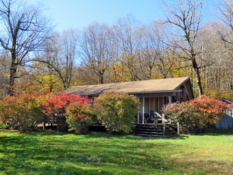
![]()
![]()
![]()
![]()
![]() On Tuesday, October 21st, I wanted to get in a longer hike than I had been doing recently. There had been some rain and numerous eye doctor appointments for my wife. I had coverage for ambulance calls from 8:00 AM to 2:00 PM so we could hike for up to 4 hours without guilt. When I got up at 9:00 AM it was 48 degrees on the back porch and I knew the temperature was forecast to rise only slightly throughout the day. I wanted to get out and hike to some elevation to keep the fitness level I had built up. I decided to head to the Frick Pond area and hike the Flynn Trail toward Beech Mountain where there are several good viewpoints. I was hoping that there would still be some nice colors on the fall leaves. I started to get ready at 9:30 AM with the skies blue but without the puffy white clouds that add to landscape pictures. Sheena was pretty excited as I started to get ready as getting out to hike is her favorite thing. I got dressed in my Mammut long-sleeved crew top with a short-sleeved compression baselayer. I put on a pair of RailRiders hiking pants which are expensive but last a long time and have features like deep pockets and a generous cut which I really like. I decided to put on my Keen Durand hiking boots which fit well. I added a new pair of Xstance insoles in an effort to find the best support and cushioning for my feet. These insoles have shock absorbing gel pads, TPU arch support, and memory foam cushioning all wrapped in a breathable fabric. The insoles have been hyped by their manufacturer and seemed to be living up to their claims. I grabbed a pair of Leki Micro Vario poles I have been using for some time because they are light and lock without slipping. I wore a light hiking hat to keep my head warm and took along a pair of light gloves. I put my gear in the back of the car and Sheena in the back seat and left my house at 10:35 AM. I drove out the DeBruce Road about 6 miles to Mongaup Road and turned left. I continued up the road to the point where it splits and stayed left on Beech Mountain Road. It was a short drive to the parking areas on the left. There were no cars in either parking area. I parked in the smaller lot and got out and set my GPS. Even though I had hiked this area extensively, I like a record of what I do on each hike. I made sure Sheena's ecollar was turned on and I let her out of the car. She immediately began to run around following her nose. We crossed the road at 10:50 AM to begin our hike on the Flynn Trail with the temperature at 52 degrees.
On Tuesday, October 21st, I wanted to get in a longer hike than I had been doing recently. There had been some rain and numerous eye doctor appointments for my wife. I had coverage for ambulance calls from 8:00 AM to 2:00 PM so we could hike for up to 4 hours without guilt. When I got up at 9:00 AM it was 48 degrees on the back porch and I knew the temperature was forecast to rise only slightly throughout the day. I wanted to get out and hike to some elevation to keep the fitness level I had built up. I decided to head to the Frick Pond area and hike the Flynn Trail toward Beech Mountain where there are several good viewpoints. I was hoping that there would still be some nice colors on the fall leaves. I started to get ready at 9:30 AM with the skies blue but without the puffy white clouds that add to landscape pictures. Sheena was pretty excited as I started to get ready as getting out to hike is her favorite thing. I got dressed in my Mammut long-sleeved crew top with a short-sleeved compression baselayer. I put on a pair of RailRiders hiking pants which are expensive but last a long time and have features like deep pockets and a generous cut which I really like. I decided to put on my Keen Durand hiking boots which fit well. I added a new pair of Xstance insoles in an effort to find the best support and cushioning for my feet. These insoles have shock absorbing gel pads, TPU arch support, and memory foam cushioning all wrapped in a breathable fabric. The insoles have been hyped by their manufacturer and seemed to be living up to their claims. I grabbed a pair of Leki Micro Vario poles I have been using for some time because they are light and lock without slipping. I wore a light hiking hat to keep my head warm and took along a pair of light gloves. I put my gear in the back of the car and Sheena in the back seat and left my house at 10:35 AM. I drove out the DeBruce Road about 6 miles to Mongaup Road and turned left. I continued up the road to the point where it splits and stayed left on Beech Mountain Road. It was a short drive to the parking areas on the left. There were no cars in either parking area. I parked in the smaller lot and got out and set my GPS. Even though I had hiked this area extensively, I like a record of what I do on each hike. I made sure Sheena's ecollar was turned on and I let her out of the car. She immediately began to run around following her nose. We crossed the road at 10:50 AM to begin our hike on the Flynn Trail with the temperature at 52 degrees.
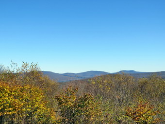 The first part of the trail near the road had become further eroded by the recent rains but people had walked around the gully forming a new trail. The walk through the woods was relatively easy and the trail was only damp. I was surprised as there had been a hard rain un the last couple of days. When we came to the end of the trail, we turned right onto what once was Beech Mountain Road. This area of the trail was also only damp. I wondered if the rest of the trail would be the same. Starting out my whole body was tired particularly my legs. The further we hiked the better I felt. I set a relaxed pace up the Flynn Trail as I was in no hurry. Sheena was about 20 feet ahead of me all the time. Every time I slowed down she did also to keep the same distance. She usually ventures off the trail following a game trail or chasing a squirrel and today was no exception. Whenever she got too far ahead I gave the command "Not too far" and she would come right back to me. We did not stop along the way but continued toward the junction with the Big Rock Trail. The Flynn Trail is uphill all the way for the first 1.7 miles to the Big Rock Junction. We passed the mile mark around the point where there is a clearing to the right of the trail. We were soon walking the final uphill section to the junction with the Big Rock Trail. It was 11:40 AM so we had covered the 1.7 mile distance in 50 minutes which was a good time. We continued through the junction and passed through the gate which is the boundary between state land and Beaverkill Land Trust property. It was a short walk to the point where the Flynn Trail heads left and downhill to Hodge Pond. Here we turned to the right on the woods road and walked along the road to the junction of some roads above the pond. At this junction a road turns left to go down to the pond. Just a little further on the road splits with the left fork passing by the site of the former Beech Mountain Boy Scout Camp and ending up on Shin Creek Road in Lew Beach. The camp has been bulldozed by the Land Trust because the building were in ruins and collapsing. The road out to Shin Creek Road is now available for hiking and has a nice parking area near Shin Creek Road. We continued up the hill toward the Hodge Pond Lookouts on a woods road that surrounds Flynn's Point on Beech Mountain, the highest point in Sullivan County. As we walked, I could see that there had not been any vehicles on the road recently as there were no new tracks, a thick layer of leaves and several blowdowns. I had noticed that I was a little tired walking up the Flynn Trail but felt more energized walking up the road. There had been some work done of the road creating runoffs so that water would run into the woods preventing erosion.
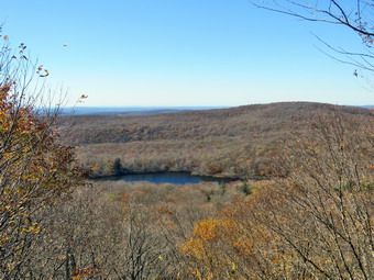 I wasn't really tired so we pushed the pace a little more. The sun was out and there was a slight breeze blowing making the conditions ideal for hiking. When we got to the old sand and gravel pit where the trail levels the sun hit me full force and I realized how warm it really was. The trail began to gain elevation again and we passed by a spring house on the right where Sheila used to like to dig in the water and get a drink. Sheena also got a drink but the amount of water was very small. There are several twists and turns along this road and it is sometimes hard for me to know exactly where I am. At 2.7 miles we came to a lookout on the left of the trail. The lookout had grown in so that there was almost no view except for the tops of some hills even with almost all of the leaves off the trees. We did not stop but continued on the road as it made a sharp right turn. Just after this the road turned to the left and another trail branched off to the right. We followed the road to the left as it gained some elevation then started downhill. We passed a woods road on the right and then the path on the left toward Mongaup Mountain, one of the Catskill Highest Hundred. The road turned to the right and soon led to a cabin with a beautiful lawn. The lawn had an incredible view to the east with many of the 3500 foot peaks visible. The panorama from this lookout takes in the Burroughs Range and many of the other Catskill peaks. Unfortunately, the trees have begun to grow up and are starting to limit the view. The sky was flat with only a few clouds and there was a haze hanging over the distant mountain peaks. Most of the trees were completely devoid of leaves but there were some nice colors in the trees nearby. I got out my camera and took some pictures. I posed Sheena near the fire ring and took some shots of her. She really seems to get posing for photos. When we were done, I got a drink and ate a bar before continuing on the woods road. Sheena was impatient as she always wants to be in motion and she easily found the woods road and head out ahead of me. We climbed a short hill to the woods road that surrounds Beech Mountain and turned left. We followed the woods road clockwise around Beech Mountain. There are some impressive ledges on the right of the trail going in this direction. I wanted to take some pictures but it was hard to get an angle. We came across a blowdown that had been cut by chainsaw. We walked passed the blowdown and arrived at the Hodge Pond Lookout.
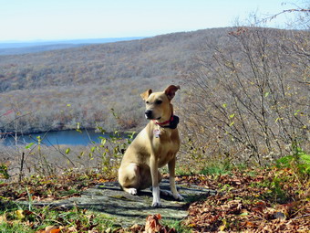 I dropped my pack and took out my camera. I took a picture of the graphic sign at the lookout which indicated the danger of falling off the ledge. A month ago the view was blocked by trees but someone had cut down most of the trees and brush blocking the view. There was an exceptional view from the viewpoint so I walked out to the lookout to take pictures. I took some pictures of the pond below and the hills in the distance. The view was a little hazy in the distance. When I was done taking pictures, I had Sheena sit on the viewpoint while I took some shots with the pond and the leaves in the background. I got another drink and gave some to Sheena. We continued on the woods road traveling clockwise around Beech Mountain. The trail was only damp in several places and the rest was dry. We were back at the road and turned left to start downhill. We definitely picked up the pace as I knew the rest of the trip back was all flat or downhill. The trip down was much quicker than the trip up. When we reached the bottom of the hill, it was 1:05 PM so I decided to continue straight ahead and return on the Flynn Trail to make sure I was home by 2:00 PM. I was lost in my own thoughts as we descended the trail. It was much easier going down than up and our pace increased. Sheena was still full of energy and was off rail more than on it. At points she was wading through ferns that were still taller than her. Sheena's solution was to bounce through ferns so her head was above the tops of the ferns. As we approached the gate at the end of the woods road, Sheena stopped to wait for me and followed behind as we continued on the Flynn Trail through the woods. We were soon back at the car. It was 1:50 PM and we had hiked 6.2 miles in 3 hours gaining 1058 feet along the way. We had stopped for a total of 12 minutes. Our speed was 2.0 mph overall and 2.2 mph moving. The temperature had risen to 54 degrees.
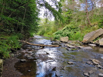
![]()
![]()
![]()
![]()
![]() On Sunday, October 19th, I was on ambulance duty after church so hiking looked out of the question. I was fortune to have another EMT cover for me from 4:00 PM to 6:00 PM so I could get in a hike with Sheena. I started to get ready to hike at 3:30 PM. I decided to go to the Parksville Rail Trail and began to get ready with the temperature at 66 degrees with cloudy skies with some blue and some sun. The Parksville Rail Trail is under three miles out and back but keeping a quick pace helps increase the difficulty. Sheena actually does get in about twice the mileage that I do as she forges ahead and then comes back to me! I have transitioned from using a leash all the time to using a GarmimSport PRO electronic collar which has many versatile settings and seems to do the job. This allows Sheena to roam and keeps me sane by not having to yank on her leash. It seems that Sheena likes hiking as she smells my clothes and then runs to sit by the door! I got dressed in my Mammut crew top without a baselayer. I put on a pair of RailRiders hiking pants which are expensive but last a long time and have features like deep pockets and a generous cut which I really like. I decided to put on my Keen Durand hiking boots which fit well. I added a new pair of Xstance insoles in an effort to find the best support and cushioning for my feet. These insoles have shock absorbing gel pads, TPU arch support, and memory foam cushioning all wrapped in a breathable fabric. The insoles have been hyped by their manufacturer and seemed to be living up to their claims. I put on my Mammut hoody although I probably did not need it. It has a lot of sippers to dump heat when needed. I grabbed a pair of Leki Micro Vario poles I have been using for some time because they are light and lock without slipping. I didn't bother to wear my OR floppy hat or gaiters. I also decided not to take my pack but to hike as fast as we could. I put my gear in the back of the car and Sheena in the back seat and left Livingston Manor at 4:00 PM. I drove out Old Route 17 toward Parksville and turned left under the Quickway overpass onto Service Road. I drove toward Parksville and pulled into the parking area on the right side of the road just after Fox Mountain Rd. There was one car parked in the lot when we arrived and I could see the owner was starting on the trail with his dog on a leash. I almost decided to go to the other trailhead in Parksville but parked instead. I made sure Sheena's ecollar was adjusted correctly and then I put her on her leash and let her out of the car. The temperature was 66 degrees but the sun made it feel warmer.
On Sunday, October 19th, I was on ambulance duty after church so hiking looked out of the question. I was fortune to have another EMT cover for me from 4:00 PM to 6:00 PM so I could get in a hike with Sheena. I started to get ready to hike at 3:30 PM. I decided to go to the Parksville Rail Trail and began to get ready with the temperature at 66 degrees with cloudy skies with some blue and some sun. The Parksville Rail Trail is under three miles out and back but keeping a quick pace helps increase the difficulty. Sheena actually does get in about twice the mileage that I do as she forges ahead and then comes back to me! I have transitioned from using a leash all the time to using a GarmimSport PRO electronic collar which has many versatile settings and seems to do the job. This allows Sheena to roam and keeps me sane by not having to yank on her leash. It seems that Sheena likes hiking as she smells my clothes and then runs to sit by the door! I got dressed in my Mammut crew top without a baselayer. I put on a pair of RailRiders hiking pants which are expensive but last a long time and have features like deep pockets and a generous cut which I really like. I decided to put on my Keen Durand hiking boots which fit well. I added a new pair of Xstance insoles in an effort to find the best support and cushioning for my feet. These insoles have shock absorbing gel pads, TPU arch support, and memory foam cushioning all wrapped in a breathable fabric. The insoles have been hyped by their manufacturer and seemed to be living up to their claims. I put on my Mammut hoody although I probably did not need it. It has a lot of sippers to dump heat when needed. I grabbed a pair of Leki Micro Vario poles I have been using for some time because they are light and lock without slipping. I didn't bother to wear my OR floppy hat or gaiters. I also decided not to take my pack but to hike as fast as we could. I put my gear in the back of the car and Sheena in the back seat and left Livingston Manor at 4:00 PM. I drove out Old Route 17 toward Parksville and turned left under the Quickway overpass onto Service Road. I drove toward Parksville and pulled into the parking area on the right side of the road just after Fox Mountain Rd. There was one car parked in the lot when we arrived and I could see the owner was starting on the trail with his dog on a leash. I almost decided to go to the other trailhead in Parksville but parked instead. I made sure Sheena's ecollar was adjusted correctly and then I put her on her leash and let her out of the car. The temperature was 66 degrees but the sun made it feel warmer.
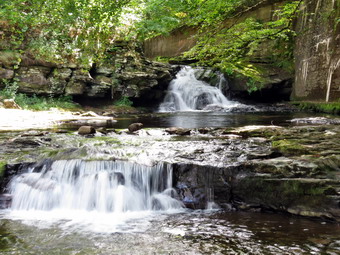 The first part of the trail was only damp from the rains that had fallen recently as the sun had dried it out. The man and his dog had only made it a short distance up the trail and did not even see us coming. We hurried by and were at least 20 feet ahead of them when the dog started to bark. We continued our fast pace and were soon far enough ahead that I let Sheena loose. Off her leash Sheena would run ahead of me a certain distance and then maintain that distance by waiting for me or increasing her pace. We were soon back under the cover of the trees. Once we were hiking on the trail, we were sheltered from the sun and there was a slight breeze that made we happy I had my hoody. The trail was wet with soft and muddy patches in all the usual spots. The trail runs parallel to the Little Beaverkill and the new section of State Route 17. It follows the route of the O&W railroad and is very flat. Sheena was setting a quick pace and I didn't mind as long as she would listen and wait for me when necessary. The water level in the stream was low but was somewhat higher due to the rain and runoff. We continued walking on the trail through some muddy patches until we came to the viewpoint just before the wooden walkways. This spot has a nice view down to the stream and the skies were blue with some nice clouds. We walked across the wooden walkways which were damp and slippery due to a layer of leaves that had fallen from the trees. The area before the bridge was only damp. Just after the bridge was a large patch of mud that was a little larger than usual. The culvert under the bridge appeared permanently blocked and the water forms the mud. No one seems concerned about solving this problem. I walked around the mud to continue the hike but Sheena walked right through it. We came to the landslide that had brought down several trees that had been cut and cleared. This area was muddy but there were some stepping stones. Sheena does not seem to mind sloshing through the water and wading through the mud. As we walked, we could see a young woman walking on the trail ahead of us. We could now hear the increase in noise from the stream. Soon we came to the falls and as we walked by I inspected them and found the water was just a little higher than last time.
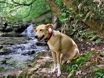 We pushed on toward the other end of the trail continuing toward Parksville with Sheena in the lead. I did my best to keep up with her. I did take a peek at the stream from the bench on the trail but found nothing interesting. We were catching up to the hiker ahead of us but not very quickly. Within a few minutes, we were nearing the Parksville end of the trail and Sheena was eager to continue. We came to a spot in the trail where we could see the other side. The large dog that had been absent for some time was back and barking loudly. We continued toward Parksville where the dogs near the end of the trail were absent. The gate at the beginning of the trail was still lying on the ground indicating it is not a priority for the Town of Liberty. Whoever places the poles has not learned that they must be deeper and have more cement to support them. I could see the young woman walking to the trailhead. We tagged the end of the trail when we reached the sign at the Parksville end of the rail trail. It was 4:32 PM and it had taken us 22 minutes to hike the length of the trail non-stop. I was surprised because I thought we weren't moving that fast! We immediately turned around and started back toward the falls. Once we arrived at the falls, we kept our fast pace back toward the car with Sheena in the lead. We soon came to the bridge, I walked around the mud while Sheena pushed through. As we approached the end of the trail, I called Sheena and told her "With" which is the equivalent of "Heel". We never did meet the man with the dog but another hiker was just starting out. I leashed Sheena and we passed the hiker with a quick "Hello". We arrived back at the car at 4:55 PM after hiking over 2.7 miles in 45 minutes. The temperature was still 66 degrees. Sheena seemed fresh and I felt she could have hiked out and back on the trail another time as could I. We returned home and we all had something to drink. There had been no other ambulance calls while we were on the trail which made me feel good.
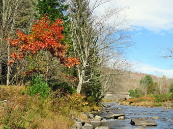
![]()
![]()
![]()
![]()
![]() On Wednesday, October 15th, I was committed to picking up a hiker at the Slide Mountain trailhead on Rt 47 at 10:30 AM and dropping him off at the trailhead on Berry Brook and Holiday Brook Roads. The hiker was from the Rochester area and was working to complete the Finger Lakes Trail. I arrived at the parking area at 10:15 AM and the hiker arrived shortly after. We transferred his gear from his car to mine and started back toward Livingston Manor using Pole-Willowemoc-DeBruce Rd. In Livingston Manor I took Beaverkill Road to the turnoff for Campground Road. I took Campground Road to the Beaverkill Covered Bridge and crossed. At the junction with Berry Brook Road I turned right and drove to the parking area where the FLT crosses the road. The weather going toward Slide had looked questionable with dark clouds and a few drops of rain. On the way back the clouds cleared and the sun came out signaling some beautiful hiking weather. I wished the hiker a good hike as he would be out for 4 days. I returned home the way I had come. When O got home I decided the weather was so nice that I wanted to take a hike. I had ambulance coverage from util 2:00 PM which allowed me some limited freedom. I decided to go to the Beaverkill Campgrounds to see the level of the water in the stream after the recent rainfall for a day and a half. I asked Cindy if she wanted to go and she agreed. She had just had eye surgery but thought getting out would be good for her. We ate lunch and started to get ready at 11:45 AM the temperature was 56 degrees on the back porch with sunny skies and some puffy white clouds. As usual, Sheena was excited but was trying to be the "good dog". I got dressed in a new Columbia Omni-Shade Omni-Wick shirt without a baselayer. I put on a pair of RailRiders hiking pants which are expensive but last a long time and have features like deep pockets and a generous cut which I really like. I thought about wearing a pair of low-cut and lighter hiking shoes but thought the trail might be wet and muddy. I decided to put on my Keen Durand hiking boots which fit well. I added a new pair of Xstance insoles in an effort to find the best support and cushioning for my feet. These insoles have shock absorbing gel pads, TPU arch support, and memory foam cushioning all wrapped in a breathable fabric. The insoles have been hyped by their manufacturer and seemed to be living up to their claims. I grabbed a pair of Leki Micro Vario poles because they are light and lock without slipping. I put on my Mammut hoody that has a lot of zippers to dump heat if needed. I decided to leave my phone at home. I put our gear in the back of the car and Sheena in the back seat and we left the house at 12:15 PM. I drove out Old Route 17 toward Roscoe and turned right on Beaverkill Road. As we started the descent into the Beaverkill Valley, I turned left on Campsite Road and followed it down to the parking area near the Beaverkill Covered Bridge. There was one car parked in the lot as I pulled in and parked. A glance at the river showed that the level was higher than it had been in some time. The sandy beach was exposed and the rock I usually stand on to take pictures was completely exposed.
On Wednesday, October 15th, I was committed to picking up a hiker at the Slide Mountain trailhead on Rt 47 at 10:30 AM and dropping him off at the trailhead on Berry Brook and Holiday Brook Roads. The hiker was from the Rochester area and was working to complete the Finger Lakes Trail. I arrived at the parking area at 10:15 AM and the hiker arrived shortly after. We transferred his gear from his car to mine and started back toward Livingston Manor using Pole-Willowemoc-DeBruce Rd. In Livingston Manor I took Beaverkill Road to the turnoff for Campground Road. I took Campground Road to the Beaverkill Covered Bridge and crossed. At the junction with Berry Brook Road I turned right and drove to the parking area where the FLT crosses the road. The weather going toward Slide had looked questionable with dark clouds and a few drops of rain. On the way back the clouds cleared and the sun came out signaling some beautiful hiking weather. I wished the hiker a good hike as he would be out for 4 days. I returned home the way I had come. When O got home I decided the weather was so nice that I wanted to take a hike. I had ambulance coverage from util 2:00 PM which allowed me some limited freedom. I decided to go to the Beaverkill Campgrounds to see the level of the water in the stream after the recent rainfall for a day and a half. I asked Cindy if she wanted to go and she agreed. She had just had eye surgery but thought getting out would be good for her. We ate lunch and started to get ready at 11:45 AM the temperature was 56 degrees on the back porch with sunny skies and some puffy white clouds. As usual, Sheena was excited but was trying to be the "good dog". I got dressed in a new Columbia Omni-Shade Omni-Wick shirt without a baselayer. I put on a pair of RailRiders hiking pants which are expensive but last a long time and have features like deep pockets and a generous cut which I really like. I thought about wearing a pair of low-cut and lighter hiking shoes but thought the trail might be wet and muddy. I decided to put on my Keen Durand hiking boots which fit well. I added a new pair of Xstance insoles in an effort to find the best support and cushioning for my feet. These insoles have shock absorbing gel pads, TPU arch support, and memory foam cushioning all wrapped in a breathable fabric. The insoles have been hyped by their manufacturer and seemed to be living up to their claims. I grabbed a pair of Leki Micro Vario poles because they are light and lock without slipping. I put on my Mammut hoody that has a lot of zippers to dump heat if needed. I decided to leave my phone at home. I put our gear in the back of the car and Sheena in the back seat and we left the house at 12:15 PM. I drove out Old Route 17 toward Roscoe and turned right on Beaverkill Road. As we started the descent into the Beaverkill Valley, I turned left on Campsite Road and followed it down to the parking area near the Beaverkill Covered Bridge. There was one car parked in the lot as I pulled in and parked. A glance at the river showed that the level was higher than it had been in some time. The sandy beach was exposed and the rock I usually stand on to take pictures was completely exposed.
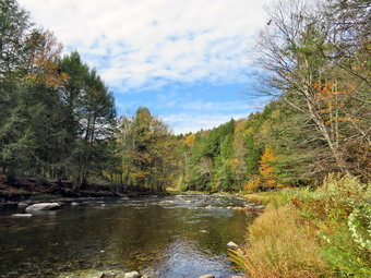 I put Sheena on her leash and set my GPS as we started our hike at 12:30 PM by walking out of the parking lot to the bridge with the temperature at 54 degrees. When we got to the other side, the gate that normally blocks the road along the river and through the old campsites was open. I looked at the trail and saw that it was completely bare and dry and had been mowed. We turned left on a woods road that parallels the river and started down the short hill. I let Sheena off her leash and she headed up the trail. I had decided to take some pictures on the way out. When we got to the spring house on the right I found there was no water so pictures would be uninteresting. I turned my attention to the small streambed next to the spring house and found it was dry with a thin layer of mud. Again no chance to take pictures. When we got to the first culvert, I noticed that the path down to the edge of the stream was eroded and very steep. I decided to attempt to get down to the stream using my poles. I successfully reached the stream and perched on a rock to take pictures. The light was behind me which was ideal for taking pictures upstream of the bridge and some pretty colorful trees. Sheena came to join me and decided to jump in the water which was pretty deep. She took a little swim and then jumped back up on shore. I worked my way back up to the bank and we continued our walk along the woods road. The landscape including the mowed grass and the picnic tables contrasted nicely with the sunlight and blue skies. The whole area had a serene feel enhanced by the sound of the flowing water. On the trail we passed by several areas with picnic tables. These tables sit unused and rotting along the road, a testimony to better days when this area had campsites. Now this area is used for day use only. We walked by more tables which had not been used in years. I did stop at one point to take some pictures of the tables that were in better condition. L also snapped some shots of the woods road covered in leaves with a bright blue sky above. A little later we came to what was once a bathroom for some campsites that had long since disappeared. There were more tables in this area. We stopped and I walked to the stream where rocks had been piled up and contained by wire screen. I walked to the edge and stood on some rocks to take more pictures of the stream in both directions. Sheena came over and stood on the wall next to me. The rapids in this area were more turbulent than during our last visit. The sunlight was playing off the water and sparkling. I returned to the picnic table where I left my pack and took a few shots of the bathroom and the woods road before we continued on the woods road. At about .7 miles into the hike the woods road met the paved road that serves the campsites. I stopped to take some pictures of the empty campsites. We continued on the road through the campsites and along the river. Many of the campsites have a cement block fireplace with a grill but some were upgraded to poured concrete. Everything was very quiet except for the water in the river. This was not surprising as the campsites were closed.
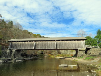 We walked along the paved road to the last campsite where the road ends and I walked down to the edge of the river. I was careful to watch where I was walking but the water level was low enough to allow me to walk out into the stream to get pictures from a different location and angle. Sheena decided she wanted to wade a little a get a short drink. I tried to get a few shots of her in the water. I stopped to take some pictures of the river especially downstream. We turned around and walked back passed the last campsite. We continued on the campsite road toward the last bathroom. Where the road split, there was a gathering of picnic tables and I took a few shots. I also took some shots of the bathroom and the clouds overhead. We stayed to the left to walk the parallel section of road back through the campsites. This road parallels the one we walked out on to make a sort of loop. I stopped again to take pictures of the volleyball net and the towering clouds. We continued along the woods road to the maintenance building and stayed right to walk back toward the parking area. We returned the way we had come although at a quicker pace. We continued our hike and I began to look to the left where the land rose out of the valley to a ridge. I could see that the land leveled off part of the way up and then started up again. I had walked up a path to this area on a previous hike and had no intention of trying it again as I was looking for something new. I had wanted to start further back but will save that for another time. We passed the spring house on the main campsite road. As we walked up the hill to the road, I retrieved my poles from under a rock. We turned right to walk through the bridge. At the end of the bridge, we turned right to head back to the car. Cindy got in the car but Sheena and I headed to the right to visit the stream and get some shots of the bridge. I walked out onto a large rock and took picture downstream. I turned to take pictures of the bridge from different zooms. I returned to the car at 1:50 PM having hiked 2.2 miles in 1 hour and 10 minutes with about 10 minutes plenty of stopped time for pictures. The car's thermometer read 58 degrees and I had just enough time to get home to cover ambulance calls.
![]()
![]()
![]()
![]()
![]() On Friday, October 10th, I drove Cindy to her post-op appointment in New Windsor. The previous day she had procedures for cataracts and glaucoma in her left eye. The procedure had gone well as expected and the subsequent appointment was just to check the outcome. We returned to Livingston Manor and ate lunch at Caf� 43. When we returned home, I decided I wanted to do for a quick hike. I checked to see that I had a crew for ambulance calls and then started to get ready to hike at 1:15 PM. I decided to go to the Parksville Rail Trail and began to get ready with the temperature at 58 degrees with bright blue skies and lots of sun. The Parksville Rail Trail is under three miles out and back but keeping a quick pace helps increase the difficulty. Sheena actually does get in about twice the mileage that I do as she forges ahead and then comes back to me! I have transitioned from using a leash all the time to using a GarmimSport PRO electronic collar which has many versatile settings and seems to do the job. This allows Sheena to roam and keeps me sane by not having to yank on her leash. It seems that Sheena likes hiking as she smells my clothes and then runs to sit by the door! I got dressed in my Mammut crew top without a baselayer. I put on a pair of RailRiders hiking pants which are expensive but last a long time and have features like deep pockets and a generous cut which I really like. I thought about wearing a pair of low-cut and lighter hiking shoes but thought the trail might be wet and muddy. I decided to put on my Keen Durand hiking boots which fit well. I added a new pair of Xstance insoles in an effort to find the best support and cushioning for my feet. These insoles have shock absorbing gel pads, TPU arch support, and memory foam cushioning all wrapped in a breathable fabric. The insoles have been hyped by their manufacturer and seemed to be living up to their claims. I grabbed a pair of Leki Micro Vario poles I have been using for some time because they are light and lock without slipping. I didn't bother to wear my OR floppy hat or gaiters. I also decided not to take my pack but to hike as fast as we could. I put my gear in the back of the car and Sheena in the back seat and left Livingston Manor at 1L35 PM. I drove out Old Route 17 toward Parksville and turned left under the Quickway overpass onto Service Road. I drove toward Parksville and pulled into the parking area on the right side of the road just after Fox Mountain Rd. There were no cars parked in the lot when we arrived. I made sure Sheena's ecollar was adjusted correctly and then I let her out of the car at 1:45 PM. The temperature was 56 degrees but the sun made it feel warmer.
On Friday, October 10th, I drove Cindy to her post-op appointment in New Windsor. The previous day she had procedures for cataracts and glaucoma in her left eye. The procedure had gone well as expected and the subsequent appointment was just to check the outcome. We returned to Livingston Manor and ate lunch at Caf� 43. When we returned home, I decided I wanted to do for a quick hike. I checked to see that I had a crew for ambulance calls and then started to get ready to hike at 1:15 PM. I decided to go to the Parksville Rail Trail and began to get ready with the temperature at 58 degrees with bright blue skies and lots of sun. The Parksville Rail Trail is under three miles out and back but keeping a quick pace helps increase the difficulty. Sheena actually does get in about twice the mileage that I do as she forges ahead and then comes back to me! I have transitioned from using a leash all the time to using a GarmimSport PRO electronic collar which has many versatile settings and seems to do the job. This allows Sheena to roam and keeps me sane by not having to yank on her leash. It seems that Sheena likes hiking as she smells my clothes and then runs to sit by the door! I got dressed in my Mammut crew top without a baselayer. I put on a pair of RailRiders hiking pants which are expensive but last a long time and have features like deep pockets and a generous cut which I really like. I thought about wearing a pair of low-cut and lighter hiking shoes but thought the trail might be wet and muddy. I decided to put on my Keen Durand hiking boots which fit well. I added a new pair of Xstance insoles in an effort to find the best support and cushioning for my feet. These insoles have shock absorbing gel pads, TPU arch support, and memory foam cushioning all wrapped in a breathable fabric. The insoles have been hyped by their manufacturer and seemed to be living up to their claims. I grabbed a pair of Leki Micro Vario poles I have been using for some time because they are light and lock without slipping. I didn't bother to wear my OR floppy hat or gaiters. I also decided not to take my pack but to hike as fast as we could. I put my gear in the back of the car and Sheena in the back seat and left Livingston Manor at 1L35 PM. I drove out Old Route 17 toward Parksville and turned left under the Quickway overpass onto Service Road. I drove toward Parksville and pulled into the parking area on the right side of the road just after Fox Mountain Rd. There were no cars parked in the lot when we arrived. I made sure Sheena's ecollar was adjusted correctly and then I let her out of the car at 1:45 PM. The temperature was 56 degrees but the sun made it feel warmer.
The first part of the trail was only damp from the hard rains that fell on Wednesday as the sun had dried it out. Off her leash Sheena would run ahead of me a certain distance and then maintain that distance by waiting for me or increasing her pace. We were soon back under the cover of the trees. Once we were hiking on the trail, we were sheltered from the sun and there was a slight breeze that left me a little chilly. The trail was wet with soft and muddy patches in all the usual spots. The trail runs parallel to the Little Beaverkill and the new section of State Route 17. It follows the route of the O&W railroad and is very flat. Sheena was setting a quick pace and I didn't mind as long as she would listen and wait for me when necessary. The water level in the stream was still low but was somewhat higher due to the rain and runoff. We continued walking on the trail through some muddy patches until we came to the viewpoint just before the wooden walkways. This spot has a nice view down to the stream and the skies were blue with some nice clouds. We walked across the wooden walkways which were damp and slippery due to a layer of leaves that had fallen from the trees. The area before the bridge was only damp. Just after the bridge was a large patch of mud that was a little larger than usual. The culvert under the bridge appeared permanently blocked and the water forms the mud. No one seems concerned about solving this problem. I walked around the mud to continue the hike but Sheena walked right through it. We came to the landslide that had brought down several trees that had been cut and cleared. This area was muddy but there were some stepping stones. Sheena does not seem to mind sloshing through the water and wading through the mud. As we walked, we could hear the increase in noise from the stream. I looked up to find a couple walking toward us with a dog on a leash. I put Sheena on her leash and we passed by the other couple with a greeting. Just before the falls we could see two more hikers coming toward us. I again put Sheena on her leash and passed by the two young people. I offered a greeting but they did not respond! We soon reached the falls. As we walked by I inspected them and found the water was just a little higher than last time.
We pushed on toward the other end of the trail continuing toward Parksville with Sheena in the lead. I did my best to keep up with her. I did take a peek at the stream from the bench on the trail but found nothing interesting. Within a few minutes, we were nearing the Parksville end of the trail and Sheena was eager to continue. We came to a spot in the trail where we could see the other side. The large dog that is often there was absent. We continued toward Parksville where the dogs near the end of the trail were barking but not as loud as usual. The gate at the beginning of the trail was still lying on the ground indicating it is not a priority for the Town of Liberty. Whoever places the poles has not learned that they must be deeper and have more cement to support them. I could see a couple coming toward us from Parksville with a small dog on a leash. I wanted to stay ahead of them so we tagged the end of the trail when we reached the sign at the Parksville end of the rail trail. It was 4:48 PM and it had taken us 33 minutes to hike the length of the trail non-stop. I was surprised because I thought e were moving a little faster than that! We immediately turned around and started back toward the car. We set a fast pace back from the falls with Sheena in the lead. Just after we passed the falls, the woman we had met earlier came toward us and passed us indicating Sheena was a cute dog. We soon came to the bridge, we walked around the mud while Sheena pushed through. As we approached the end of the trail, I called Sheena and told her "With" which is the equivalent of "Heel". We arrived back at the car at 5:15 PM after hiking over 2.7 miles in 1 hour. This meant that we had hiked back in 27 minutes even though I though we were moving slower than on the way out! The temperature had risen to 76 degrees. Sheena seemed fresh and I felt she could have hiked out and back on the trail another time as could I. We returned home and we all had something to drink. There had been no other ambulance calls while we were on the trail which made me feel good.
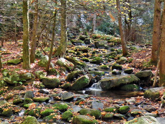
![]()
![]()
![]()
![]()
![]() On Tuesday, October 7th I planned to get in a longer hike somewhere away from Livingston Manor. I had full ambulance coverage from 8:00 AM to 2:00 PM and planned to get an early start. An ambulance call came in at 4:00 AM which cut into Mt sleep so I slept in a little later than I had planned. When I got up at 9:00 AM the temperature was 64 degrees but with sunny blue skies. I decided to go to the Neversink Unique Area to hike the loop including Denton Falls and Mullet Brook Falls. I knew Cindy did not want to go but Sheena was showing she wanted to hike somewhere. I began to get ready at 9:15 AM. I got dressed in my Mammut crew top and without a baselayer. I put on a pair of RailRiders hiking pants which are expensive but last a long time and have features like deep pockets and a generous cut which I really like. My toes were sore from hiking the day before but I decided to put on my Keen Durand hiking boots which fit well. I added a new pair of Xstance insoles in an effort to find the best support and cushioning for my feet. These insoles have shock absorbing gel pads, TPU arch support, and memory foam cushioning all wrapped in a breathable fabric. The insoles have been hyped by their manufacturer and seemed to be living up to their claims. I decided to wear my Mammut hoody which has plenty of zippers and pockets. I grabbed a pair of Leki Micro Vario poles I have been using for some time because they are light and lock without slipping. I would be hiking with Sheena off leash for most of the hike so the poles made sense. I put my gear in the back of the car and Sheena in the back seat. We left Livingston Manor at 9:45 AM as I drove east on the Quickway towards Rock Hill. I drove to Rock Hill and got off at exit 109. I turned right off the exit and drove to the parking area at the end of Katrina Falls Road. There were no cars parked in the lot. I parked the car and began to get ready by setting my GPS. While I was doing this, Sheena was hanging over the back seat ready to go. Sheena loves to hike and would go out everyday if she could. The temperature had been un the 70's on the way to the trailhead but was now 68 degrees. I decided the Mammut hoody was a little too much and left it behind in the car. The wide woods road was surprisingly dry but I knew this probably would continue as there had not been much rain. I could hear Wolf Brook babbling as we walked down the trail which parallels the brook. At .5 miles we came to a yellow spur trail on the right side of the main trail. A sign indicated that this trail led to Hackeldam on the Neversink River. This was the area where a "swinging bridge" crossed the Neversink and was an important area of commerce and industry. I thought we might visit there in the way back.
On Tuesday, October 7th I planned to get in a longer hike somewhere away from Livingston Manor. I had full ambulance coverage from 8:00 AM to 2:00 PM and planned to get an early start. An ambulance call came in at 4:00 AM which cut into Mt sleep so I slept in a little later than I had planned. When I got up at 9:00 AM the temperature was 64 degrees but with sunny blue skies. I decided to go to the Neversink Unique Area to hike the loop including Denton Falls and Mullet Brook Falls. I knew Cindy did not want to go but Sheena was showing she wanted to hike somewhere. I began to get ready at 9:15 AM. I got dressed in my Mammut crew top and without a baselayer. I put on a pair of RailRiders hiking pants which are expensive but last a long time and have features like deep pockets and a generous cut which I really like. My toes were sore from hiking the day before but I decided to put on my Keen Durand hiking boots which fit well. I added a new pair of Xstance insoles in an effort to find the best support and cushioning for my feet. These insoles have shock absorbing gel pads, TPU arch support, and memory foam cushioning all wrapped in a breathable fabric. The insoles have been hyped by their manufacturer and seemed to be living up to their claims. I decided to wear my Mammut hoody which has plenty of zippers and pockets. I grabbed a pair of Leki Micro Vario poles I have been using for some time because they are light and lock without slipping. I would be hiking with Sheena off leash for most of the hike so the poles made sense. I put my gear in the back of the car and Sheena in the back seat. We left Livingston Manor at 9:45 AM as I drove east on the Quickway towards Rock Hill. I drove to Rock Hill and got off at exit 109. I turned right off the exit and drove to the parking area at the end of Katrina Falls Road. There were no cars parked in the lot. I parked the car and began to get ready by setting my GPS. While I was doing this, Sheena was hanging over the back seat ready to go. Sheena loves to hike and would go out everyday if she could. The temperature had been un the 70's on the way to the trailhead but was now 68 degrees. I decided the Mammut hoody was a little too much and left it behind in the car. The wide woods road was surprisingly dry but I knew this probably would continue as there had not been much rain. I could hear Wolf Brook babbling as we walked down the trail which parallels the brook. At .5 miles we came to a yellow spur trail on the right side of the main trail. A sign indicated that this trail led to Hackeldam on the Neversink River. This was the area where a "swinging bridge" crossed the Neversink and was an important area of commerce and industry. I thought we might visit there in the way back.
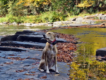 We turned left and walked down to the small bridge that crosses Wolf Brook. The bridge continues to deteriorate although someone had added some sheets of plywood to cover up the holes. On the other hand the bridge was now shorter than it had been. The stream now covered quite a bit of the trail beyond the bridge although the water was not very deep. I stopped to take some picture of the bridge and of the brook. The brook was barely flowing and I could see that the small channel above the bridge had widened and diverted some of the water but it also was very shallow. After I completed my pictures, we made our way across the brook that was covering the trail. Sheena just waded through the water but I used some stepping stones to make sure the water did not go over the tops of my boots. At the top of the hill we came to the split in the trails with the red trail going left and the blue trail heading right. There was a new sign at the junction showing that the red trail to the right was the Mullet Brook Trail Loop and the Wolf Brook Access. There was a concern that people were getting lost in the Neversink Gorge due to the lack of signs and this is a welcome addition. Mileages had been and the sign indicated that the blue trail to the right went to Denton Falls. We stayed to the right on the blue trail which needed some trimming as the laurel was growing into the trail. The trail rolled up and down a little until we reached another yellow spur trail on the right that was labeled Old River Way. We continued straight ahead on the main blue trail. As we approached the bridge across Mullet Brook, I walked off the trail to the right and stopped at the edge of the brook. There was so little water that there were no interesting scenes to photograph. We walked the main trail uphill to the bridge. The bridge had been replaced a few years ago after it had almost fallen into the brook. We continued across the bridge and up the hill. The next yellow spur trail on the right led down to Denton Falls so we turned right and followed the trail. I wanted to go to Denton Falls to see a falls on the Neversink as I expected the volume of water would be high. As we had walked along the trail to this point, I could look down to the river and saw rapids and whitecaps along the entire length.
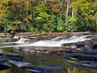 The trail up top was relatively dry as it worked its way through the laurel. We broke out of the brush and tried to find the trail. It was disappointing that the markers were still few and far between. The missing markers cause hikers to make their own paths which makes the best path unclear. When we came to the steeper section of the trail that descends to the river, the trail became a little slippery from the many leaves that had fallen from the trees. I followed Sheena as she followed the track down to the marked trail and then turned left to parallel the river. There are always some muddy spots on this section but all it was muddier than usual. Hikers had been widening the trail to avoid the mud but this made the muddier areas even bigger! When we got to the rocks "steps" that go down to the river, I was very careful to work my way over the roots and the rocks. At the bottom of the path, we walked out on the rocks and over to a large boulder where I dropped my pack and got out the camera. The water was very low but the water moving over the rocks still made some noise. I took some pictures upstream and downstream although the sky was pretty much flat with only a few clouds. I found a way to get downstream but I was careful with my footing as I had fallen on the slippery rocks last time I was here. I got to a point below the falls with good footing and was surprised at how little water was going over the falls. I took pictures of the falls from several different angles and zooms. I also took shots downstream and upstream. Sheena was walking out on the exposed rocks and playing in the water. I decided I wanted some shots from the side of the falls and started back the way I came.I took some pictures from the side of the falls. I had Sheena pose for a few shots with the river, sky, and clouds in the background. We walked back up the rocks to my pack where I stowed the camera and got a drink and a bar.
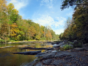 We started back up the trail and I found climbing up easier than coming down. Sheena decided to start to do some zoomies. She does not seem to care about the mud and runs through it with abandon. We continued to work our way up the bank out of the gorge. Several times I though I was going the right way but Sheena was going another. In every case Sheena was correct! At the main blue trail, we turned right and immediately ran into another trail junction. The blue trail continues to the right and parallels the river heading toward High Falls. The red trail turns left and heads over the hill back toward the parking area. There was a sign indicating the purpose of the red trail but none for the blue trail. I thought about going to High Falls but adding another 4 miles seemed a little too much for me. We turned left on the red trail to start the loop and to visit Mullet Brook Falls. The laurel was encroaching on the trail and could use a trim. We climbed the hill and then turned left on the yellow spur trail to Mullet Brook Falls. We arrived at the falls and found no one else there. The falls were as dry as I have seen them with only a trickle of water and no plunge pool at the bottom. I put my pack down and got out the camera. I headed up the rocks toward the right side of the falls. When I got to a good viewpoint, I started taking pictures of the falls from different zooms. The light proved to be almost perfect so I took quite a few shots. I decided I wanted to get in front of the falls to take some more pictures. I walked back down the rocks and crossed a small part of the stream before walking across the rocks. I found the place I wanted directly in front of the falls and took a number of shots with different settings and zooms. While I was doing this, Sheena wait patiently for me. I again asked Sheena to pose and she tried her best. When I was done, we worked our way back to my pack. I got a drink and we headed back out the yellow trail toward the main red trail.
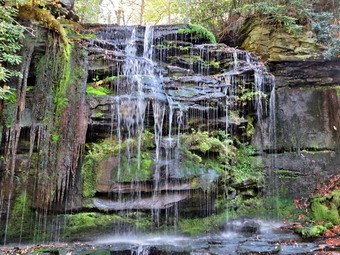 We turned left on the red trail and headed uphill which usually tires me out but felt good on this day. For a half mile we walked uphill gaining 250 feet. We were soon at the upper bridge across Mullet Brook. The trees that had come down on the bridge had been cleared and the bridge had been repaired. I didn't really want to take anymore pictures so we continued on the trail. We came to the spur trail that leads to a parking area in the Wolf Brook Multiple Use Area and found a young lady there looking at her cell phone. I said "Hello" and she answered briefly. We turned left to stay on the red trail passing by the trail leading out to the Wolf Lake parking area. The rest of the hike was downhill except for the hill back up to the parking area. For the next .85 miles we lost 400 feet. There were no blowdowns across the trail but we did run into some areas where the trail narrowed because of the brush along the trail. The trail was dry for the whole length. We were soon back at the junction with the blue trail. We turned right and walked down the hill to cross the bridge over Wolf Brook. As we started t hike up the hill, I looked up to see a young couple with a pitbull on a leash. The dog seemed interested in Sheena but Sheena seemed more interesting to pass by as quickly as possible. The couple said "Hello" and I returned the greeting. When I let Sheena go, she was off like a shot up the trail. We continued on the trail and I thought about hiking down to Hackeldam but decided against it. We turned right to follow the trail up the hill to the parking area. The steepest section of the trail was less than 10% but I was a little tired by this time. Just before the parking area we met a single male hiker headed out on the rail. As he passed by he commented on Sheena being a good hiking partner and I readily agreed. Sheena headed up the rail toward the parking area and I followed. We were back at the car at 1:00 PM after hiking 4.6 miles in 2 hours and 45 minutes. This included the stops to take pictures. We gained about 965 feet in elevation. The temperature was 76 degrees as we left the parking lot.
![]()
![]()
![]()
![]()
![]() On Monday, October 6th, I was committed to covering ambulance calls all day. After covering an afternoon call, I called another EMT and asked if he could cover calls for an hour or so. He agreed and I decided to go to the Parksville Rail Trail. I asked Cindy if she would like to go to the Parksville Rail Trail as it is close but interesting with a nice falls. She said "Yes" and we began to get ready with the temperature at 72 degrees with bright blue skies and lots of sun. The Parksville Rail Trail is under three miles out and back but keeping a quick pace helps increase the difficulty. Sheena actually does get in about twice the mileage that I do as she forges ahead and then comes back to me! I have transitioned from using a leash all the time to using a GarmimSport PRO electronic collar which has many versatile settings and seems to do the job. This allows Sheena to roam and keeps me sane by not having to yank on her leash. It seems that Sheena likes hiking as she smells my clothes and then runs to sit by the door! I got dressed in a new Columbia Omni-Shade Omni-Wick shirt without a baselayer. I put on a pair of RailRiders hiking pants which are expensive but last a long time and have features like deep pockets and a generous cut which I really like. I thought about wearing a pair of low-cut and lighter hiking shoes but thought the trail might be wet and muddy. I decided to put on my Keen Durand hiking boots which fit well. I added a new pair of Xstance insoles in an effort to find the best support and cushioning for my feet. These insoles have shock absorbing gel pads, TPU arch support, and memory foam cushioning all wrapped in a breathable fabric. The insoles have been hyped by their manufacturer and seemed to be living up to their claims. I grabbed a pair of Leki Micro Vario poles I have been using for some time because they are light and lock without slipping. I didn't bother to wear my OR floppy hat or gaiters. I also decided not to take my pack but to hike as fast as Cindy could hike. I put our gear in the back of the car and Sheena in the back seat and we left Livingston Manor at 4:00 PM. I drove out Old Route 17 toward Parksville and turned left under the Quickway overpass onto Service Road. I drove toward Parksville and pulled into the parking area on the right side of the road just after Fox Mountain Rd. There were no cars parked in the lot when we arrived. I made sure Sheena's ecollar was adjusted correctly and then I let her out of the car at 4:15 PM. The temperature was 74 degrees and the sun made it feel warmer.
On Monday, October 6th, I was committed to covering ambulance calls all day. After covering an afternoon call, I called another EMT and asked if he could cover calls for an hour or so. He agreed and I decided to go to the Parksville Rail Trail. I asked Cindy if she would like to go to the Parksville Rail Trail as it is close but interesting with a nice falls. She said "Yes" and we began to get ready with the temperature at 72 degrees with bright blue skies and lots of sun. The Parksville Rail Trail is under three miles out and back but keeping a quick pace helps increase the difficulty. Sheena actually does get in about twice the mileage that I do as she forges ahead and then comes back to me! I have transitioned from using a leash all the time to using a GarmimSport PRO electronic collar which has many versatile settings and seems to do the job. This allows Sheena to roam and keeps me sane by not having to yank on her leash. It seems that Sheena likes hiking as she smells my clothes and then runs to sit by the door! I got dressed in a new Columbia Omni-Shade Omni-Wick shirt without a baselayer. I put on a pair of RailRiders hiking pants which are expensive but last a long time and have features like deep pockets and a generous cut which I really like. I thought about wearing a pair of low-cut and lighter hiking shoes but thought the trail might be wet and muddy. I decided to put on my Keen Durand hiking boots which fit well. I added a new pair of Xstance insoles in an effort to find the best support and cushioning for my feet. These insoles have shock absorbing gel pads, TPU arch support, and memory foam cushioning all wrapped in a breathable fabric. The insoles have been hyped by their manufacturer and seemed to be living up to their claims. I grabbed a pair of Leki Micro Vario poles I have been using for some time because they are light and lock without slipping. I didn't bother to wear my OR floppy hat or gaiters. I also decided not to take my pack but to hike as fast as Cindy could hike. I put our gear in the back of the car and Sheena in the back seat and we left Livingston Manor at 4:00 PM. I drove out Old Route 17 toward Parksville and turned left under the Quickway overpass onto Service Road. I drove toward Parksville and pulled into the parking area on the right side of the road just after Fox Mountain Rd. There were no cars parked in the lot when we arrived. I made sure Sheena's ecollar was adjusted correctly and then I let her out of the car at 4:15 PM. The temperature was 74 degrees and the sun made it feel warmer.
The first part of the trail was only damp as the sun had dried it out. Off her leash Sheena would run ahead of me a certain distance and then maintain that distance by waiting for me or increasing her pace. We were soon back under the cover of the trees. Once we were hiking on the trail, we were sheltered from the sun but I was still warm. The trail was wet with soft and muddy patches in all the usual spots. The trail runs parallel to the Little Beaverkill and the new section of State Route 17. It follows the route of the O&W railroad and is very flat. Sheena was setting a quick pace and I didn't mind as long as she would listen and wait for us when necessary. The water level in the stream was still very low. We continued walking on the trail through some muddy patches until we came to the viewpoint just before the wooden walkways. This spot has a nice view down to the stream and the skies were blue with some nice clouds. We walked across the wooden walkways which were misty dry but slippery due to a layer of leaves that had fallen from the trees. The area before the bridge was only damp. Just after the bridge was a large patch of mud that was a little larger than usual. The culvert under the bridge appeared permanently blocked and the water forms the mud. No one seems concerned about solving this problem. We walked around the mud to continue the hike but Sheena walked right through it. We came to the landslide that had brought down several trees that had been cut and cleared. This area is now muddy but there were some stepping stones. Sheena does not seem to mind sloshing through the water and wading through the mud. As we walked, we could hear the increase in noise from the stream. I looked up to find a lone hiker coming toward us. I took Sheena off the trail until she passed us. We soon reached the falls. As we walked by I inspected them and found the water was about the same as last time.
We pushed on toward the other end of the trail continuing toward Parksville with Sheena in the lead. I did my best to keep up with her and Cindy wasn't far behind. I did take a peek at the stream from the bench on the trail. Within a few minutes, we were nearing the Parksville end of the trail and Sheena was eager to continue. We came to a spot in the trail where we could see the other side. The large dog that is often there was absent. We continued toward Parksville where the dogs near the end of the trail were barking but not as loud as usual. The gate at the beginning of the trail was still lying on the ground indicating it is not a priority for the Town of Liberty. Whoever places the poles has not learned that they must be deeper and have more cement to support them. I could see a couple coming toward us from Parksville with a small dog on a leash. I wanted to stay ahead of them so we tagged the end of the trail when we reached the sign at the Parksville end of the rail trail. It was 4:48 PM and it had taken us 33 minutes to hike the length of the trail non-stop. I was surprised because I thought e were moving a little faster than that! We immediately turned around and started back toward the car. We set a fast pace back from the falls with Sheena in the lead. Just after we passed the falls, the woman we had met earlier came toward us and passed us indicating Sheena was a cute dog. We soon came to the bridge, we walked around the mud while Sheena pushed through. As we approached the end of the trail, I called Sheena and told her "With" which is the equivalent of "Heel". We arrived back at the car at 5:15 PM after hiking over 2.7 miles in 1 hour. This meant that we had hiked back in 27 minutes even though I though we were moving slower than on the way out! The temperature had risen to 76 degrees. Sheena seemed fresh and I felt she could have hiked out and back on the trail another time as could I. We returned home and we all had something to drink. There had been no other ambulance calls while we were on the trail which made me feel good.
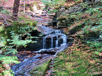
![]()
![]()
![]()
![]()
![]() On Thursday, October 2nd, I wanted to get out for a longer hike as I had missed hiking the first day of October and might miss tomorrow due to being on call for the ambulance corps. I had some things to do early in the morning which didn't bother me as the temperature was 32 degrees at 7:00 AM. I decided to go to Trout Pond and hike the loop in a clockwise direction with a short visit to Mud Pond. It was 46 degrees when I started to get ready at 9:15 AM. Sheena got wind of what was going on and began running around the house barking. I put on my long-sleeved Mammut crew top with no baselayer. I wore a pair of RailRiders hiking pants which are expensive but last a long time and have features like deep pockets and a generous cut which I really like. The pants have Velcro closures at the ankles. I decided to put on my Keen Durand hiking boots which fit well. I added a new pair of Xstance insoles in an effort to find the best support and cushioning for my feet. These insoles have shock absorbing gel pads, TPU arch support, and memory foam cushioning all wrapped in a breathable fabric. The insoles have been hyped by their manufacturer and seemed to be living up to their claims. I grabbed a pair of Leki Micro Vario poles I have been using for some time because they are light and lock without slipping. I donned my Mammut Hoody which has pitzips to dump heat as I new I could easily stow it in my pack. I put on a light hat and took along a pair of light gloves. I put my gear in the back and Sheena in the back seat. I headed to Roscoe at 9:30 AM on State Route 17, got off at exit 94 and got on Route 206. I followed it across the Delaware County line to Morton Hill Road. After a left turn on Morton Hill Road, I drove to the intersection with Russell Brook Road. For several years I had been parking at the lower parking area but this tome I decided to do a "legacy" hike. I turned around and parked on the side of the road to avoid the parking area which is private. There was already one car parked there an I know that the owners do not appreciate this. The NYNJTC maps have a gray P marking this area which means roadside parking only but many people cannot read map legends or do not care. I set my GPS and made sure Sheena's ecollar was on as we began our hike down Russell Brook Road at 9:55 AM. The temperature was 42 degrees but the sun was shining brightly which made it feel almost warm. Russell Brook Road was almost completely dry even though there had been some showers the previous week. As we walked along the road, I noticed that many of the leaves had already fallen and none of the colors were very bright. I had come to Trout Pond because I hoped for some nice fall colors and this was not a good start. The campsite on the left had a van parked and a chair set up by the fire pit but no one was around. We continued on down Russell Brook Road to the overlook over the upper falls. There was more water in the stream than my last visit but that wasn't saying much. We walked down to the overlook and I put down my pack and got out the camera. I took some shots and then packed up to continue the hike down toward the parking area where there were several cars already parked.
On Thursday, October 2nd, I wanted to get out for a longer hike as I had missed hiking the first day of October and might miss tomorrow due to being on call for the ambulance corps. I had some things to do early in the morning which didn't bother me as the temperature was 32 degrees at 7:00 AM. I decided to go to Trout Pond and hike the loop in a clockwise direction with a short visit to Mud Pond. It was 46 degrees when I started to get ready at 9:15 AM. Sheena got wind of what was going on and began running around the house barking. I put on my long-sleeved Mammut crew top with no baselayer. I wore a pair of RailRiders hiking pants which are expensive but last a long time and have features like deep pockets and a generous cut which I really like. The pants have Velcro closures at the ankles. I decided to put on my Keen Durand hiking boots which fit well. I added a new pair of Xstance insoles in an effort to find the best support and cushioning for my feet. These insoles have shock absorbing gel pads, TPU arch support, and memory foam cushioning all wrapped in a breathable fabric. The insoles have been hyped by their manufacturer and seemed to be living up to their claims. I grabbed a pair of Leki Micro Vario poles I have been using for some time because they are light and lock without slipping. I donned my Mammut Hoody which has pitzips to dump heat as I new I could easily stow it in my pack. I put on a light hat and took along a pair of light gloves. I put my gear in the back and Sheena in the back seat. I headed to Roscoe at 9:30 AM on State Route 17, got off at exit 94 and got on Route 206. I followed it across the Delaware County line to Morton Hill Road. After a left turn on Morton Hill Road, I drove to the intersection with Russell Brook Road. For several years I had been parking at the lower parking area but this tome I decided to do a "legacy" hike. I turned around and parked on the side of the road to avoid the parking area which is private. There was already one car parked there an I know that the owners do not appreciate this. The NYNJTC maps have a gray P marking this area which means roadside parking only but many people cannot read map legends or do not care. I set my GPS and made sure Sheena's ecollar was on as we began our hike down Russell Brook Road at 9:55 AM. The temperature was 42 degrees but the sun was shining brightly which made it feel almost warm. Russell Brook Road was almost completely dry even though there had been some showers the previous week. As we walked along the road, I noticed that many of the leaves had already fallen and none of the colors were very bright. I had come to Trout Pond because I hoped for some nice fall colors and this was not a good start. The campsite on the left had a van parked and a chair set up by the fire pit but no one was around. We continued on down Russell Brook Road to the overlook over the upper falls. There was more water in the stream than my last visit but that wasn't saying much. We walked down to the overlook and I put down my pack and got out the camera. I took some shots and then packed up to continue the hike down toward the parking area where there were several cars already parked.
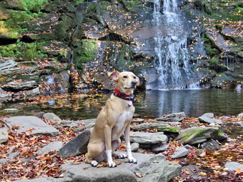 We walked down to the woods road that goes down to the bridge that crosses the brook. The Japanese knotweed was still green and overgrowing the trail. I stopped to take some pictures of the knotweed which I used to keep clear with a machete. I decided to walk to the falls since I could see there were no people there at the time. The informal path to the falls was pretty clear as someone had cut back the vegetation. We walked along the path and then down the bank to the streambed. The falls consisted of a small stream of water flowing down over the rock layers. It was pretty but the volume was nothing compared to the usual flow. I took some shots including some of Sheena who "automatically" posed in front of the falls. I took pictures of the upper part of the falls and some of the pool beneath the falls. I also snapped some shots downstream. I was happy to see that there were no rock piles in the area below the falls. When I was done, we headed back up the bank and out to the main trail. We turned right and then at the trail junction, we turned to the left to climb the steeper hill toward Mud Pond. The trail was dry and covered with a layer of leaves and the outlet stream from Trout Pond was almost dry. I was surprised that no one had claimed the large camping site on the right side of the trail. The sun was out and as soon as we started to climb the hill, I felt warm and opened all the zippers on my hoody. The climb seemed much easier than I remembered but the rock were much worse. The leaves also covered the rocks which made picking a path much harder. There was one large blowdown across the trail which would require a chainsaw to remove it. I thought I might call DEC Region 4 to report it and to ask for Ranger Elliot who does magic with a chainsaw. We reached the top of the hill at 10:48 M after hiking 1.6 miles. The woods road down the other side was also dry when it is usually wet. We walked passed the trail back to Trout Pond and continued on the Mud Pond Trail looking for the woods road that led down to Mud Pond. We passed a sign for a campsite where there was a proper fire ring set up. Just after that was the woods road so we turned left and headed down to the shores of the pond. We came to the shore and I noticed the water level was relatively high compared to other lakes and ponds. I put down my pack and got out the camera. There was very little color on the leaves remaining on the trees and there weren't many of those. The sky was blue but flat with only a few wispy clouds. I took pictures and then returned my camera to the lack and walked back out to the main trail. We turned right and walked a short distance to the trail junction. At 2.1 miles we made a left to follow the trail up to the shoulder of Cherry Ridge. When we started on the trail, I again noticed that there was no water even in places that are often wet and muddy. We walked through the forest of small birch trees and down the other side. There were also a few small blowdowns along the trail that needed to be cleared. Most of these could easily be removed with hand tools. The large trunks that had been on the trail had all been cleared by a DEC crew. The ascent continued for the next 1.2 miles but it was more boring than difficult. At 3.3 miles into the hike we were at the highest point and ready to start the descent to Trout Pond. The trail continued to be very rocky with a few sticks thrown in which made the descent tricky and hurt my feet a little.
 The descent of the trail went more quickly than I had thought. As we were approaching the pond I caught what looked like sunlight electing off glass. I put Sheena on her leash and as we got closer to the trail junction I could see that there was a small SUV parked on the trail and a pickup trick backed up so that its back tires were in the lake! We walked to Te bridge over the outlet and I got out my camera. Taking pictures of the lake was challenging because of the position of the sun. I did my best to get some good shots making sure I took one of the pickup. There were people walking through the water near the trout spawning box and I began to believe they might be from the DEC. I took some shots of the completely dry inlet stream before putting away the camera and shouldering my pack. We continued on the trail toward the SUV which had DEC written on the door. We crossed the small bridge and headed toward the outlet end of the pond. The trail was completely dry in places where is always wet. I saw three people ahead but did not know whether they were other hikers or DEC employees. I put Sheena on her leash and as we approached the people I recognized a friend from Livingston Manor who introduced the couple as his friends. We talked for a few minutes and the woman said she thought she recognized me. My friend mentioned I was a member of the ambulance corps and the woman remember that I had cared for a family member the year before. She renewed an invitation to hike on their large tract of private land! Sheena and I were a little faster than this group and they let us pass as we headed for the outlet end of the lake.
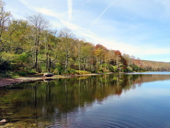 When we came to the path to the lake, we turned right and walked to the beach where I put down my pack. Sheena and I walked over to the shore so that I could take some pictures of the pond. There were some nice reflections on the clouds and trees in the water but there were very few leaves left on the trees and their color was muted. I snapped a few shots of the lake including some of the water level. The volume of water was greatly reduced with the spillway completely dry and at least 10 feet from the water. I took some more shots from different angles before walking back to my pack. I packed up in a hurry because the group of three was approaching and I wanted to stay ahead of them. We headed back to the main trail just ahead of the group. I said "Hello" and then started down the trail at a quick pace. We were soon considerably ahead of the other hikers. The hike from the outlet to the trail junction is all downhill and on this day it was dry. I continued to follow the quick pace set by Sheena. We were soon at the trail register and the trail junction where our loop had started. We continued on the main trail hiking passed the knotweed and crossed the bridge over Russell Brook. The SUV that had been at the other end of the pond came up behind us so I pulled Sheena off the trail to let it pass. We walked up to the lower parking area which still had three cars but they were different than the ones that had been there at the beginning of the hike! The SUV drove through the gate and closed it and drove up the road out of sight. As we walked up the road back to the car, I Merced there was no one at the falls and the van at the campsite was gone. The walk up the road was easier and quicker than I thought it would be. We arrived back at the car at 1:02 PM having covered 6.0 miles and 1150 vertical feet in 3 hours and 8 minutes. Our overall speed was 2.0 mph with a moving average of 2.2 mph The temperature was 60 degrees as I pulled away.
![]()
![]()
![]()
![]()
![]() On Tuesday, September 30th, I wanted to get in a longer hike than I had been doing recently. I had coverage for ambulance calls from 8:00 AM to 2:00 PM so we could hike for up to 4 hours without guilt. When I got up at 9:00 AM it was 60 degrees on the back porch and I knew the temperature was forecast to rise throughput the day. I wanted to get out and hike to some elevation to test my fitness. I decided to head to the Frick Pond area and hike the Flynn Trail toward Beech Mountain where there are several good viewpoints. I was hoping that there would be some nice colors on the fall leaves. I started to get ready at 9:30 AM with the skies blue but without the puffy white clouds that add to landscape pictures. Sheena was pretty excited as I started to get ready as getting out to hike is her favorite thing. I got dressed in my new Columbia Omni-shade short-sleeved crew top with no baselayer due to the expected heat. I put on a pair of RailRiders hiking pants which are expensive but last a long time and have features like deep pockets and a generous cut which I really like. I decided to put on my Keen Durand hiking boots which fit well. I added a new pair of Xstance insoles in an effort to find the best support and cushioning for my feet. These insoles have shock absorbing gel pads, TPU arch support, and memory foam cushioning all wrapped in a breathable fabric. The insoles have been hyped by their manufacturer and seemed to be living up to their claims. I grabbed a pair of Leki Micro Vario poles I have been using for some time because they are light and lock without slipping. I wore my OR floppy hat as shade from the sun and a place to sprat insect repellent. I put my gear in the back of the car and Sheena in the back seat and left my house at 10:50 AM. I drove out the DeBruce Road about 6 miles to Mongaup Road and turned left. I continued up the road to the point where it splits and stayed left on Beech Mountain Road. It was a short drive to the parking areas on the left. There were no cars in either parking area. I parked in the smaller lot. I got out and set my GPS. Even though I had hiked this area extensively, I like a record of what I do on each hike. I made sure Sheena's ecollar was turned on and I let her out of the car. She immediately began to run around following her nose. We crossed the road at 10:07 AM to begin our hike on the Flynn Trail with the temperature at 72 degrees.
On Tuesday, September 30th, I wanted to get in a longer hike than I had been doing recently. I had coverage for ambulance calls from 8:00 AM to 2:00 PM so we could hike for up to 4 hours without guilt. When I got up at 9:00 AM it was 60 degrees on the back porch and I knew the temperature was forecast to rise throughput the day. I wanted to get out and hike to some elevation to test my fitness. I decided to head to the Frick Pond area and hike the Flynn Trail toward Beech Mountain where there are several good viewpoints. I was hoping that there would be some nice colors on the fall leaves. I started to get ready at 9:30 AM with the skies blue but without the puffy white clouds that add to landscape pictures. Sheena was pretty excited as I started to get ready as getting out to hike is her favorite thing. I got dressed in my new Columbia Omni-shade short-sleeved crew top with no baselayer due to the expected heat. I put on a pair of RailRiders hiking pants which are expensive but last a long time and have features like deep pockets and a generous cut which I really like. I decided to put on my Keen Durand hiking boots which fit well. I added a new pair of Xstance insoles in an effort to find the best support and cushioning for my feet. These insoles have shock absorbing gel pads, TPU arch support, and memory foam cushioning all wrapped in a breathable fabric. The insoles have been hyped by their manufacturer and seemed to be living up to their claims. I grabbed a pair of Leki Micro Vario poles I have been using for some time because they are light and lock without slipping. I wore my OR floppy hat as shade from the sun and a place to sprat insect repellent. I put my gear in the back of the car and Sheena in the back seat and left my house at 10:50 AM. I drove out the DeBruce Road about 6 miles to Mongaup Road and turned left. I continued up the road to the point where it splits and stayed left on Beech Mountain Road. It was a short drive to the parking areas on the left. There were no cars in either parking area. I parked in the smaller lot. I got out and set my GPS. Even though I had hiked this area extensively, I like a record of what I do on each hike. I made sure Sheena's ecollar was turned on and I let her out of the car. She immediately began to run around following her nose. We crossed the road at 10:07 AM to begin our hike on the Flynn Trail with the temperature at 72 degrees.
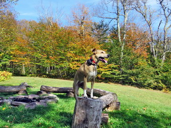 The first part of the trail near the road had become further eroded by the recent rains but people had walked around the gully forming a new trail. The walk through the woods was relatively easy and the trail was only damp. When we came to the end of the trail, we turned right onto what once was Beech Mountain Road. This area of the trail was also damp. I wondered if the rest of the trail would be the same. Starting out my whole body was tired particularly my legs. The further we hiked the better I felt. I set a relaxed pace up the Flynn Trail at first but that increased as we continued up the trail. Sheena was about 20 feet ahead of me all the time. Every time I slowed down she did also to keep the same distance. Sometimes she would venture off the trail following a game trail or chasing a squirrel. Whenever she got too far ahead I gave the command "Not too far" and she would come right back to me. We did not stop along the way but continued toward the junction with the Big Rock Trail. The Flynn Trail is uphill all the way for the first 1.7 miles to the Big Rock Junction. We passed the mile mark around the point where there is a clearing to the right of the trail. We were soon walking the final uphill section to the junction with the Big Rock Trail. It was 10:52 AM so we had covered the 1.7 mile distance in 45 minutes which was a very good time. We continued through the junction and passed through the gate which is the boundary between state land and Beaverkill Land Trust property. It was a short walk to the point where the Flynn Trail heads left and downhill to Hodge Pond. Here we turned to the right on the woods road and walked along the road to the junction of some roads above the pond. At this junction a road turns left to go down to the pond. Just a little further on the road splits with the left fork passing by the site of the former Beech Mountain Boy Scout Camp and ending up on Shin Creek Road in Lew Beach. The camp has been bulldozed by the Land Trust because the building were in ruins and collapsing. The road out to Shin Creek Road is now available for hiking and has a nice parking area near Shin Creek Road. There was a sign facing me that said "Parking" which made me scratch my head. There is a grassy "field" in that direction but it looked unused. We continued up the hill toward the Hodge Pond Lookouts on a woods road that surrounds Flynn's Point on Beech Mountain, the highest point in Sullivan County. As we walked, I could see that there had not been any vehicles on the road recently as there were no new tracks and a thick layer of leaves was present. I had noticed that I was a little tired walking up the Flynn Trail but felt even more energized walking up the road. There had been some work done of the road creating runoffs so that water would run into the woods preventing erosion.
 I wasn't really tired so we pushed the pace a little more. The sun was out and there was a slight breeze blowing making the conditions ideal for hiking. When we got to the old sand and gravel pit where the trail levels the sun hit me full force and I realized how hot it really was. The trail began to gain elevation again and we passed by a spring house on the right where Sheila used to like to dig in the water and get a drink. Sheena also got a drink but the amount of water was very small. There are several twists and turns along this road and it is sometimes hard for me to know exactly where I am. At 2.7 miles we came to a lookout on the left of the trail. The lookout had grown in so that there was almost no view except for the tops of some hills. We did not stop but continued on the road as it made a sharp right turn. Just after this the road turned to the left and another trail branched off to the right. We followed the road to the left as it gained some elevation then started downhill. We passed a woods road on the right and then the path on the left toward Mongaup Mountain, one of the Catskill Highest Hundred. The road turned to the right and soon led to a cabin with a beautiful lawn. The lawn had an incredible view to the east with many of the 3500 foot peaks visible. The panorama from this lookout takes in the Burroughs Range and many of the other Catskill peaks. Unfortunately, the trees have begun to grow up and are starting to limit the view. The sky was flat without and distinct clouds and there was a haze hanging over the mountain peaks. Most of the trees were still green or had lost their leaves but there were some ice colors especially in the trees nearby. I got out my camera and took some pictures. I posed Sheena near the fire ring and took some shots of her. She really seems to get posing for photos. When we were done, I got a drink and ate a bar before continuing on the woods road. Sheena was impatient as she always wants to be in motion and she easily found the woods road and head out ahead of me. We climbed a short hill to the woods road that surrounds Beech Mountain and turned left. We followed the woods road clockwise around Beech Mountain. There are some impressive ledges on the right of the trail going in this direction. We came across a blowdown that had been cut by chainsaw. Another part of the tree had fallen across the trail and would have to be cleared. We walked around the blowdown and arrived at the Hodge Pond Lookout. I dropped my pack and took out my camera. I took a picture of the graphic sign at the lookout which indicated the danger of falling off the ledge. A month ago the view was blocked by trees but someone had cut down most of the trees and brush blocking the view. There was an exceptional view from the viewpoint so I walked out to the lookout to take pictures. I took some pictures of the pond below and the hills in the distance. The view was a little hazy in the distance. When I was done taking pictures, I had Sheena sit on the viewpoint while I took some shots with the pond and the leaves in the background. I got another drink and gave some to Sheena.
 We continued on the woods road traveling clockwise around Beech Mountain. The trail was only damp in several places and the rest was dry. We were back at the road and turned left to start downhill. We definitely picked up the pace as I knew the rest of the trip back was all flat or downhill. The trip down was much quicker than the trip up. When we reached the bottom of the hill, it was 12:10 PM so I decided to turn right on the woods road to walk down to Hodge Pond. My ambulance coverage ended at 2:00 PM but I felt I had plenty of time to extend the hike. We walked down the woods road to the field at the outlet end of Hodge Pond. We walked over to the shore where I took off my pack and got out the camera. The water level in the pond was slighty lower than I had seen it before but much higher than many other ponds or lakes. The trees around the pond showed some colors so I concentrated on them taking pictures from various angles and zooms. I also took shots of the outlet that had been dammed by the beavers. This area was now part of the pond including a section of the Flynn Trail! The water here was a little lower than on previous trips but the dam looked very solid. I packed up my camera and we headed for the point where the Flynn Trail entered the woods. We started up the hill which always seems long to me but I was feeling pretty energetic on this day. Sheena was ahead of me when I heard barking behind me. I turned around to see a small fluffy dog walking up the trail toward us. Sheena turned to go to greet the dog but I called her off. I took a step toward the dog and it ran back down the trail. This was a strange encounter but it was even stranger that I heard no one call the dog or speak a word. As we continued up the trail I listened carefully and heard nothing. I never saw the dog or the owner again. I began to think the dog may have gotten loose and was lost! The trip up the hill went quickly and we were soon at the junction with the woods road that we had used earlier. We stayed right on the Flynn Trail and soon passed through the gate. We arrived at the junction with the Big Rock Trail at 12:40 PM after hiking 5.1 miles. I still had some time so we turned right and started down the Big Rock Trail.
 The trail was covered in leaves that had fallen from the trees. Some were bright colors while others were brown. There were even some reds from the maple trees along the trail. The hike down the trail went well and more quickly than I expected. It was definitely easier than the uphill hike except for the toe bang! This trail can be tricky as there are three levels that make it seem like the bottom of the hill. We were soon at Times Square and I thought about turning right to hike up and around the Logger's Loop to add some distance to our hike. I eventually turned left to walk the final section of the Loggers Loop as I had not been that way in some time. This section of the trail was a little wetter than the rest of the trail had been. We descended a little and then started to climb up the trail. The trail was dry enough to walk straight up the hill without sidestepping to avoid any mud. We reached the top of the hill and started downhill toward Gravestone Junction. We came to two blowdowns near the primitive campsites. The blowdowns have been there for months blocking the trail as there has been no maintenance. The NYNJTC was supposed to be assigning new maintainers or sending the Catskill Trail Crew to maintain these trails. Apparently, they have done neither. This is a shame as I always kept these trails in good condition and either cleared them myself or enlisted one of the local rangers. The trails around Frick Pond are used by many people as an introduction to hiking and are recommended by many local businesses and organizations. Sheena walked up to each of the blowdowns and jumped over them. I walked up to the blowdowns and sat on them to get over. We continued our hike by walking through chest high weeds that almost obscured the trail. This was another black mark on the NYNJTC as it made the trail less than inviting. When we reached Gravestone Junction, we turned left on the Quick Lake Trail and headed back toward the parking area. We passed the Lobdell Memorial marker which was in good shape. The trail is very rocky and was a little wet on this day. We passed the trail register and were soon back at the car. It was 1:30 PM and we had hiked 7.1 miles in 3 hours and 23 minutes gaining 1303 feet along the way. We had stopped for a total of 18 minutes. Our speed was 2.0 mph overall and 2.3 mph moving. The temperature had risen to 76 degrees!
![]()
![]()
![]()
![]()
![]() On Monday, September 29th, I was committed to helping a couple from Ohio hike the Finger Lames Trail. I picked them up at the Denning Road Trailhead at 7:15 AM and drove them to the point where the FLT cross Route 206 between Roscoe and Donwsville. I dropped them off at 8:15 AM so they could begin their adventure. I had help them plan an itinerary that had a reasonable amount of miles each day and allowed camping at some leantos. When I got home my crew had already covered two ambulance calls so when another came in I decided to go. When I returned my wife and I planned to eat at Caf� 43 but just as we arrived the pager sounded for another call. I responded to the call with my driver. I got home at 12:30 PM and confirmed with another EMT that they would cover for the next hour and a half! I asked Cindy if she would like to go to the Parksville Rail Trail as it is close but interesting with a nice falls. She said "Yes" and we began to get ready with the temperature at 72 degrees with bright blue skies and lots of sun. The Parksville Rail Trail is under three miles out and back but keeping a quick pace helps increase the difficulty. Sheena actually does get in about twice the mileage that I do as she forges ahead and then comes back to me! I have transitioned from using a leash all the time to using a GarmimSport PRO electronic collar which has many versatile settings and seems to do the job. This allows Sheena to roam and keeps me sane by not having to yank on her leash. It seems that Sheena likes hiking as she smells my clothes and then runs to sit by the door! I got dressed in a new Columbia Omni-Shade Omni-Wick shirt without a baselayer. I put on a pair of RailRiders hiking pants which are expensive but last a long time and have features like deep pockets and a generous cut which I really like. I thought about wearing a pair of low-cut and lighter hiking shoes but thought the trail might be wet and muddy. I decided to put on my Keen Durand hiking boots which fit well. I added a new pair of Xstance insoles in an effort to find the best support and cushioning for my feet. These insoles have shock absorbing gel pads, TPU arch support, and memory foam cushioning all wrapped in a breathable fabric. The insoles have been hyped by their manufacturer and seemed to be living up to their claims. I grabbed a pair of Leki Micro Vario poles I have been using for some time because they are light and lock without slipping. I didn't bother to wear my OR floppy hat or gaiters. I also decided not to take my pack but to hike as fast as Cindy could hike. I put our gear in the back of the car and Sheena in the back seat and we left Livingston Manor at 1:10 PM. I drove out Old Route 17 toward Parksville and turned left under the Quickway overpass onto Service Road. I drove toward Parksville and pulled into the parking area on the right side of the road just after Fox Mountain Rd. There were no cars parked in the lot when we arrived. I made sure Sheena's ecollar was adjusted correctly and then I let her out of the car at 1:25 PM. The temperature was 74 degrees and the sun made it feel warmer.
On Monday, September 29th, I was committed to helping a couple from Ohio hike the Finger Lames Trail. I picked them up at the Denning Road Trailhead at 7:15 AM and drove them to the point where the FLT cross Route 206 between Roscoe and Donwsville. I dropped them off at 8:15 AM so they could begin their adventure. I had help them plan an itinerary that had a reasonable amount of miles each day and allowed camping at some leantos. When I got home my crew had already covered two ambulance calls so when another came in I decided to go. When I returned my wife and I planned to eat at Caf� 43 but just as we arrived the pager sounded for another call. I responded to the call with my driver. I got home at 12:30 PM and confirmed with another EMT that they would cover for the next hour and a half! I asked Cindy if she would like to go to the Parksville Rail Trail as it is close but interesting with a nice falls. She said "Yes" and we began to get ready with the temperature at 72 degrees with bright blue skies and lots of sun. The Parksville Rail Trail is under three miles out and back but keeping a quick pace helps increase the difficulty. Sheena actually does get in about twice the mileage that I do as she forges ahead and then comes back to me! I have transitioned from using a leash all the time to using a GarmimSport PRO electronic collar which has many versatile settings and seems to do the job. This allows Sheena to roam and keeps me sane by not having to yank on her leash. It seems that Sheena likes hiking as she smells my clothes and then runs to sit by the door! I got dressed in a new Columbia Omni-Shade Omni-Wick shirt without a baselayer. I put on a pair of RailRiders hiking pants which are expensive but last a long time and have features like deep pockets and a generous cut which I really like. I thought about wearing a pair of low-cut and lighter hiking shoes but thought the trail might be wet and muddy. I decided to put on my Keen Durand hiking boots which fit well. I added a new pair of Xstance insoles in an effort to find the best support and cushioning for my feet. These insoles have shock absorbing gel pads, TPU arch support, and memory foam cushioning all wrapped in a breathable fabric. The insoles have been hyped by their manufacturer and seemed to be living up to their claims. I grabbed a pair of Leki Micro Vario poles I have been using for some time because they are light and lock without slipping. I didn't bother to wear my OR floppy hat or gaiters. I also decided not to take my pack but to hike as fast as Cindy could hike. I put our gear in the back of the car and Sheena in the back seat and we left Livingston Manor at 1:10 PM. I drove out Old Route 17 toward Parksville and turned left under the Quickway overpass onto Service Road. I drove toward Parksville and pulled into the parking area on the right side of the road just after Fox Mountain Rd. There were no cars parked in the lot when we arrived. I made sure Sheena's ecollar was adjusted correctly and then I let her out of the car at 1:25 PM. The temperature was 74 degrees and the sun made it feel warmer.
The first part of the trail was wet from the rains that had fallen during recent storms. There was evidence of small streams running down the trail from the brief but heavy rain. Off her leash Sheena would run ahead of me a certain distance and then maintain that distance by waiting for me or increasing her pace. We were soon back under the cover of the trees. Once we were hiking on the trail, we were sheltered from the sun but I was still warm. The trail was wet with soft and muddy patches in all the usual spots. The trail runs parallel to the Little Beaverkill and the new section of State Route 17. It follows the route of the O&W railroad and is very flat. Sheena was setting a quick pace and I didn't mind as long as she would listen and wait for me when necessary. The water level in the stream was still low despite the rain. We continued walking on the trail through some muddy patches until we came to the viewpoint just before the wooden walkways. This spot has a nice view down to the stream and the skies were blue with some nice clouds. We walked across the wooden walkways which were wetter and slipperier than during our last visit. The area before the bridge was only damp. Just after the bridge was a large patch of mud that was a little larger than usual. The culvert under the bridge appeared permanently blocked and the water forms the mud. No one seems concerned about solving this problem. I walked around the mud to continue the hike but Sheena walked right through it. We came to the landslide that had brought down several trees that had been cut and cleared. This area is now muddy but there were some stepping stones. Sheena does not seem to mind sloshing through the water and wading through the mud. As we walked, we could hear the increase in noise from the stream. I looked up to a couple walking toward us and I took Sheena off the trail until they passed us. We soon reached the falls. As we walked by I inspected them and found the water was about the same as last time.
We pushed on toward the other end of the trail continuing toward Parksville with Sheena in the lead. I did my best to keep up with her and Cindy wasn't far behind. I did take a peek at the stream from the bench on the trail. Within a few minutes, we were nearing the Parksville end of the trail and Sheena was eager to continue. We came to a spot in the trail where we could see the other side. The large dog that is often there was absent. We continued toward Parksville where the dogs near the end of the trail were barking their heads off but, strangely, there was no loud music playing. The gate at the beginning of the trail was lying on the ground. Whoever laces the poles has not learned than they must be deeper and have more cement to support them. We tagged the end of the trail when we reached the sign at the Parksville end of the rail trail. It was 1:59 PM and it had taken us 31 minutes to hike the length of the trail non-stop. We immediately turned around and started back toward the car. We set a fast pace back from the falls with Sheena in the lead. Just after we passed the falls, we caught up to the couple we met who were walking slowly and enjoying the beautiful day. I put Sheena on her leash to pass them and released her as soon as we were clear. We soon came to the bridge, we walked around the mud while Sheena pushed through. As we approached the end of the trail, I called Sheena and told her "With" which is the equivalent of "Heel". We arrived back at the car at 1:30 PM after hiking over 2.7 miles in 1 hour and 5 minutes. The temperature had risen to 76 degrees. Sheena seemed fresh and I felt she could have hiked out and back on the trail another time as could I. We returned home and we both had something to drink. There had been no other ambulance calls while we were on the trail which made me feel good.
![]()
![]()
![]()
![]()
![]() On Friday, September 26th, I wanted to get out for a longer hike after sticking to Round Top for several walks. I was supposed to have ambulance coverage from 8:00 AM to 2:00 PM but at 8:30 AM when a call came in no EMT responded. I responded to the mutual aid call for another corps. When I got home I asked Cindy if she would like to go to Frick Pond. She said "Yes". I planned a route up the Flynn Trail and down the Big Rock Trail to Frick Pond. We started to get ready at 10:45 AM, the temperature on the back porch was 72 degrees with blue skies and towering white clouds. I got dressed in a new Columbia Omni-Shade Omni-Wick shirt without a baselayer. I put on a pair of RailRiders hiking pants which are expensive but last a long time and have features like deep pockets and a generous cut which I really like. I decided to put on my Keen Durand hiking boots which fit well. I added a new pair of Xstance insoles in an effort to find the best support and cushioning for my feet. These insoles have shock absorbing gel pads, TPU arch support, and memory foam cushioning all wrapped in a breathable fabric. The insoles have been hyped by their manufacturer and seemed to be living up to their claims. I grabbed a pair of Leki Micro Vario poles I have been using for some time because they are light and lock without slipping. I put on my OR floppy hat in case I needed to use insect spray and wore my OR gaiters in case we met up with any ticks. We put our gear in the back and Sheena in the backseat and headed out the DeBruce Road at 11:10 AM. After 6 miles, at Mongaup Pond Road, I turned left and continued to follow the road bearing left onto Beech Mountain Road at the fork. When we arrived in the parking area there was one car parked in the smaller lot and I parked next to it. Sheena was acting as if she hadn't hiked in a month as she ran around and headed for the trail. The temperature was 67 degrees and the skies were blue with white clouds with a slight breeze blowing. I set my GPS as we got ready to head out on the Flynn Trail. We crossed the road and began our hike at 11:30 AM.
On Friday, September 26th, I wanted to get out for a longer hike after sticking to Round Top for several walks. I was supposed to have ambulance coverage from 8:00 AM to 2:00 PM but at 8:30 AM when a call came in no EMT responded. I responded to the mutual aid call for another corps. When I got home I asked Cindy if she would like to go to Frick Pond. She said "Yes". I planned a route up the Flynn Trail and down the Big Rock Trail to Frick Pond. We started to get ready at 10:45 AM, the temperature on the back porch was 72 degrees with blue skies and towering white clouds. I got dressed in a new Columbia Omni-Shade Omni-Wick shirt without a baselayer. I put on a pair of RailRiders hiking pants which are expensive but last a long time and have features like deep pockets and a generous cut which I really like. I decided to put on my Keen Durand hiking boots which fit well. I added a new pair of Xstance insoles in an effort to find the best support and cushioning for my feet. These insoles have shock absorbing gel pads, TPU arch support, and memory foam cushioning all wrapped in a breathable fabric. The insoles have been hyped by their manufacturer and seemed to be living up to their claims. I grabbed a pair of Leki Micro Vario poles I have been using for some time because they are light and lock without slipping. I put on my OR floppy hat in case I needed to use insect spray and wore my OR gaiters in case we met up with any ticks. We put our gear in the back and Sheena in the backseat and headed out the DeBruce Road at 11:10 AM. After 6 miles, at Mongaup Pond Road, I turned left and continued to follow the road bearing left onto Beech Mountain Road at the fork. When we arrived in the parking area there was one car parked in the smaller lot and I parked next to it. Sheena was acting as if she hadn't hiked in a month as she ran around and headed for the trail. The temperature was 67 degrees and the skies were blue with white clouds with a slight breeze blowing. I set my GPS as we got ready to head out on the Flynn Trail. We crossed the road and began our hike at 11:30 AM.
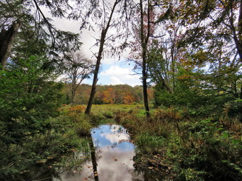 The Flynn Trail is sited along what used to be Beech Mountain Road which was the access for the Beech Mountain Boy Scout Camp. We walked the trail through the woods which was damp in places but not muddy. We started out slowly but soon were keeping a good pace. We turned right on the woods road and continued to set a good pace up the hill. The path was narrow and it was obvious a stream of water had run down the trail during the rains last night. The trail gains a little over 600 feet in 1.7 miles to the highest point at the junction with the Big Rock Trail. We passed the hemlock that used to form a tunnel but was cleared by the DEC. We began to find some small branches on the trail which had come down in the winds from the storm yesterday. We continued to find similar conditions for the rest of the hike. The day was cool but beautiful with plenty of sun. I began to warm up even though I only had a single layer. On the way up the trail we came to the rock ledges on the right side of the trail. As we approached and the clearing to the right of the trail, I stopped to take some pictures of the rock ledges on the right side of the trail. It was a beautiful day and the sun was shining in the rocks and the trail. Many leaves had come down on the ground but there were still many on the trees although the colors were muted. I noticed that I was very relaxed and decided it was partly due to the sound of the leaves under foot. I thought about visiting the clearing but decided I wanted to stay on the main trail. We descended a little and then began walking uphill. We were soon at the junction with the Big Rock Trail. I thought about extending the hike to Hodge Pond but in the end we turned left to walk down the Big Rock Trail. It was 12:25 PM and we had hiked 1.75 miles uphill in 55 minutes.
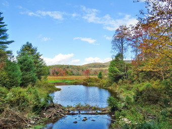 The Big Rock Trail was only a little damp as we started down the long descent. At one point I looked down and saw a good-sized garter snake sunning itself on the trail. Sheena had already passed by without paying much attention. I carefully put down my pack and got out the camera. I warned Sheena off and took a number of shots. When I was done, I put the camera away and we continued downhill. The snake moved a little as we were leaving. The hike down the trail went well and more quickly than I expected. It was definitely easier than the uphill hike. This trail can be tricky as there are three levels that make it seem like the bottom of the hill. We were soon at Times Square and I thought about turning right to hike up and around the Logger's Loop to add some distance to our hike. I decided against this as it was getting late and we continued our hike by walking straight across Times Square to stay on the Big Rock Trail. The Big Rock Trail around the back of Frick Pond can be very wet but on this day it was damp with a few muddy spots under the leaves. We crossed the two small bridges over the inlets to the pond and I decided to stop to take a few pictures. There was some nice color on some of the trees in the wetlands. The water under the first bridge was backed up from the wetlands. The area under the second bridge was now flowing but with a reduced volume. When we got to the area that was covered by tall evergreens, I pushed on through as I had taken pictures here very recently. The wooden boardwalks continue to show wear with many boards loose and other beginning to rot. Much of the boardwalk now "floats" in midair as the supports are rotting. There was a layer of leaves on the walkways making them slipperier than usual.
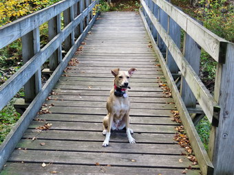 The rest of the trail was damp with several wet and muddy spots. At the next trail junction we turned left on the Quick Lake Trail to head for the bridge across the outlet of Frick Pond. We walked along the west side of Frick Pond to the bridge across the outlet of the pond. The mudhole was wet but not muddy as the drainage work and the stepping stones did their job. I stopped at the bridge for a minute and took a few photographs as there was nice color on the north end of the pond. I took some pictures of Beech Mountain, the highest point in Sullivan County. I took some more shots of the pond and a few of Sheena on the bridge. Sheena and I then walked up the hill to meet Cindy at the top. We continued to Gravestone Junction and passed the Lobdell memorial marker. The marker is a memorial to two children who died in the 1930's in a fire that consumed their cabin. The trail to the memorial was well-worn but the marker was standing intact. The trail back to the register was damp and muddy in spots. We passed the trail register heading toward the parking area. We continued straight ahead to follow the woods road out to the car in the small lot. We arrived at the car at 1:30 PM having hiked 4.0 miles in 1 hours and 55 minutes with an elevation gain of 668 feet. Our overall average speed was 2 MPG with a moving average of 2.3 MPH. The temperature had risen to 71 degrees.
![]()
![]()
![]()
![]() On Monday, September 22nd I planned to get out for a hike but could only do that on Round Top as I was the only EMT around to go on calls. Round Top is always available for a hike and although there are few surprises it is always better than staying at home. I wanted to wait to start the hike until the afternoon after the fall equinox and the official beginning of fall. I did some errands around town and some chores at home. I started to get ready to hike at 2:00 PM with the temperature at 64 degrees on the back porch. Sheena was jumping around and would not leave my side showing she was ready to get outside. She likes to smell my hiking clothes to make sure I am getting dressed in the right clothes. I got dressed in a new Columbia Omni-Shade Omni-Wick shirt without a baselayer. I put on a pair of RailRiders hiking pants which are expensive but last a long time and have features like deep pockets and a generous cut which I really like. I decided to put on my Keen Durand hiking boots which fit well. I added a new pair of Xstance insoles in an effort to find the best support and cushioning for my feet. These insoles have shock absorbing gel pads, TPU arch support, and memory foam cushioning all wrapped in a breathable fabric. The insoles have been hyped by their manufacturer and seemed to be living up to their claims. I grabbed a pair of Leki Micro Vario poles I have been using for some time because they are light and lock without slipping. I didn't bother to wear my OR floppy hat or gaiters. I took my cell phone with me because even though I planned to hike quickly, I was the only EMT around to respond. At 2:20 PM I made sure Sheena's ecollar was turned on and put her on her leash. We walked out the door to start the hike and headed down the driveway and to the street. Sheena knows to pause and look both ways until I say "Cross". We crossed the street and walked through the field next to the Presbyterian Church. We walked to the back of the church and began the ascent of the steepest hill behind the church. The hill is short but gets the circulation pumping and is the steepest and longest climb on the "trail." I held my poles in one hand and Sheena's leash as Sheena pulled my up the hill. We did stop not on the way to the top of the hill. I could really feel that I had been hiking more consistently. At the top we paused for a minute so I could look around at the hills that surround the hamlet of Livingston Manor. The skies were bright blue but there weren't many clouds. The leaves on many trees were turning and falling. We continued the hike by turning left at the trailhead. The trail was completely dry with a covering of leaves. The temperature under the trees seemed cooler than in the sun.
On Monday, September 22nd I planned to get out for a hike but could only do that on Round Top as I was the only EMT around to go on calls. Round Top is always available for a hike and although there are few surprises it is always better than staying at home. I wanted to wait to start the hike until the afternoon after the fall equinox and the official beginning of fall. I did some errands around town and some chores at home. I started to get ready to hike at 2:00 PM with the temperature at 64 degrees on the back porch. Sheena was jumping around and would not leave my side showing she was ready to get outside. She likes to smell my hiking clothes to make sure I am getting dressed in the right clothes. I got dressed in a new Columbia Omni-Shade Omni-Wick shirt without a baselayer. I put on a pair of RailRiders hiking pants which are expensive but last a long time and have features like deep pockets and a generous cut which I really like. I decided to put on my Keen Durand hiking boots which fit well. I added a new pair of Xstance insoles in an effort to find the best support and cushioning for my feet. These insoles have shock absorbing gel pads, TPU arch support, and memory foam cushioning all wrapped in a breathable fabric. The insoles have been hyped by their manufacturer and seemed to be living up to their claims. I grabbed a pair of Leki Micro Vario poles I have been using for some time because they are light and lock without slipping. I didn't bother to wear my OR floppy hat or gaiters. I took my cell phone with me because even though I planned to hike quickly, I was the only EMT around to respond. At 2:20 PM I made sure Sheena's ecollar was turned on and put her on her leash. We walked out the door to start the hike and headed down the driveway and to the street. Sheena knows to pause and look both ways until I say "Cross". We crossed the street and walked through the field next to the Presbyterian Church. We walked to the back of the church and began the ascent of the steepest hill behind the church. The hill is short but gets the circulation pumping and is the steepest and longest climb on the "trail." I held my poles in one hand and Sheena's leash as Sheena pulled my up the hill. We did stop not on the way to the top of the hill. I could really feel that I had been hiking more consistently. At the top we paused for a minute so I could look around at the hills that surround the hamlet of Livingston Manor. The skies were bright blue but there weren't many clouds. The leaves on many trees were turning and falling. We continued the hike by turning left at the trailhead. The trail was completely dry with a covering of leaves. The temperature under the trees seemed cooler than in the sun.
At the first trail junction, I told Sheena "Right" and she immediately turned right and started up the woods road which has the gentler approach of the two. It was a pleasure to walk on the trails and it was obvious more people were using them. Ferns and grasses were beginning to turn brown and there were more leaves on the trail. At the end of the woods road, we turned left up the hill on the trail. We continued up the trail to the first trail junction with the upper blue trail where we turned left to follow the yellow trail along the base of Round Top. We continued on the yellow trail along the base of Round Top. Sheena was running ahead so that I could not see her and then rushing back to find me. We came to the next junction with the blue trail and turned right to head up the blue trail toward the summit. When I we got to the switchback, I decided to follow Sheena as she headed straight up the trail. We continued straight ahead and up the hill toward the summit of Round Top bypassing the white crossover trail. As we passed over the summit, I noticed that the trail showed much less wear and I assumed fewer people were taking the time to walk this trail. We continued over the summit and down the blue trail toward the junction with the yellow trail. We bypassed the white crossover trail again and continued down to the yellow trail. At the junction with the yellow trail we turned right and walked the yellow trail along the base of Round Top toward the next junction with the blue trail. At the next junction, we turned left and started slightly downhill toward the lookout over town. We passed the "sitting rock" and continued downhill. Sheena was ahead of me but she was sometimes hard to spot as he color blends into the leaves on the trail. Everything was starting to turn yellow and brown including the ferns along the way. As we reached the lookout, we followed the yellow trail as it turned left. We walked down the hill to the first trail junction. At the first trail junction, we immediately turned around and started back up the trail.
Climbing the hill to the lookout seemed easier as I have been hiking more. As we reached the top of the hill, we followed the yellow trail as it continued passed the upper part of the lookout. Where the trail turned right, we followed it uphill passing through a large area of ferns which were turning fellow and brown. We passed the sitting rock and continued uphill to the junction with the blue trail. We turned right to follow the yellow trail along the base of Round Top. This area had quite a few branches encroaching on the trail and I knew I should make a trip to trim them before winter. When the snow falls, it collects on the branches and, at times, can almost block the trail. At the junction with the blue trail, we turned left to climb the trail toward the summit. We passed by the white crossover trail and continued toward the summit. We approached the top, walked over the summit and started down the other side again bypassing the white trail. We continued straight down the blue trail and followed to the junction with the yellow trail. We turned left and again walked along the yellow trail to the next junction with the blue trail. I wanted to add a little more distance so we turned left and again headed toward the summit if Round Top. This time we turned left on the white crossover trail about 2/3 of the way to the top. We walked along the white trail but it was obviously the least used trail. When we are back at the blue trail, we turned left and then left again on the switchback that we had avoided the other two times. There were now two small tree down across the trail. I tried dislodging the second but it would not drop. We made the turn in the woods and headed back to the main trial. We turned left on the main blue trail and left on the yellow trail when we reached the bottom of the hill. We walked along the base of Round Top adjourned right when we again reached the junction with the blue trail. We followed the yellow trail to the woods road and walked the woods road out to the first trail junction. I noticed that Sheena completely blended with the fallen leaves and it was hard to see her until she moved. The cliffs to the right on the trail are always impressive for such a short hike. We turned left and walked straight ahead out to the trailhead where we turned right. We walked downhill to the road behind the church. We walked out through the parking lot and across the street to our driveway. We were back home at 3:35 PM after hiking over 2 miles in 1 hour and 15 minutes. I was glad there were no ambulance calls while we were hiking.