
What You Missed
Summer 2026
Summer 2026
![]()
![]()
![]()
![]()
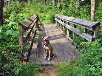
![]() On Wednesday, July 15th, I wanted to get in a hike despite the forecast for high heat and humidity for almost the entire day. Ambulance calls had picked up and were keeping me busy but I had coverage from 6:00 AM to 6:00 PM. As luck would have it several calls came in during the morning hours amd I stuck around in case a second crew was needed. by 1:30 PM things had quieted down so I decided to AGAIN go to Parksville and hike the rail trail. I knew the Little Beaverkill might still be high from the rains a few days ago. I started getting ready at 1:45 PM with the temperature at 84 degrees in the back porch. As I was getting dressed, Sheena sniffed my clothes to confirm we were going to hike. I got dressed in my Columbia Omnishade long-sleeved shirt which really does seem to be cooler than others. I put on a pair of RailRiders hiking pants which are expensive but last a long time and have features like deep pockets and a generous cut which I really like. I decided to put on my Keen Durand hiking boots which fit well. I added a new pair of Xstance insoles in an effort to find the best support and cushioning for my feet. These insoles have shock absorbing gel pads, TPU arch support, and memory foam cushioning all wrapped in a breathable fabric. The insoles have been hyped by their manufacturer and seemed to be living up to their claims. I grabbed a pair of Leki Makalu Lite poles I have been using for some time because they are light and lock without slipping. I decided to wear my OR BugOut gaiters as a defense against the ticks that are looking for a warm home and a meal! I put the ecollar on Sheena and turned it on. I put my gear in the back of the car and Sheena in the back seat. We left Livingston Manor at 2:00 PM with a temperature of 84 degrees on the back porch. There was an overcast sky which blocked the sun and a breeze which made it feel very comfortable. I drove out Old Route 17 toward Parksville and just after Fox Mountain Road, I pulled into the parking area on the right side of the road. There were no cars parked in the lot. We started out on the trail at 2:08PM under overcast skies.
On Wednesday, July 15th, I wanted to get in a hike despite the forecast for high heat and humidity for almost the entire day. Ambulance calls had picked up and were keeping me busy but I had coverage from 6:00 AM to 6:00 PM. As luck would have it several calls came in during the morning hours amd I stuck around in case a second crew was needed. by 1:30 PM things had quieted down so I decided to AGAIN go to Parksville and hike the rail trail. I knew the Little Beaverkill might still be high from the rains a few days ago. I started getting ready at 1:45 PM with the temperature at 84 degrees in the back porch. As I was getting dressed, Sheena sniffed my clothes to confirm we were going to hike. I got dressed in my Columbia Omnishade long-sleeved shirt which really does seem to be cooler than others. I put on a pair of RailRiders hiking pants which are expensive but last a long time and have features like deep pockets and a generous cut which I really like. I decided to put on my Keen Durand hiking boots which fit well. I added a new pair of Xstance insoles in an effort to find the best support and cushioning for my feet. These insoles have shock absorbing gel pads, TPU arch support, and memory foam cushioning all wrapped in a breathable fabric. The insoles have been hyped by their manufacturer and seemed to be living up to their claims. I grabbed a pair of Leki Makalu Lite poles I have been using for some time because they are light and lock without slipping. I decided to wear my OR BugOut gaiters as a defense against the ticks that are looking for a warm home and a meal! I put the ecollar on Sheena and turned it on. I put my gear in the back of the car and Sheena in the back seat. We left Livingston Manor at 2:00 PM with a temperature of 84 degrees on the back porch. There was an overcast sky which blocked the sun and a breeze which made it feel very comfortable. I drove out Old Route 17 toward Parksville and just after Fox Mountain Road, I pulled into the parking area on the right side of the road. There were no cars parked in the lot. We started out on the trail at 2:08PM under overcast skies.
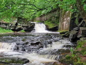
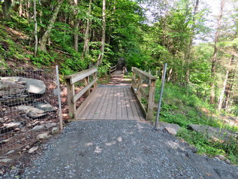
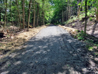
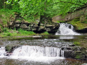
 The first part of the trail was damp but was drying. Once we were on the trail and sheltered by the trees the temperature did not chang much as there was no breeze but no direct sunlight.The trail was about as I expected some wet areas and some mud. There seemed to be less water and mud than during our last trip. The rail trail runs parallel to the Little Beaverkill and the new section of State Route 17. It follows the route of the O&W railroad and is very flat. The water level in the stream was a little lower than the last trip but NT nearly as dry as Trout Pond the day before. As we continued to hike, we passed several benches placed for people to rest in warmer weather. I did not stop at the area just before the wooden walkways and bridge as my objective was to hike as fast as we could. We walked across the long walkway which had dried out and was not at all slippery. We came to the bridge and found that the work done to prevent erosion seemed to have worked. The culvert under the bridge was clear ad allowing water to drain downhill. The large boulders now held back the dirt and stones that often wash down the hillside to block the flow of water through the culvert. The crushed stone on either side of the bridge held and remained in place. In a very short distance we came to the area where a large mudslide had brought trees and dirt down onto the trail. This area had been cleared and crusher run added to replace the mud. As we continued I noted the other places where they had done work and all of it seemed to be holding up well. We continued on the trail heading toward the falls. As we walked toward the falls, we could hear an increase in the noise from the stream and I knew the falls was just ahead. At the falls, I took a peek and found the volume was still good. No one was cooling themselves off at the falls or lying in the sun on the rock shelves above.
 I wanted to push the pace so we continued to walk without stopping. We continued on the trail toward Parksville. Soon we were nearing the Parksville end of the trail. The large dog across the stream was missing. On the Parksville end of the trail we found the small garden and a very informative sign. The pack of barking dogs that always greets us was not there but just as we approached the end their owner cranked up his obnoxious music. The sign listed the businesses and hotels that existed in Parksville during its heyday. The Young's Gap Hotel had room for 600 guests! The sign also explained the role of the railroad in the dairy industry which was a thriving one in all of Sullivan County. It was 2:32 PM when we headed back toward the car. We had covered the walk out in only 24 minutes and I decided to lush hard on the way back. I knew the walk back was usually quicker. We set what I thought was a faster pace on the way back. We passed the falls and still found no people enjoying themselves below or above the falls. We continued passed the mudslide and the bridges and kept a good pace. We crossed the bridge and the wooden walkway. As we neared the end of the wooded part of trail, I gave Sheena the "With" command and she fell in behind me. We did meet two young ladies just starting out on the trail and Sheena ignored them. We were back at the car at 3:54 PM having walked the return route in 22 minutes. The whole hike took us just 46 minutes which was our best time ever! The temperature at the car was 86 degrees.
![]()
![]()
![]()
![]()
![]() On Tuesday, July 14th I had coverage for ambulance calls from 8:30 AM to 2:30 PM. I planned to get out for a hike somewhere that I had not been in some time. I decided I wanted to take Sheena and go to the area around Trout Pond. This is an area I have hiked many times but I had not been there in some time. As often happens a call came in at 5:30 AM and I responded. The patient had to be transported to Middletown instead of Harris which means it is a 100 mile trip rather than 30 miles! I was tired when I got hoe but I knew I would feel better if I did. I was also convinced by Sheena's obvious indications that she wanted to go. I decided not to waste any time as there was a heat advisory from noon on. I started to get ready at 8:45 AM with the temperatures at 72 degrees on the back porch. Sheena is a Feist-Cur cross which are actual types of dogs used on farms and for hunting in the south. She loves to get out and hike. Even though she is only not quite 2 years old she is very strong for a small dog. I am glad that I have transitioned to an ecollar and that Sheena has learned basic commands very quickly. On this day Sheena was hanging out near me so that I would not forget to take her. As I was getting dressed, Sheena sniffed my clothes to confirm we were going to hike. I got dressed in my Columbia Omnishade long-sleeved shirt which really does seem to be cooler than others. I put on a pair of RailRiders hiking pants which are expensive but last a long time and have features like deep pockets and a generous cut which I really like. I decided to put on my Keen Durand hiking boots which fit well. I added a new pair of Xstance insoles in an effort to find the best support and cushioning for my feet. These insoles have shock absorbing gel pads, TPU arch support, and memory foam cushioning all wrapped in a breathable fabric. The insoles have been hyped by their manufacturer and seemed to be living up to their claims. I grabbed a pair of Leki Makalu Lite poles I have been using for some time because they are light and lock without slipping. I decided to wear my OR BugOut gaiters as a defense against the ticks that are looking for a warm home and a meal! I put the ecollar on Sheena and turned it on. I put my gear in the back of the car and Sheena in the back seat. We left Livingston Manor at 9:05 AM with a temperature of 73 degrees on the back porch.
On Tuesday, July 14th I had coverage for ambulance calls from 8:30 AM to 2:30 PM. I planned to get out for a hike somewhere that I had not been in some time. I decided I wanted to take Sheena and go to the area around Trout Pond. This is an area I have hiked many times but I had not been there in some time. As often happens a call came in at 5:30 AM and I responded. The patient had to be transported to Middletown instead of Harris which means it is a 100 mile trip rather than 30 miles! I was tired when I got hoe but I knew I would feel better if I did. I was also convinced by Sheena's obvious indications that she wanted to go. I decided not to waste any time as there was a heat advisory from noon on. I started to get ready at 8:45 AM with the temperatures at 72 degrees on the back porch. Sheena is a Feist-Cur cross which are actual types of dogs used on farms and for hunting in the south. She loves to get out and hike. Even though she is only not quite 2 years old she is very strong for a small dog. I am glad that I have transitioned to an ecollar and that Sheena has learned basic commands very quickly. On this day Sheena was hanging out near me so that I would not forget to take her. As I was getting dressed, Sheena sniffed my clothes to confirm we were going to hike. I got dressed in my Columbia Omnishade long-sleeved shirt which really does seem to be cooler than others. I put on a pair of RailRiders hiking pants which are expensive but last a long time and have features like deep pockets and a generous cut which I really like. I decided to put on my Keen Durand hiking boots which fit well. I added a new pair of Xstance insoles in an effort to find the best support and cushioning for my feet. These insoles have shock absorbing gel pads, TPU arch support, and memory foam cushioning all wrapped in a breathable fabric. The insoles have been hyped by their manufacturer and seemed to be living up to their claims. I grabbed a pair of Leki Makalu Lite poles I have been using for some time because they are light and lock without slipping. I decided to wear my OR BugOut gaiters as a defense against the ticks that are looking for a warm home and a meal! I put the ecollar on Sheena and turned it on. I put my gear in the back of the car and Sheena in the back seat. We left Livingston Manor at 9:05 AM with a temperature of 73 degrees on the back porch.
 I drove north on the Quickway towards Roscoe and got off at exit 94 heading north on Route 206 towards Downsville. After crossing the Rockland Flats and passing the Roscoe Nursing Home, I turned left on Morton Hill Road and drove to the intersection with Russell Brook Road. A car had just pulled into the parking on the left side of Morton Hill Road. I pulled up next to him and told him the lot is private property. He seemed like a decent guy but gave the same lame excuse I have heard so many times. 'I have been doing it for years and many other people park here.' In other words, I really don't care about the rights of others as long as it is convenint for me. People see the open space and park there without thinking about the fact that the land is private. I did not want to have to walk back up Russell Brook Road at the end of the hike so I decided to drive down the road to park in the lower lot. I thought about parking at the overlook for the upper falls but decided against it. I drove down to the lower parking lot and parked the car in the lot where six other cars were parked! I did not see any people so assumed they were camping or out hiking. Russell Brook Falls is popular as a falls and swimming area and people also like to camp at Trout Pond. It was early in the season and it was a weekday so I was surprised that there were so man cars. My intention was to visit the falls on the way out as the lighting was best that way. I had forgotten my GPS unit but was not concerned as I had done the hike before. We started our hike by turning on the electronic collar on Sheena and the remote in my pocket. When I let Sheena out of the car she started running around the parking area sniffing everything in sight. At 9:25 AM we started our hike by walking down the woods road toward the bridge across Russell Brook. The road was mostly dry with a few damp spots.
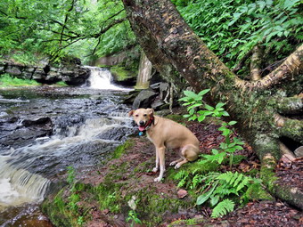
 As we crossed the bridge, I could see that the water level in the stream was lower than I expected. The Japanese knotweed had bounced back to narrow the path encroaching on the area available for hikers. The history of this area is very interesting. Russell Brook Falls had been the site of a dam that impounded water for a waterwheel in Butternut Grove. The wheel was still there a few years ago. The area near the register box was the "landing zone" for loggers who cleared the evergreen trees, not for tanning but, for the production of wood alcohol. The trees were transported on narrow gauge railway that ran parallel to Russell Brook. The railway met the mainline O&W near Butternut Grove where the logs were unloaded. There were several acid factories in the area that produced wood alcohol. There was also a factory on the lower part of Russell Brook that produced khaki dye for the uniforms of American troops during World War I. We continued on the trail to the first junction where we turned right. When we came to the path to the falls, it was almost impossible to see it as the knotweed almost completely obscured it. We turned right and walked toward the falls getting wet from the water on the vegetation. We walked to the spot where the path descends to the streambed. We walked down to the bottom and to the streambed. I was glad there were no people present. The falls had only a trickle of water and the stream below was almost dry. There had been some localized storms but this was apparently not one of those locations. I put down my pack and got out my camera and took some pictures of the falls at different angles and zooms. I also took shots of the stream. I remembered how Sheila would pose in front of the falls while I took pictures of her. I got Sheena to pose by the falls and took a few shots. She is getting very good at posing and staying until I call her. I returned to my pack and put away the camera. We walked back up to the path that runs out to the main trail. I had some time constraints and decided not to go up to the top of the falls.
 At the main trail we turned right and followed it passed the register box and up the trail toward Trout Pond. Sheena had headed to the left but was quick to see where I was headed and raced ahead of me. The trail was barely damp but not really muddy at all. All of the small streams that normally cross the trail were dry. I did notice that several blowdowns had been cut and cleared from the trail using a chainsaw. These trails are maintained by the DEC and the frequency that they are maintained is spotty and usually occurs once in the spring. We continued on the trail uphill toward Trout Pond. I wasn't consciously pushing the pace but the walk seemed to go very quickly as we passed the path to the first primitive campsite on the left. My breathing and heart rate were up but it felt good. Sheena was leading the way but keeping a consistent distance ahead of me. She did come back to visit several times! I could barely hear the outlet stream from Trout Pond indicating not much water was coming out of the pond. Sheena was ahead of me on the trail with an occasional trip off trail. Giving her the command "Trail" brought here right back. When she is on the trail, she picks a certain distance ahead of me and maintains that distance by waiting for me or speeding up. Soon we were at the outlet end of the pond and we walked to the beach which we had to ourselves. The beach was a wide band of exposed sand and a quick glance at the other shores showed the water level was low. I put my pack down to get out my camera and while I was doing that I heard splashing as Sheena was doing some wading in the water. The skies were blue but there was some general, unconsolidated cloudiness rather than nice puffy individual clouds The sun was shining but not enough to interfere with photography as it was behind me. I made sure to get shots of the pond with some zooms of the shoreline showing the water level. I also some of the beach and the spillway. The distance between the spillway and the water was a least 6 feet. I stood in the spillway and took some pictures. When I was done, I packed up and we returned to the main trail to walk the flat woods road toward the inlet end of the pond.
 This trail is always wet but on this day it was almost completely dry. I did see what looked like recent vehicle tracks along the trail! Sheena kept walking over to the edge of the water looking like she might jump in again. There were a lot of squirrels and chipmunks running around and Sheena was busy chasing them. The weeds were high and sometimes I could only tell where she was because she kept hopping up. I could see a large campsite on the other side of the pond with music and voices. The large campsite on the right of the trail was empty. The small stream just before the trail junction near the leanto was dry. I looked up and saw a small SUV parked just off the trail with no one around! I looked for handicapped markers but saw none. O wondered how one gets permission to do this. When we came to the bridge, I stopped to take a few pictures of the pond from the bridge. The inlet stream was completely dry. Sheena was doing zoomies around the trails and paths. I got her to sit still long enough that I could take some pictures of her on the bridge. I also took some pictures of the car. At the start of the hike I questioned whether I would feel like continuing around the pond as there is a pretty good climb. I was feeling great and decided to continue. We crossed the bridge and stayed to the right on the Mud Pond Trail which would take us over Cherry Ridge and form a loop back to the parking area. The trail was relatively dry but very rocky as we started to ascend the hill. As we continued up the trail, I slowed a little as the grade increased. I had not been hiking many hills lately and I felt it. We began to run into places where branches, small trees, and large trees had been cut and removed from the trail. These trails are maintained by the DEC but I was not sure when the work had been done. There were also a few new blowdowns that had not been cleared from the high winds that had blown through the area in the passed few weeks.
 From the bridge at the inlet we climbed 430 feet over the next .75 miles. The trail headed west from the inlet until turning sharply south at around 2 miles. The highest point on the trail was at 2.2 miles after which most of the rest of the hike is downhill. I was not surprised that I was getting tired on the climb but I still felt great. As we started down the other side, there was no water or mud in the places where there is often standing or running water. I was able to make better time than usual as I did not have to avoid the water and mud. These conditions continued for the rest of the trip. We ascended a the hill to the stand of small birch trees and then descended the other side. At 3.4 miles we had descended 420 feet from Cherry Ridge to the snowmobile trail near Mud Pond. I could see that the trail was only damp so we stayed on the woods road. I considered walking over to Mud Pond but I was a little later than I wanted. We ascended a small hill before starting downhill back toward the parking area. This area usually has some running water across it and some running down the trail but it too was dry. This part of the trail is exceptionally rocky making the descent tricky. Even though I was being careful there were times I was very glad I had the poles! I looked up at one point and saw three people headed toward us with a dog. I pulled Sheena off the trail to let them go by. I had not noticed there was another group of young hikers coming up behind us. What I did notice was that Sheena's collar with all her tags was missing! I was not sure it had been on her at the start of the hike and that annoyed me. After the two groups passed each other and use Sheena and I went back to the trail to continue. The group of young hikers we were following was moving quickly and was soon out of sight! I completely missed the small stream near the bottom of the hill as it was dry. We passed the large campsite on the left which was also empty and left me wondering where all the people were. We came to the bridge over the outlet stream For Trout Pond. All told, we had dropped 380 feet over the .7 miles back to the bridge. I crossed the bridge over the outlet stream which barely had any water flowing. We continued to the main Trout Pond Trail where we turned right. We continued on the trail passing the knotweed. We crossed the bridge and walked up the trail to the parking area and the car. We were back at the car at 11:55 AM and had hiked 4.6 miles in 2 hours and 30 minutes with an elevation gain of 925 feet. We had stopped about 15 minutes for pictures. My moving speed was just under 2 mph but I was satisfied because of the rolling terrain. The lot had a few more cars and the temperature had risen to 80 degrees although it still felt comfortable.
![]()
![]()
![]()
![]()
![]() On Tuesday, July 7th, I wanted to get in a hike despite the forecast for showers for almost the entire day. Ambulance calls had picked up and were keeping me busy but I had coverage from 8:30 AM to 2:30 PM. As luck would have it a call came in early in the morning and I did not get home until after 9:00 AM. When I got home, I decided to AGAIN go to Parksville and hike the rail trail. I knew the Little Beaverkill might be high as it had rained the last few days. As I was getting dressed, Sheena sniffed my clothes to confirm we were going to hike. I got dressed in my Columbia Omnishade long-sleeved shirt which really does seem to be cooler than others. I put on a pair of RailRiders hiking pants which are expensive but last a long time and have features like deep pockets and a generous cut which I really like. I decided to put on my Keen Durand hiking boots which fit well. I added a new pair of Xstance insoles in an effort to find the best support and cushioning for my feet. These insoles have shock absorbing gel pads, TPU arch support, and memory foam cushioning all wrapped in a breathable fabric. The insoles have been hyped by their manufacturer and seemed to be living up to their claims. I grabbed a pair of Leki Makalu Lite poles I have been using for some time because they are light and lock without slipping. I decided to wear my OR BugOut gaiters as a defense against the ticks that are looking for a warm home and a meal! I put the ecollar on Sheena and turned it on. I put my gear in the back of the car and Sheena in the back seat. We left Livingston Manor at 10:00 AM with a temperature of 64 degrees on the back porch. This was so much cooler than the week before and felt very comfortable. I drove out Old Route 17 toward Parksville and just after Fox Mountain Road, I pulled into the parking area on the right side of the road. There were no cars parked in the lot. We started out on the trail at 10:13 AM under overcast skies with some most in the air.
On Tuesday, July 7th, I wanted to get in a hike despite the forecast for showers for almost the entire day. Ambulance calls had picked up and were keeping me busy but I had coverage from 8:30 AM to 2:30 PM. As luck would have it a call came in early in the morning and I did not get home until after 9:00 AM. When I got home, I decided to AGAIN go to Parksville and hike the rail trail. I knew the Little Beaverkill might be high as it had rained the last few days. As I was getting dressed, Sheena sniffed my clothes to confirm we were going to hike. I got dressed in my Columbia Omnishade long-sleeved shirt which really does seem to be cooler than others. I put on a pair of RailRiders hiking pants which are expensive but last a long time and have features like deep pockets and a generous cut which I really like. I decided to put on my Keen Durand hiking boots which fit well. I added a new pair of Xstance insoles in an effort to find the best support and cushioning for my feet. These insoles have shock absorbing gel pads, TPU arch support, and memory foam cushioning all wrapped in a breathable fabric. The insoles have been hyped by their manufacturer and seemed to be living up to their claims. I grabbed a pair of Leki Makalu Lite poles I have been using for some time because they are light and lock without slipping. I decided to wear my OR BugOut gaiters as a defense against the ticks that are looking for a warm home and a meal! I put the ecollar on Sheena and turned it on. I put my gear in the back of the car and Sheena in the back seat. We left Livingston Manor at 10:00 AM with a temperature of 64 degrees on the back porch. This was so much cooler than the week before and felt very comfortable. I drove out Old Route 17 toward Parksville and just after Fox Mountain Road, I pulled into the parking area on the right side of the road. There were no cars parked in the lot. We started out on the trail at 10:13 AM under overcast skies with some most in the air.
The first part of the trail was wet from the rain overnight but was drying. Once we were on the trail and sheltered by the trees the temperature did not changed much as there was no breeze and no direct sunlight.The trail was about as I expected some wet areas and some mud. There seemed to be more water and mud than during our last trip. The rail trail runs parallel to the Little Beaverkill and the new section of State Route 17. It follows the route of the O&W railroad and is very flat. The water level in the stream was exactly the same as the day before. As we continued to hike, we passed several benches placed for people to rest in warmer weather. I did not stop at the area just before the wooden walkways and bridge as our objective was to hike as fast as we could. We walked across the long walkway carefully as it was wet and very slippery. We came to the bridge and found that the work done to prevent erosion seemed to have worked. The culvert under the bridge was clear ad allowing water to drain downhill. The large boulders now held back the dirt and stones that often wash down the hillside to block the flow of water through the culvert. The crushed stone on either side of the bridge held and remained in place. In a very short distance we came to the area where a large mudslide had brought trees and dirt down onto the trail. This area had been cleared and crusher run added to replace the mud. As we continued I noted the other places where they had done work and all of it seemed to be holding up well. I looked ahead and saw a woman walking with dog on a leash. I thought she was walking toward us so I pulled Sheena off the trail near one of the benches and waited for her to pass. After a short time, I peeked out at the trail and saw no one! I concluded that woman and dog were headed toward Parksville. We continued on the trail heading toward the falls. As we walked toward the falls, we could hear an increase in the noise from the stream and I knew the falls was just ahead. At the falls, I looked down to the base and saw the volume was much higher than on our previous visit. I was surprised that no one was cooling themselves off at the falls or lying in the sun on the rock shelves above.
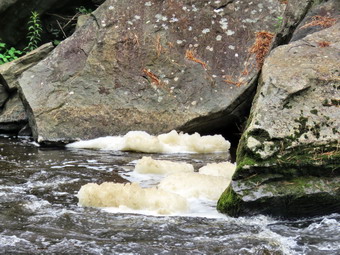
We started down the path to the base of the falls. Sheena scampered down the path without a probe. I was much more careful as the rocks were wet and slippery. When we reached the stream, I took off my pack and got out my camera. The overcast skies were better for photography than bright sunlight. I took pictures of the falls and rapids from different angles and zooms. There was an impressive foam on the river just below the rapids so I grabbed some shots. I also took shots downstream where everything was so green. I was almost done but Sheena had other ideas, She ran to some rocks and sat down with the falls in the background. I took shots as she looked in different directions and changed her position. When she was done, I put the camera away, shouldered the pack, and walked back up to the mainsail. I again put down my pack and took out the camera. I took shots from above the falls and some upstream. After I was done, we continued on the trail toward Parksville. Soon we were nearing the Parksville end of the trail. The large dog across the stream only started to bark as we were almost passed and then it was half-hearted. On the Parksville end of the trail we found the small garden and a very informative sign. The pack of barking dogs that always greets seemed to be inside and we only heard a few barks. The sign listed the businesses and hotels that existed in Parksville during its heyday. The Young's Gap Hotel had room for 600 guests! The sign also explained the role of the railroad in the dairy industry which was a thriving one in all of Sullivan County. It was 10:49 AM when we headed back toward the car. We had covered the walk out in 39 minutes but at least 10 minutes was consumed taking pictures. I knew the walk back was usually quicker. We set what I thought was a faster pace on the way back. We passed the falls and still found no people enjoying themselves below or above the falls. We continued passed the mudslide and the bridges and kept a good pace. We crossed the bridge and the wooden walkway. Sheena decided that the bridge was the place for zoomies! She would run straight at me and then try to stop slipping on the wet surface! She did this several times and each time I thought she would slam into me! As we neared the end of the wooded part of trail, I gave Sheena the "With" command and she fell in behind me. We were back at the car at 12:15 PM having walked the return route in 26 minutes. The whole hike took us just over an hour including time for photography. We had met no other hikers which is what I prefer. The temperature at the car was 66 degrees and a light mist was in the air.
![]()
![]()
![]()
![]()
![]() On THursday, July 2nd, I wanted to get in a hike despite the forecast for a heat index over 100 degrees! This would be the third day in a row of hiking and although the distances were short I was feeling physically and mentally better. I had ambulance coverage from 8:30 AM to 2:30 PM. As luck would have it a call came in early in the morning and we were halfway there when we were canceled. This happened two more times before 10:00 AM! When I got home, I decided to again go to Parksville and hike the rail trail just to say we had hiked in the heat. I knew the Little Beaverkill would be low as it had not rained much since yesterday. As I was getting dressed, Sheena sniffed my clothes to confirm we were going to hike. I got dressed in my Columbia Omnishade long-sleeved shirt which really does seem to be cooler than others. I put on a pair of RailRiders hiking pants which are expensive but last a long time and have features like deep pockets and a generous cut which I really like. I decided to put on my Keen Durand hiking boots which fit well. I added a new pair of Xstance insoles in an effort to find the best support and cushioning for my feet. These insoles have shock absorbing gel pads, TPU arch support, and memory foam cushioning all wrapped in a breathable fabric. The insoles have been hyped by their manufacturer and seemed to be living up to their claims. I grabbed a pair of Leki Makalu Lite poles I have been using for some time because they are light and lock without slipping. I decided to wear my OR BugOut gaiters as a defense against the ticks that are looking for a warm home and a meal! I put the ecollar on Sheena and turned it on. I put my gear in the back of the car and Sheena in the back seat. We left Livingston Manor at 12:45 PM with a temperature of 93 degrees on the back porch and drove out Old Route 17 toward Parksville. Just after Fox Mountain Road, I pulled into the parking area on the right side of the road. There were no cars parked in the lot. We started out on the trail at 11:57 AM under blue skies with lots of sun and a nice breeze blowing. The temperature was 92 degrees and the heat index was 105 with high humidity.
On THursday, July 2nd, I wanted to get in a hike despite the forecast for a heat index over 100 degrees! This would be the third day in a row of hiking and although the distances were short I was feeling physically and mentally better. I had ambulance coverage from 8:30 AM to 2:30 PM. As luck would have it a call came in early in the morning and we were halfway there when we were canceled. This happened two more times before 10:00 AM! When I got home, I decided to again go to Parksville and hike the rail trail just to say we had hiked in the heat. I knew the Little Beaverkill would be low as it had not rained much since yesterday. As I was getting dressed, Sheena sniffed my clothes to confirm we were going to hike. I got dressed in my Columbia Omnishade long-sleeved shirt which really does seem to be cooler than others. I put on a pair of RailRiders hiking pants which are expensive but last a long time and have features like deep pockets and a generous cut which I really like. I decided to put on my Keen Durand hiking boots which fit well. I added a new pair of Xstance insoles in an effort to find the best support and cushioning for my feet. These insoles have shock absorbing gel pads, TPU arch support, and memory foam cushioning all wrapped in a breathable fabric. The insoles have been hyped by their manufacturer and seemed to be living up to their claims. I grabbed a pair of Leki Makalu Lite poles I have been using for some time because they are light and lock without slipping. I decided to wear my OR BugOut gaiters as a defense against the ticks that are looking for a warm home and a meal! I put the ecollar on Sheena and turned it on. I put my gear in the back of the car and Sheena in the back seat. We left Livingston Manor at 12:45 PM with a temperature of 93 degrees on the back porch and drove out Old Route 17 toward Parksville. Just after Fox Mountain Road, I pulled into the parking area on the right side of the road. There were no cars parked in the lot. We started out on the trail at 11:57 AM under blue skies with lots of sun and a nice breeze blowing. The temperature was 92 degrees and the heat index was 105 with high humidity.
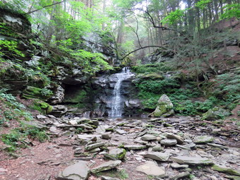
 The first part of the trail was just damp from a shower overnight but drying quickly. Once we were on the trail and sheltered by the trees it was a little warmer as the trees blocked the pleasant breeze. The trail was about as I expected some damp areas and some mud. There seemed to be less water and mud than during our last trip. The rail trail runs parallel to the Little Beaverkill and the new section of State Route 17. It follows the route of the O&W railroad and is very flat. The water level in the stream was exactly the same as the day before. As we continued to hike, we passed several benches placed for people to rest in warmer weather. I did not stop at the area just before the wooden walkways and bridge as our objective was to hike as fast as we could. We walked across the long walkway and then we came to the bridge. We already knew the crew had finished their work and had done a great job! They had cleared all of the debris that was blocking the culvert under the bridge. Large boulders now held back the dirt and stones that often wash down the hillside to block the flow of water through the culvert. The crew had added crushed stone on either side of the bridge to smooth the way on and off the brdige. More stone had been added to fill in the mud pit on the Parksville side. Some fencing had been added and the overall effect was very pleasing. In a very short distance we came to the area where a large mudslide had brought trees and dirt down onto the trail. This area had been partly cleared in the past but the Liberty crew had graded it and added some crusher run. They also removed much of the debris, erected some fencing, and added some hay to help grass to grow back. As we continued I noted the other places where they had done work and all of it seemed to be holding up well. We continued on the trail heading toward the falls. As we walked toward the falls, we could hear an increase in the noise from the stream and I knew the falls was just ahead. I was surprised that no one was cooling themselves off at the falls or lying in the sun on the rock shelves above.
 We passed the path down to the falls as I wanted to save time and I noticed the falls looked the same as last time. Soon we were nearing the Parksville end of the trail. The large dog across the stream was not present and I missed him. On the Parksville end of the trail we found the small garden and a very informative sign. The pack of barking dogs that always greets us was also absent. The sign listed the businesses and hotels that existed in Parksville during its heyday. The Young's Gap Hotel had room for 600 guests! The sign also explained the role of the railroad in the dairy industry which was a thriving one in all of Sullivan County. It was 12:21 PM when we headed back toward the car. We had covered the walk out in 24 minutes but I knew the walk back was usually quicker. We set what I thought was a faster pace on the way back. We passed the falls an found people enjoying themselves below and above the falls. We continued passed the mudslide and the bridges and kept a good pace. We crossed the bridge and the wooden walkway. As we neared the end of the wooded part of trail, I gave Sheena the "With" command and she fell in behind me. We were back at the car at 1:45 PM having walked the return route in 24 minutes. The whole hike took us 48 minutes which I believe is our record! We had met no other hikers which is what I prefer. The temperature at the car was 91 degrees. Usually when I drive away the temperature goes down but by the time I was on the flats in read 94 degrees!
![]()
![]()
![]()
![]()
![]() On Wednesday, July 1st, I wanted to get in a hike despite the forecast for a heat index over 100 degrees! I had ambulance coverage from 6:00 AM to 2:00 PM I thought. When my crew did not respond to an early mutual aid call, I made other arrangements which kept me on call until.noon! I decided to just go to Parksville and hike the rail trail because it is under three miles out and back and I was not sure how Sheena or I would adapt to the heat and humidity. I knew the Little Beaverkill would be low as it had not rained much since our last trip. As I was getting dressed, Sheena sniffed my clothes and became very excited. I got dressed in a Mountain Hardwear ` long-sleeved shirt. I put on a pair of RailRiders hiking pants which are expensive but last a long time and have features like deep pockets and a generous cut which I really like. I decided to put on my Keen Durand hiking boots which fit well. I added a new pair of Xstance insoles in an effort to find the best support and cushioning for my feet. These insoles have shock absorbing gel pads, TPU arch support, and memory foam cushioning all wrapped in a breathable fabric. The insoles have been hyped by their manufacturer and seemed to be living up to their claims. I grabbed a pair of Leki Makalu Lite poles I have been using for some time because they are light and lock without slipping. I decided to wear my OR BugOut gaiters as a defense against the ticks that are looking for a warm home and a meal! I put the ecollar on Sheena and turned it on. I put my gear in the back of the car and Sheena in the back seat. We left Livingston Manor at 12:45 PM and drove out Old Route 17 toward Parksville. Just after Fox Mountain Road, I pulled into the parking area on the right side of the road. There were two cars parked in the lot. We started out on the trail at 12:55 PM under blue skies with lots of sun. The temperature was 91 degrees and the heat index was 101 with high humidity.
On Wednesday, July 1st, I wanted to get in a hike despite the forecast for a heat index over 100 degrees! I had ambulance coverage from 6:00 AM to 2:00 PM I thought. When my crew did not respond to an early mutual aid call, I made other arrangements which kept me on call until.noon! I decided to just go to Parksville and hike the rail trail because it is under three miles out and back and I was not sure how Sheena or I would adapt to the heat and humidity. I knew the Little Beaverkill would be low as it had not rained much since our last trip. As I was getting dressed, Sheena sniffed my clothes and became very excited. I got dressed in a Mountain Hardwear ` long-sleeved shirt. I put on a pair of RailRiders hiking pants which are expensive but last a long time and have features like deep pockets and a generous cut which I really like. I decided to put on my Keen Durand hiking boots which fit well. I added a new pair of Xstance insoles in an effort to find the best support and cushioning for my feet. These insoles have shock absorbing gel pads, TPU arch support, and memory foam cushioning all wrapped in a breathable fabric. The insoles have been hyped by their manufacturer and seemed to be living up to their claims. I grabbed a pair of Leki Makalu Lite poles I have been using for some time because they are light and lock without slipping. I decided to wear my OR BugOut gaiters as a defense against the ticks that are looking for a warm home and a meal! I put the ecollar on Sheena and turned it on. I put my gear in the back of the car and Sheena in the back seat. We left Livingston Manor at 12:45 PM and drove out Old Route 17 toward Parksville. Just after Fox Mountain Road, I pulled into the parking area on the right side of the road. There were two cars parked in the lot. We started out on the trail at 12:55 PM under blue skies with lots of sun. The temperature was 91 degrees and the heat index was 101 with high humidity.
The first part of the trail was just damp from a shower overnight but drying quickly. Once we were on the trail and sheltered by the trees it was a little cooler. The trail was about as I expected some damp areas and some mud. There seemed to be less water and mud than during our last trip. The rail trail runs parallel to the Little Beaverkill and the new section of State Route 17. It follows the route of the O&W railroad and is very flat. The water level in the stream was not quite as high as the last time we had hiked along the trail. As we continued to hike, we passed several benches placed for people to rest in warmer weather. I did not stop at the area just before the wooden walkways and bridge as our objective was to hike as fast as we could. We walked across the long walkway and then we came to the bridge. We already knew the crew had finished their work and had done a great job! They had cleared all of the debris that was blocking the culvert under the bridge. Large boulders now held back the dirt and stones that often wash down the hillside to block the flow of water through the culvert. The crew had added crushed stone on either side of the bridge to smooth the way on and off the brdige. More stone had been added to fill in the mud pit on the Parksville side. Some fencing had been added and the overall effect was very pleasing. In a very short distance we came to the area where a large mudslide had brought trees and dirt down onto the trail. This area had been partly cleared in the past but the Liberty crew had graded it and added some crusher run. They also removed much of the debris, erected some fencing, and added some hay to help grass to grow back. As we continued I noted the other places where they had done work and all of it seemed to be holding up well. We continued on the trail heading toward the falls. As I looked ahead, O could see two women sitting on a bench. As we approached I told Sheena "With" and she fell in behind me. As we passed the ladies greet me and I returned the favor. I told Sheena "Up trail" and she did just that. As we walked toward the falls, we could hear an increase in the noise from the stream and I knew the falls was just ahead. I could also hear voices which meant there were people enjoying the cool water.
We passed the path down to the falls as I wanted to save time and I noticed the falls looked the same as last time. Soon we were nearing the Parksville end of the trail. Many of the rundown buildings had beem removed or were being renovated. Several of the buildings showed that work had been done on them. The large dog across the stream was not present and I missed him. On the Parksville end of the trail we found the small garden and a very informative sign. The pack of barking dogs that always greets us was also absent. The sign listed the businesses and hotels that existed in Parksville during its heyday. The Young's Gap Hotel had room for 600 guests! The sign also explained the role of the railroad in the dairy industry which was a thriving one in all of Sullivan County. It was 1:21 PM when we headed back toward the car. We had covered the walk out in 26 minutes but I knew the walk back was usually quicker. We set what I thought was a faster pace on the way back but that did not stop Sheena from going into full zoomie mode. She was racing ahead and then sprinting back toward me. She added some growling and attempts to bite my feet! We passed the falls, the mudslide and the bridges and continued to keep a good pace. Up ahead I could see the two women who had been sitting on the bench headed back to the parking area. We crossed the bridge and the wooden walkway. As we neared the end of the wooded part of trail, I gave Sheena the "With" command and she fell in behind me. We were back at the car at 1:45 PM having walked the return route in 24 minutes. The whole hike took us 50 minutes which was the best in some time!
![]()
![]()
![]()
![]()
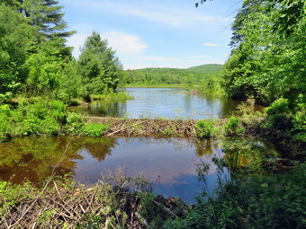
![]() On Tuesday, June 30th, I wanted to get out for a longer hike after sticking to shorter hikes on the rail trail. I covered an ambulance all early in the morning and finally returned home at 10:30 AM with the temperature at 75 degrees on the back porch. I thought I might try a shorter hike in the Frick Pond area. I intended to hike up Flynn Trail and then make a decision about the route I would take. As usual, Sheena was excited but was trying to be the "good dog". I decided to wear a Columbia Omni-Shade Omni-Wick crew shirt without a baselayer. I wore my Railriders hiking pants which are expensive but last along time and have features like deep pockets and a generous cut which I really like. The pants have Velcro closures at the ankles. I thought about warmer pants but decided against it. I decided to put on my Keen Durand hiking boots which fit well. I added a new pair of Xstance insoles in an effort to find the best support and cushioning for my feet. These insoles have shock absorbing gel pads, TPU arch support, and memory foam cushioning all wrapped in a breathable fabric. The insoles have been hyped by their manufacturer and seemed to be living up to their claims. I grabbed a pair of Leki Makalu Lite poles I have been using for some time because they are light and lock without slipping. I put on my OR BugOut gaiters as I knew that the trails would be dry but the ticks would be out! I also decided to wear my OR floppy hat. I put my gear in the back and Sheena in the backseat and headed out the DeBruce Road at 11:40 AM. After 6 miles, at Mongaup Pond Road, I turned left and continued to follow the road bearing left onto Beech Mountain Road at the fork. When we arrived in the parking area there were no cars parked in either lot. Sheena was acting as if she hadn't hiked in a month as she ran around and headed for the trail. Even though it was a little later on the day, the temperature was 75 degrees at the trailhead as it is usually cooler there than in town. The skies were now mostly blue with white clouds. I set my GPS as we got ready to head out on the Flynn Trail. We crossed the road and began our hike at 11:57 AM.
On Tuesday, June 30th, I wanted to get out for a longer hike after sticking to shorter hikes on the rail trail. I covered an ambulance all early in the morning and finally returned home at 10:30 AM with the temperature at 75 degrees on the back porch. I thought I might try a shorter hike in the Frick Pond area. I intended to hike up Flynn Trail and then make a decision about the route I would take. As usual, Sheena was excited but was trying to be the "good dog". I decided to wear a Columbia Omni-Shade Omni-Wick crew shirt without a baselayer. I wore my Railriders hiking pants which are expensive but last along time and have features like deep pockets and a generous cut which I really like. The pants have Velcro closures at the ankles. I thought about warmer pants but decided against it. I decided to put on my Keen Durand hiking boots which fit well. I added a new pair of Xstance insoles in an effort to find the best support and cushioning for my feet. These insoles have shock absorbing gel pads, TPU arch support, and memory foam cushioning all wrapped in a breathable fabric. The insoles have been hyped by their manufacturer and seemed to be living up to their claims. I grabbed a pair of Leki Makalu Lite poles I have been using for some time because they are light and lock without slipping. I put on my OR BugOut gaiters as I knew that the trails would be dry but the ticks would be out! I also decided to wear my OR floppy hat. I put my gear in the back and Sheena in the backseat and headed out the DeBruce Road at 11:40 AM. After 6 miles, at Mongaup Pond Road, I turned left and continued to follow the road bearing left onto Beech Mountain Road at the fork. When we arrived in the parking area there were no cars parked in either lot. Sheena was acting as if she hadn't hiked in a month as she ran around and headed for the trail. Even though it was a little later on the day, the temperature was 75 degrees at the trailhead as it is usually cooler there than in town. The skies were now mostly blue with white clouds. I set my GPS as we got ready to head out on the Flynn Trail. We crossed the road and began our hike at 11:57 AM.
 The Flynn Trail is sited along what used to be Beech Mountain Road which was the access for the Beech Mountain Boy Scout Camp. We walked the trail through the woods which was damp in places but not muddy. We started out slowly because my muscles felt tired but soon were keeping a good pace. I almost did not notice the right turn onto the woods road. We began a consistent climb at a slightly faster pace than a week ago. The path was narrow and it did not seem that many people were using the trail. The trail gains a little over 600 feet in 1.7 miles to the highest point at the junction with the Big Rock Trail. We passed the hemlock that used to form a tunnel but was cleared by the DEC. We began to find some small branches on the trail which had come down in the winds from various storms. We continued to find similar conditions for the rest of the hike. The day was getting warmer as the sun came out full force. I began to warm up even though I only had a single layer. On the way up the trail we came to the rock ledges on the right side of the trail. I sometimes take pictures here but decided that I might not take any pictures on this day. As we approached and the clearing to the right of the trail, I debated walking up to the field but decided against it. It was a beautiful day and the sun was shining on the rocks and the trail. I noticed that I was very relaxed and decided it was partly due to the sounds of the winds and the birds. Sheena was keeping mostly to the trail but also was making some detours to chase game. Since the grass and ferns were taller than her, Sheena would periodically jump straight up to see where she was going. Sheena would take the time to come back to check on me occasionally. We descended a little and then began walking uphill. Along the way there had been several blowdowns that had not been cleared as Te NYNJTC has apparently not assigned new trail maintainers which is a shame. We were soon at the junction with the Big Rock Trail. I was a little tired and I needed to be back before 2:00 PM so I decided to leave the longer hikes for another day. We turned left to walk down the Big Rock Trail. It was 10:54 AM and we had hiked 1.7 miles uphill in an 53 minutes. This was slower than usual but I was enjoying the relaxed pace.
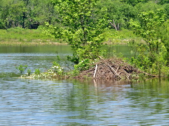
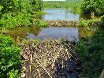 The Big Rock Trail was only a little damp as we started down the long descent. The hike down the trail went well and more quickly than I expected. It was definitely easier than the uphill hike! This trail can be tricky as there are three levels that make it seem like the bottom of the hill. On this day the descents seemed to go quickly and I was not discouraged. We encounter huge swarms of mosquitoes that overwhelmed my repellent with sheer numbers. I quickened my pace to a near jog and we were soon at Times Square. This was my last chance to lengthen the hike and I thought about turning right to hike up and around the Logger's Loop to add some distance. I decided against this as it was getting late and we continued our hike by walking straight across Times Square to stay on the Big Rock Trail. The Big Rock Trail around the back of Frick Pond can be very wet but this day there was barely any mud. Sheena hiked right through the water and mud that was present and was getting filthy! Sheena alerted and I saw a man coming toward us with a dog on a leash. I pulled Sheena off the trail and asked the man to pass by which he did. Sheena and I continued and soon ran into the rest of the family consisting of son, daughter and wife. We crossed the two small bridges over the inlets to the pond and I decided not to stop to take any pictures. The first of the inlet streams was almost dry and the water was not flowing. The second inlet stream had even less water. When we got to the area that was covered by tall evergreens, I pushed on through as I had taken pictures here very recently. The wooden boardwalks continue to show wear with many boards loose and other beginning to rot. Much of the boardwalk now "floats" in midair as the supports are rotting. The local rangers and the DEC field office have been alerted several times but don't really seem to care as any work including repalcement are not in "The Plan".
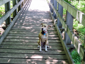 The rest of the trail was damp with several wet and muddy spots. At the next trail junction we turned left on the Quick Lake Trail to head for the bridge across the outlet of Frick Pond. We walked along the west side of Frick Pond to the bridge across the outlet of the pond. The mudhole was wet but not muddy as the drainage work and the stepping stones did their job. I stopped at the bridge to admire two new beavers dams that had been constructed. Unfortunately, both dams had now been damaged with the lower one ripped out completely and the upper one reduced in size. The water level in the pond had dropped significantly making the beaver lodge unusable. There were more tracks in the dirt indicating that someone had brought in a large machine to vandalize this beautiful area! In the past, I have tried to determined who was responsible for this devastation. I have called everyone from the local ranger to the Region 3 office to the state DEC offices. Either someone has taken it upon themselves to do this or the DEC does not want to admit they have given permission. This lack of transparency is disturbing. I know that if I did something similar there would be heavy fines. Sheena and I walked up the hill and continued to Gravestone Junction. The tracks of the machinery were still very obvious and had chewed up the trail with no regard to the work done by maintainers. We passed the Lobdell Memorial marker just after Gravestone Junction. The marker is a memorial to two children who died in the 1930's in a fire that consumed their cabin. The trail to the memorial was well-worn but the marker was standing intact. The trail back to the register was damp and muddy in spots but not as wet as I expected. We passed the trail register heading toward the parking area and continued straight ahead to follow the woods road out to the car. We arrived at the car at 12:02 PM having hiked 4.1 miles in 2 hours with an elevation gain of 640 feet. Our overall average speed was just under 2 MPH with a moving average of 2 MPH. The temperature had risen to 78 degrees!
![]()
![]()
![]()
![]()
![]() On Thursday, June 25th, I wanted to get in another hike to make it three days in a row. I had ambulance coverage from 8:30 AM to 2:30 PM so my I plan seemed doable. I decided to just go to Parksville and hike the rail trail even though it is under three miles out and back. I asked Cindy if she would like to go and she said "Yes". The catch was that she would not be back from her Bible study until noon! I knew the Little Beaverkill would be low as it had not rained much since our last trip. I did want to see how the Town of Liberty's work on the bridge was holding up. By the time Cindy got home and we ate lunch it was 12:30 PM but I knew we still had time to just walk the trail. The temperature was right 74 degrees on the back porch with blue skies and plenty of sun. As we were getting dressed, Sheena sniffed my clothes and became very excited. I got dressed in my Columbia OmniShade long-sleeved shirt. I put on a pair of RailRiders hiking pants which are expensive but last a long time and have features like deep pockets and a generous cut which I really like. I decided to put on my Keen Durand hiking boots which fit well. I added a new pair of Xstance insoles in an effort to find the best support and cushioning for my feet. These insoles have shock absorbing gel pads, TPU arch support, and memory foam cushioning all wrapped in a breathable fabric. The insoles have been hyped by their manufacturer and seemed to be living up to their claims. I grabbed a pair of Leki Makalu Lite poles I have been using for some time because they are light and lock without slipping. I decided to wear my OR BugOut gaiters as a defense against the ticks that are looking for a warm home and a meal! I put the ecollar on Sheena and turned it on. I put our gear in the back of the car and Sheena in the back seat. We left Livingston Manor at 12:45 AM and drove out Old Route 17 toward Parksville. Just after Fox Mountain Road, I pulled into the parking area on the right side of the road. There was one car parked in the lot. We started out on the trail at 1:00 PM under blue skies with lots of sun. The temperature seemed cool but we both noticed the humidity was high.
On Thursday, June 25th, I wanted to get in another hike to make it three days in a row. I had ambulance coverage from 8:30 AM to 2:30 PM so my I plan seemed doable. I decided to just go to Parksville and hike the rail trail even though it is under three miles out and back. I asked Cindy if she would like to go and she said "Yes". The catch was that she would not be back from her Bible study until noon! I knew the Little Beaverkill would be low as it had not rained much since our last trip. I did want to see how the Town of Liberty's work on the bridge was holding up. By the time Cindy got home and we ate lunch it was 12:30 PM but I knew we still had time to just walk the trail. The temperature was right 74 degrees on the back porch with blue skies and plenty of sun. As we were getting dressed, Sheena sniffed my clothes and became very excited. I got dressed in my Columbia OmniShade long-sleeved shirt. I put on a pair of RailRiders hiking pants which are expensive but last a long time and have features like deep pockets and a generous cut which I really like. I decided to put on my Keen Durand hiking boots which fit well. I added a new pair of Xstance insoles in an effort to find the best support and cushioning for my feet. These insoles have shock absorbing gel pads, TPU arch support, and memory foam cushioning all wrapped in a breathable fabric. The insoles have been hyped by their manufacturer and seemed to be living up to their claims. I grabbed a pair of Leki Makalu Lite poles I have been using for some time because they are light and lock without slipping. I decided to wear my OR BugOut gaiters as a defense against the ticks that are looking for a warm home and a meal! I put the ecollar on Sheena and turned it on. I put our gear in the back of the car and Sheena in the back seat. We left Livingston Manor at 12:45 AM and drove out Old Route 17 toward Parksville. Just after Fox Mountain Road, I pulled into the parking area on the right side of the road. There was one car parked in the lot. We started out on the trail at 1:00 PM under blue skies with lots of sun. The temperature seemed cool but we both noticed the humidity was high.
The first part of the trail was just damp but drying quickly. We continued hiking and once we were on the trail and sheltered by the trees it was a little cooler with the breeze blowing. The trail was about as I expected some damp areas and some mud. There seemed to be less water and mud than during our last trip. Just as we were about to enter the trees a woman came walking toward us and I took Sheena to the side of the trail. As the woman walked by we exchanged greetings. The rail trail runs parallel to the Little Beaverkill and the new section of State Route 17. It follows the route of the O&W railroad and is very flat. The water level in the stream was not quite as high as the last time we had hiked along the trail. As we continued to hike, we passed several benches placed for people to rest in warmer weather. I did not stop at the area just before the wooden walkways and bridge as our objective was to hike as fast as we could. We walked across the long walkway and then we came to the bridge. We already knew the crew had finished their work and had done a great job! They had cleared all of the debris that was blocking the culvert udder the bridge. Large boulders now held back the dirt and stones that often wash down the hillside to block the flow of water through the culvert. The crew had added crushed stone on either side of the bridge to smooth the way on and off the brdige. More stone had been added to fill in the mud pit on the Parksville side. Some fencing had been added and the overall effect was very pleasing. In a very short distance we came to the area where a large mudslide had brought trees and dirt down onto the trail. This area had been partly cleared in the past but the Liberty crew had graded it and added some crusher run. They also removed much of the debris, erected some fencing, and added some hay to help grass to grow back. As we continued I noted the other places where they had done work and all of it seemed to be holding up well. We continued on the trail heading toward the falls. As we walked toward the falls, we could hear an increase in the noise from the stream and I knew the falls was just ahead.
We passed the path down to the falls as I wanted to save time and the falls looked the same as last time. Soon we were nearing the Parksville end of the trail. Many of the rundown buildings had beem removed or were being renovated. Several of the buildings showed that work had been done on them. The large dog across the stream was not present and I missed him. On the Parksville end of the trail we found the small garden and a very informative sign. The pack of barking dogs that always greets us was again present and voicing their concern. The sign listed the businesses and hotels that existed in Parksville during its heyday. The Young's Gap Hotel had room for 600 guests! The sign also explained the role of the railroad in the dairy industry which was a thriving one in all of Sullivan County. It was 1:30 PM when we headed back toward the car. We had covered the walk out in 30 minutes but I knew the walk back was usually quicker. We set what I thought was a faster pace on the way back but that did not stop Sheena from going into full zoomie mode. She was racing ahead and then sprinting back toward us. She added some growling and attempts to bite our feet! We passed the mudslide and the bridges and continued to keep a good pace. We crossed the bridge and the wooden walkway. As we neared the end of the wooded part of trail, I gave Sheena the "With" command and she fell in behind me. We were back at the car at 1:30 PM having walked the return route in 30 minutes. The whole hike took us 1 hour which I judged good.
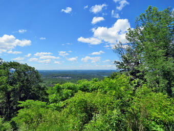
![]() On Wednesday, June 24th I was scheduled to hike at Walnut Mountain with Lisa at 10:30 AM. Lisa wanted tot show me the work that had been done to create the Walnut Mountain House walking trail. I knew this included signs to explain the history of the Walnut Mountain House and some benches. I had thought Cindy wanted to go with me but at the last minute she decided against it. I had ambulance coverage from 8:30 AM to 2:30 PM so I had plenty of time to get in a few miles. By the time I started to get ready at 9:45 AM the temperature was 74 degrees on the back porch with blue skies amd plenty of sun. As I was getting dressed, Sheena sniffed my clothes and became very excited. I got dressed in my Columbia OmniShade long-sleeved shirt without a baselayer. I put on a pair of RailRiders hiking pants which are expensive but last a long time and have features like deep pockets and a generous cut which I really like. I decided to put on my Keen Durand hiking boots which fit well. I added a new pair of Xstance insoles in an effort to find the best support and cushioning for my feet. These insoles have shock absorbing gel pads, TPU arch support, and memory foam cushioning all wrapped in a breathable fabric. The insoles have been hyped by their manufacturer and seemed to be living up to their claims. I grabbed a pair of Leki Makalu Lite poles I have been using for some time because they are light and lock without slipping. I decided to wear my OR BugOut gaiters as a defense against the ticks that are looking for a warm home and a meal! At 10:00 AM I left home and got on State Rt 7 east toward Liberty. I got off at exit 100, tuned right off the traffic circle and headed into town. At the next traffic circle I too the second exit to get on South Main Street and drove to the traffic light. I turned left on Lake Street and followed it until it became State Route 55. In a short distance I turned right on Walnut Mountain Road, drove to the parking area next to the baseball field and parked. There were only two other cars in the lot. One car had just parked and the couple were getting ready to hike. It was only 10:15 AM and I knew I would have to wait for Lisa. The temperature was 76 degrees with sunshine and clouds in a bright blue sky with low humidity and a slight breeze. Lisa arrived at 10:25 AM and we began to get ready to hike stepping off at 10:30 AM.
On Wednesday, June 24th I was scheduled to hike at Walnut Mountain with Lisa at 10:30 AM. Lisa wanted tot show me the work that had been done to create the Walnut Mountain House walking trail. I knew this included signs to explain the history of the Walnut Mountain House and some benches. I had thought Cindy wanted to go with me but at the last minute she decided against it. I had ambulance coverage from 8:30 AM to 2:30 PM so I had plenty of time to get in a few miles. By the time I started to get ready at 9:45 AM the temperature was 74 degrees on the back porch with blue skies amd plenty of sun. As I was getting dressed, Sheena sniffed my clothes and became very excited. I got dressed in my Columbia OmniShade long-sleeved shirt without a baselayer. I put on a pair of RailRiders hiking pants which are expensive but last a long time and have features like deep pockets and a generous cut which I really like. I decided to put on my Keen Durand hiking boots which fit well. I added a new pair of Xstance insoles in an effort to find the best support and cushioning for my feet. These insoles have shock absorbing gel pads, TPU arch support, and memory foam cushioning all wrapped in a breathable fabric. The insoles have been hyped by their manufacturer and seemed to be living up to their claims. I grabbed a pair of Leki Makalu Lite poles I have been using for some time because they are light and lock without slipping. I decided to wear my OR BugOut gaiters as a defense against the ticks that are looking for a warm home and a meal! At 10:00 AM I left home and got on State Rt 7 east toward Liberty. I got off at exit 100, tuned right off the traffic circle and headed into town. At the next traffic circle I too the second exit to get on South Main Street and drove to the traffic light. I turned left on Lake Street and followed it until it became State Route 55. In a short distance I turned right on Walnut Mountain Road, drove to the parking area next to the baseball field and parked. There were only two other cars in the lot. One car had just parked and the couple were getting ready to hike. It was only 10:15 AM and I knew I would have to wait for Lisa. The temperature was 76 degrees with sunshine and clouds in a bright blue sky with low humidity and a slight breeze. Lisa arrived at 10:25 AM and we began to get ready to hike stepping off at 10:30 AM.
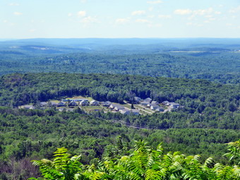 From the parking area we walked to the gate on the Mountain Overlook which is also a carriageway. The first interpretive sign is located here and ties general overview of the walking tour. From here the trail winds a little as it ascends to a junction with the West Lake West trail. Along the way was the second sign with a newly constructed bench next to it. The bench allows people to take a break if they wish. We continued to the junction with the West Lake West trail which continues straight ahead. We paused a minute before turning left. The Mountain Overlook Trail was now headed southwest as it continued its gentle climb. The third sign was cited at a junction where a trail branched off to the left. This sign pointed out the many rock ledges and had a picture of what they looked like at the turn go the 20th century! We continued straight ahead to the overlook. The view from the overlook was much open but it was a little hazy. It was easy to see down to Swam Lake and several housing developments. The sky was blue with some interesting clouds. I dropped my pack and took out my camera. I took some pictures of the lookout and then turned my attention to the view. I took numerous pictures of the landscapes and some of the sky. After I had finished, we turned around and started back the way we had come. In a short distance, at the trail junction, we stayed to the left and then the right to continue on The Walut Mountain House walking tour which followed the Mountain House Trail. On the right was another sign which pointed out the ledges which used to be wide open and afforded and even more spectacular view. We continued up the trail, which was a slightly steeper climb, until it leveled out. On the left was a large stone foundation which is all that remains of the Walnut Mountain House. It was constructed in 1887 and torn down in 1919. Other structures were built to support in but very little remains of these outbuildings. We turned left to follow a short trail around the foundation reading signs five and six. I dropped my pack and took a number of pictures fighting the bright sun for each shot. The work that has been done us very impressive and Lisa told me about the plans for more research. At this point Lisa had to get back but I had some more time so we parted way.
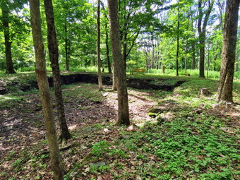 I had no particular route that I wanted to take and was more constrained by time than distance. I headed for one of the single track bicycle trails amd this one went up to the summit plateau of Walnut Mountain. The summit was wilder than I remembered with high grass and weeds on the trail and impressive stand on briars over the interior. We walked anticlockwise on the barely visible trail until we were on the west side where the trail was more discernable and there were some interesting rock ledges. I stopped to take some shots of the rock ledges and thought it would e nice to be below them to take some pictures from that angle. As we almost completed the loop around the top, I noticed a trail that went down and to the right. Thinking that trail might take us below the ledges, I turned right and started to loop back around the summit plateau im a clockwise direction but one level down. Soon we were looking up at the ledges where we had been looking down! I got out the camera and did the best job I could taking pictures. The problem was that the bright sunlight that made it such a nice day was not conducive to photography! When I was done, I packed up the camera and we continued to follow the single track bike trails until we were back at the site of the Walnut Mountain House. We turned left on the Mounatin House trail and followed it as it wound through several switchbacks until it ended at the Mountain Overlook Trail. We turned left and walked downhill to the junction with the Walnut Loop West Trail. We turned left and after a slight uphill the trail flattened and we passed by the Walnut Loop North trail that turned right and headed out to the West Lake parking area.
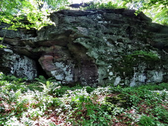 We followed the trail as it bent to the left and worked our way passed some large blowdowns across the trail. I was looking for a trail I had cleared for a cross country course. I knew it would be hard to find as it had not been used in at least 5 years and was not maintained. Soon the carriageway we were walking started to gain elevation and I knew I had missed the trail. I decided to retrace my steps to find it. I kept looking for the trail on the right just before the blowdowns. We turned right and started back up the mountain. The trail was actually in good shape until just before it ended and would require only a little maintenance. As we walked up the trail I wondered that I decided to make the course so hilly! At the top we tired right on the Sunset Trail which is mostly flat until it gains a little elevation at the end. This trail end at a junction with the Mountain House Trail and the Mountain Overlook trail. We continued straight ahead and then turned left on the Mountain Overlook trail. There was one hiker at the sign where we turned right on a connector trail and continued downhill to the lower lookout where we turned left on the Walnut Loop South Trail. We followed this passed the lower lookout where ether were new picnic table and a new bench at the edge of an open field. We continued until the trail entered the trees and started downhill passing the disc golf course. We walked by the finish line for the cross country course and then through and old red shale quarry. I look down and saw some arrows painted on the rock indicating the direction of travel for the runners. I was surprised that the painted arrow were still there after several years! We continued out through the trees to the playground and then to the car. It was 1:00PM when we finished. I estimated we had walked over 4 miles with about a 600foot elevation gain.